
Total Distance: 17 km
Return Time: 6 hours
Elevation Gain: 587 m
Difficulty: Moderate
Region: Annie Lake
The Berney Creek valley is in the Annie Lake Area and there is an old exploration road that brings you to the alpine and the beautiful turquoise waters of Berney Lake. There is much to explore in this area with good backcountry camping options and extended hiking options. This valley is great access to Mount MacNeil and Radelet Peak. While the hike itself is straightforward to Berney Lake, there are a few challenges. Firstly, the driving access requires fording Becker Creek and the Wheaton River by vehicle as these two main bridges have been removed along the Annie Lake Road. This means timing your trip for when there are lower water levels (mid- to late-summer). The second challenge is that once you start hiking the Berney Creek road, there are about a dozen rockslides that you have to hike across, including one that has taken out the entire road itself. These rockslides just slow you down and require more careful footing.
From Whitehorse, drive south on the Alaska Highway to the Carcross Cutoff and turn right onto the South Klondike Highway. Drive south for about 17 km and turn right onto the Annie Lake Road. After 26 km on the Annie Lake Road, you will cross a bridge over the Wheaton River. The road is not maintained after this and is a bit rougher. There have been washouts in the past, requiring a higher clearance vehicle to get around (keep an eye on recent conditions for updates). Around 10.7 km after the bridge, you will reach the first of two water crossings, Becker Creek. After that it is 6.9 km of dirt road until you'll take a right onto a road that leads down to the Wheaton River crossing. This crossing is a lot more substantial, but doable in a 4x4 truck at low water (best timing late summer/early fall when runoff from snow melt is lower).
Once across the Wheaton River, drive on the main road for about 200 m and then keep left at the next main road junction. The road is in good condition for about 5.5 km until you reach some old mining gates (that were open as of Summer 2024). Here there are a lot of large rocks and bumps to navigate, keep to the main road to the right of all the rocky piles. After this, drive up the hill and take the next left, there is good parking here at the junction of Skukum Creek Road and Berney Creek Road. This is the trailhead.
Alternatively to crossing the creeks by vehicle, you could wade across the water crossings with a bike or e-bike to access the trailhead, but prepare for a 12.6 km bike ride (one way).
From the parking area, continue hiking the road towards Skukum Creek. The road here has a couple little washouts that would make it difficult to drive. Then you'll reach a large gravel parking area before the Skukum Creek bridge. The bridge has been washed out so you can either tentatively cross the broken bridge and drop down on the other side or cross the creek itself via boulders on the upstream side of the broken bridge.
After this you will be following the Berney Creek road for about 8 km. There are numerous rockslides that have enveloped the road most of the way up with loose rocks, and another actual road washout exactly 2 km from the trailhead. This washout requires going up and around the vegetated rocky slope above. The many rockslides just require careful hiking on the loose rocks.
The valley here is beautiful as you pass the rocky peaks of Mount MacNeil (on your left) and Mount Reid (on your right) as well as many unnamed mountains. There is a known route up Mount MacNeil from this valley that requires a bit of scrampbling. Mount Reid is better accessed from the Skukum Creek Valley to the north. There are ample areas to explore in this area with many hikeable little valleys and ridges where you could choose your own adventure.
To reach Berney Lake, the small turqoise lake at the headwaters of the creek, it is fastest to leave the road around 7.7 km from the trailhead and follow the creek up a few more hundred metres. There are suitable camping spots all along the upper valley once you are in the alpine.
For extended hiking options see Radelet Peak. From the lake it is also possible to continue following the road north and then east to connect to the Skukum Creek area and it's many explroation roads and loop back to the trailhead. Best to consult satelite imagery and other maps that show the old roads in the area. See the Mount Skukum description here for more reference.

The vehicle crossing of Becker Creek along the Annie Lake Road.

The vehicle crossing of the Wheaton River, as viewed from the far side of the crossing.

The broken bridge over Skukum Creek on the Berney Creek Road, as viewed from the far side.
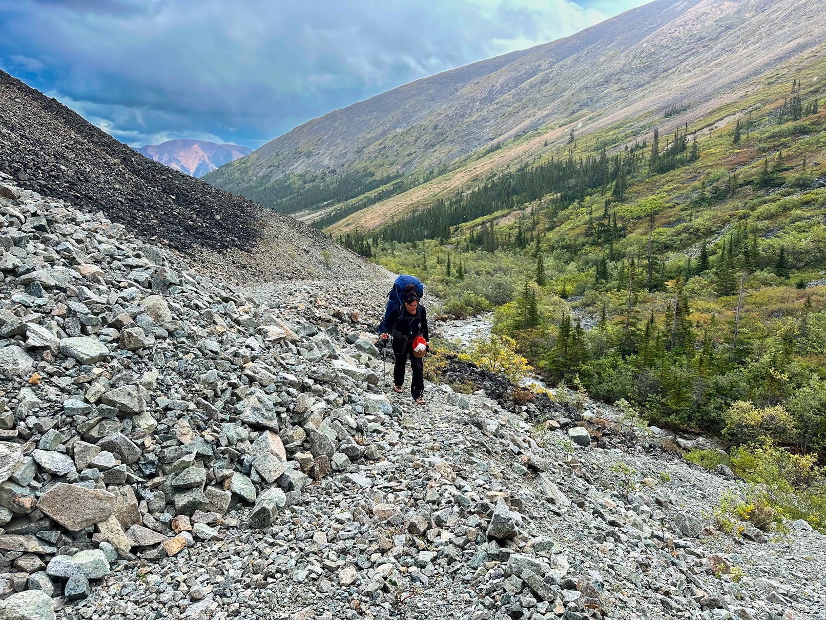
Hiking up Berney Creek Road with the many rockslides.

Tentatively crossing one of the more destructive rockslides on the way back.

Looking up towards the head of the valley where Berney Lake lies.

The view of some of the mountains and cirques on the south side of the Berney Creek Valley.

The view looking back down the valley from the alpine once you leave the road.

Berney Lake as seen from above. You can see the Berney Creek Road continues up around to the north towards the Skukum Creek Valley.

Heading back down the road to the trailhead.

