Total Distance: 14 km
Return Time: 8.5 hours
Elevation Gain: 1506 m
Difficulty: Difficult
Region: Haines
Traditional Territory: CIA
Tukgahgo Mountain is a long day hike from Haines, Alaska with considerable elevation gain. The route takes you up steeply through the Alaskan rainforest to the alpine to gain incredible views! Ideally you can book the amazing Tukga Hut with Haines Huts & Trails and do the mountain as a day hike from the hut. Otherwise, prepare for a long day.
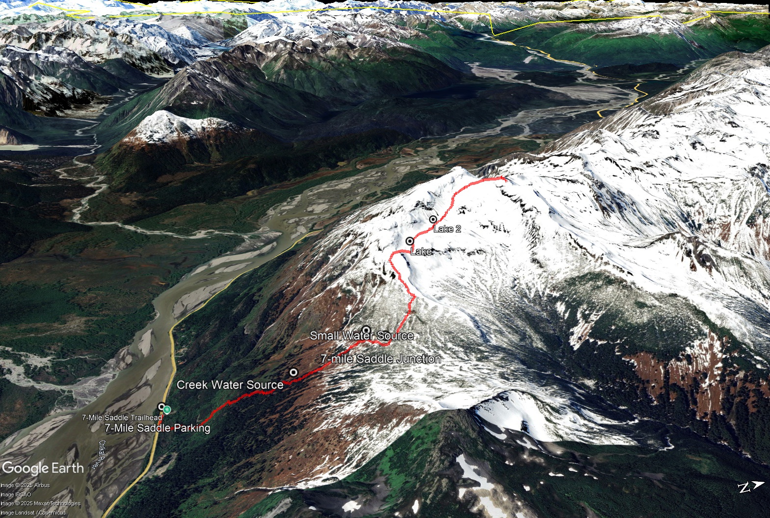
The parking for the trailhead is located at Mile 7 of the Haines Highway, 7 miles (11.3 km) from Haines or 53 km from the US customs heading into Haines. There is a 'hiking sign' indicating parking. Note the trailhead is actually 200 m east.
Be prepared, this route is very long with considerable elevation gain. The initial part of this route, via the 7-mile Saddle Trail is very steep to get to the alpine. It can be very slippery when it rains and snow lingers in the alpine, long into the summer. Pack snowshoes for early season hiking in May and June.
From the parking area, head east along the highway and walk 200 m to reach the trailhead. The trail starts with a boardwalk that leads to the forest. You'll shortly reach a waterfall and trailhead sign with various trail distances. The elevation gain starts here and doesn't really end until you reach the summit.
Follow the trail up through the coastal rainforest. Marvel at the huge Sitka Spruce and Devil's Club and keep an eye out for ripe blueberries, black currants, and salmonberries in August. You will leave the big trees behind and enter the sub-alpine with scattered stands of stunted Western Hemlock and open meadows of wildflowers and alpine plants.
2.9 km from the trailhead you will reach a fork in the trail. The trail to the right goes to the 7-Mile Saddle, while the trail to the left is the Chilly Ridge trail and the trail to the Tukga Hut. It is another 0.7 km to the alpine and 177 m elevation gain. Here you'll get your first glimpse of Tukgahgo Mountain and Chilly Ridge.
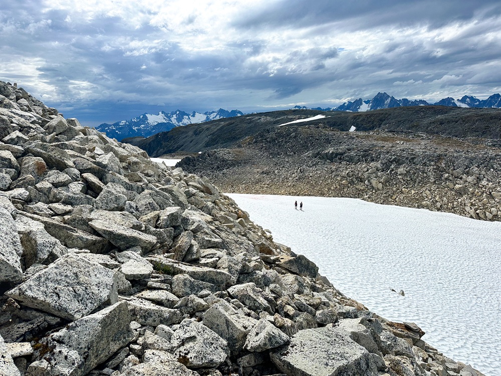
From the alpine, gain the ridge to the west. This will allow you to skip side hilling a large steep boulder field. Follow the ridge for about 520 m until you reach a small saddle with a route down to a small lake on your right. Here you will leave the ridge and drop down to a small lake below (losing about 50 m elevation gain). From the lake, follow the same contour slightly west - northwest towards another lake. Continue following this contour, gaining elevation as you approach the base of the mountain. You will need to head towards the left/western side of the mountain to gain the 'easiest' route up. It will still require traversing and climbing up some snow slopes and steep boulder fields but is the most gradual option. Use your route-finding skills and/or make sure to check out the GPS track.
Once up the steep sections, head now right/east towards the rounded summit of the mountain. There is a radio repeater station near the summit here. Enjoy the views in all directions! You can see a portion of Chilkoot Lake to the north, as well as Lutak Inlet to the east. The Chilkat Inlet and Mud Bay extend to the south. The mountains in all directions are stunning. Return the way you came down.
NOTES ON WATER
There are water sources along the route, either before reaching the 7-Mile Saddle via a small drainage or after at the small alpine lakes below Chilly Ridge on the way to the mountain.
ALTERNATE ROUTE
From the alpine you can actually follow the Chilly Ridge route and join up with the Tukgahgo Mountain route for the summit and return route. Add on another hour to the hike.
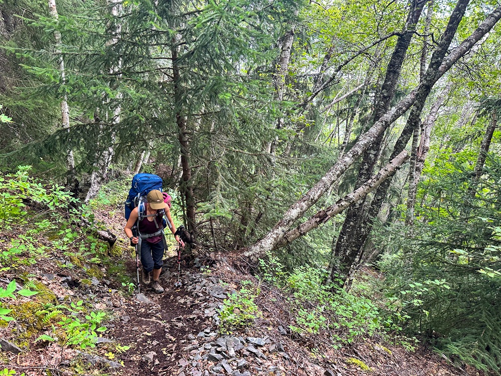
Hiking the steep 7-Mile Saddle portion of the trail.
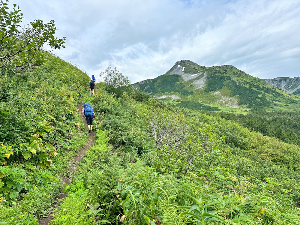
Getting up into the sub-alpine.
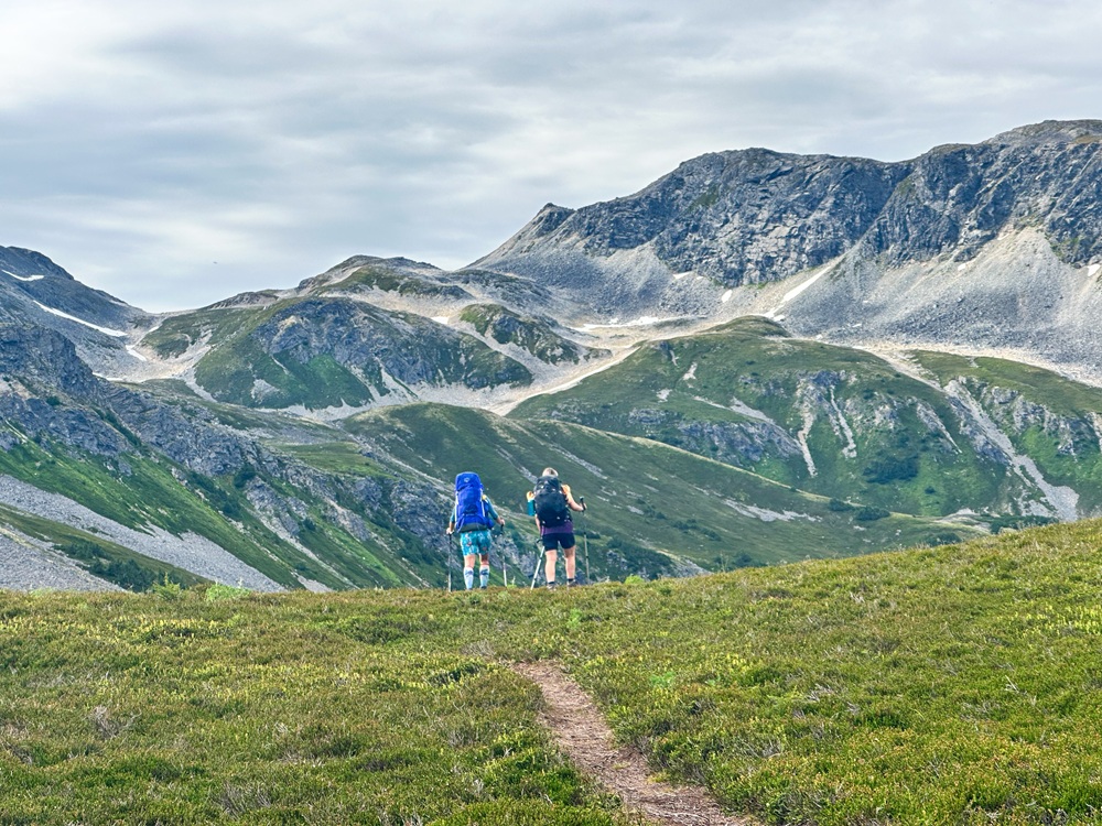
Reaching the open alpine with the first views of Tukgahgo Mountain.
Hiking up some of the snow patches near the base of the mountain.
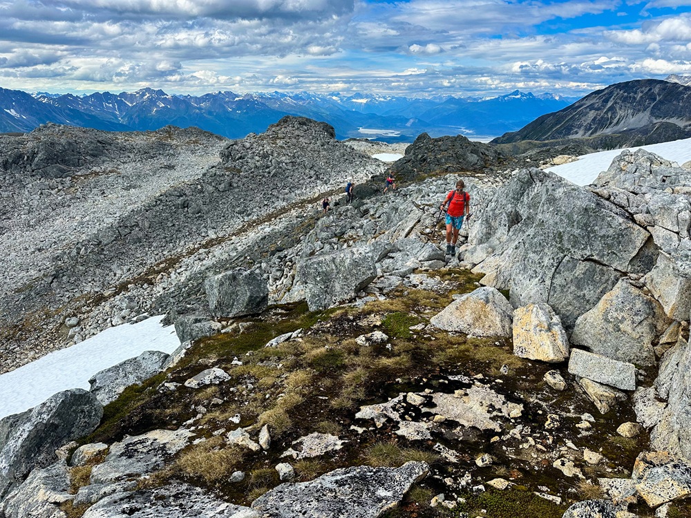
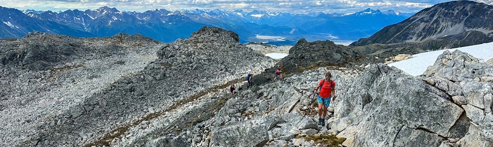
Nearing the rocky summit.
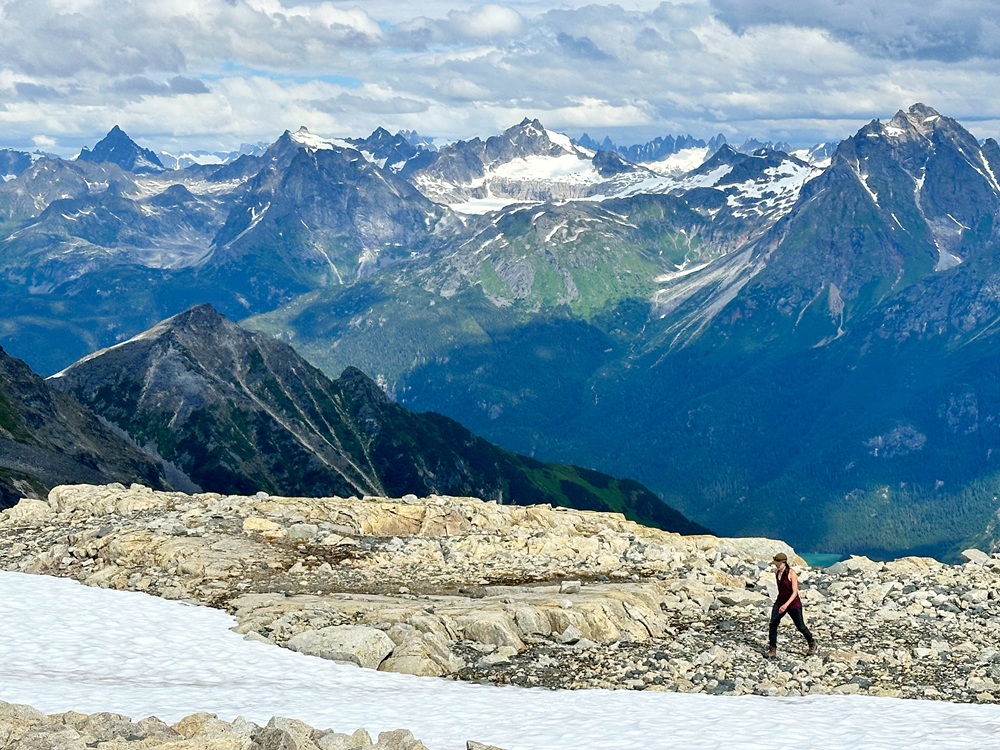
Views upon views of mountains to the north.
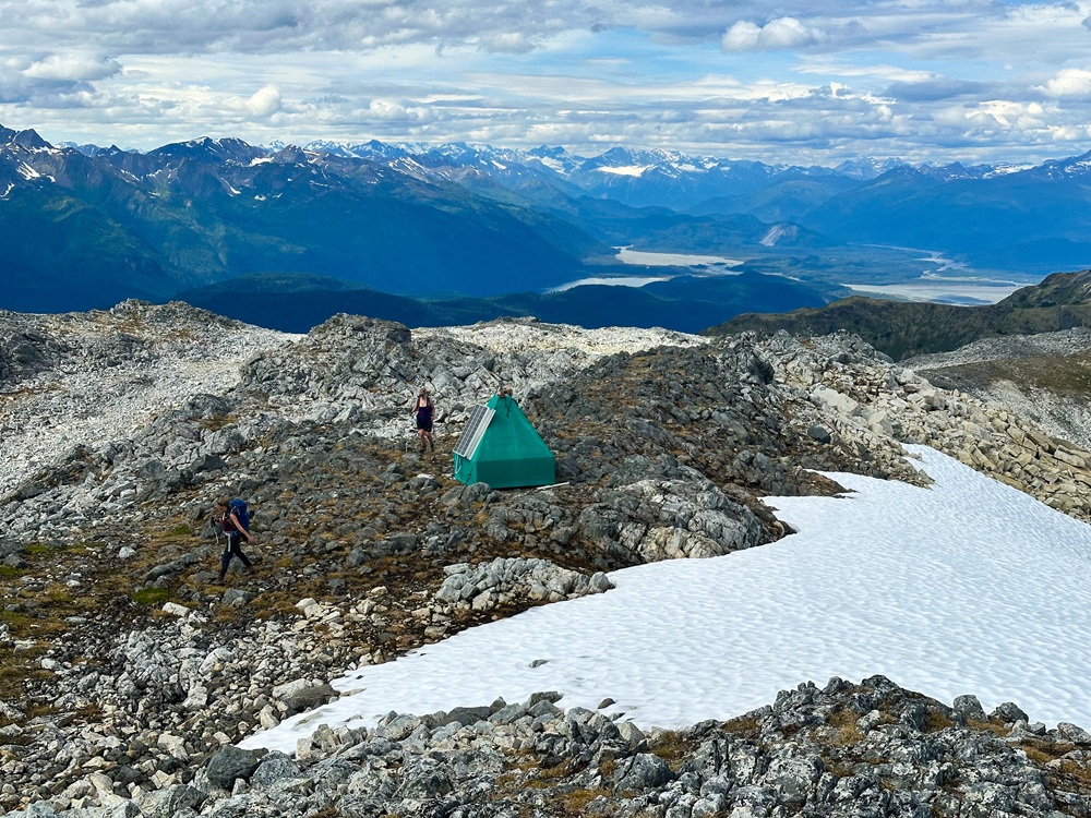
Approaching the radio repeater near the summit.
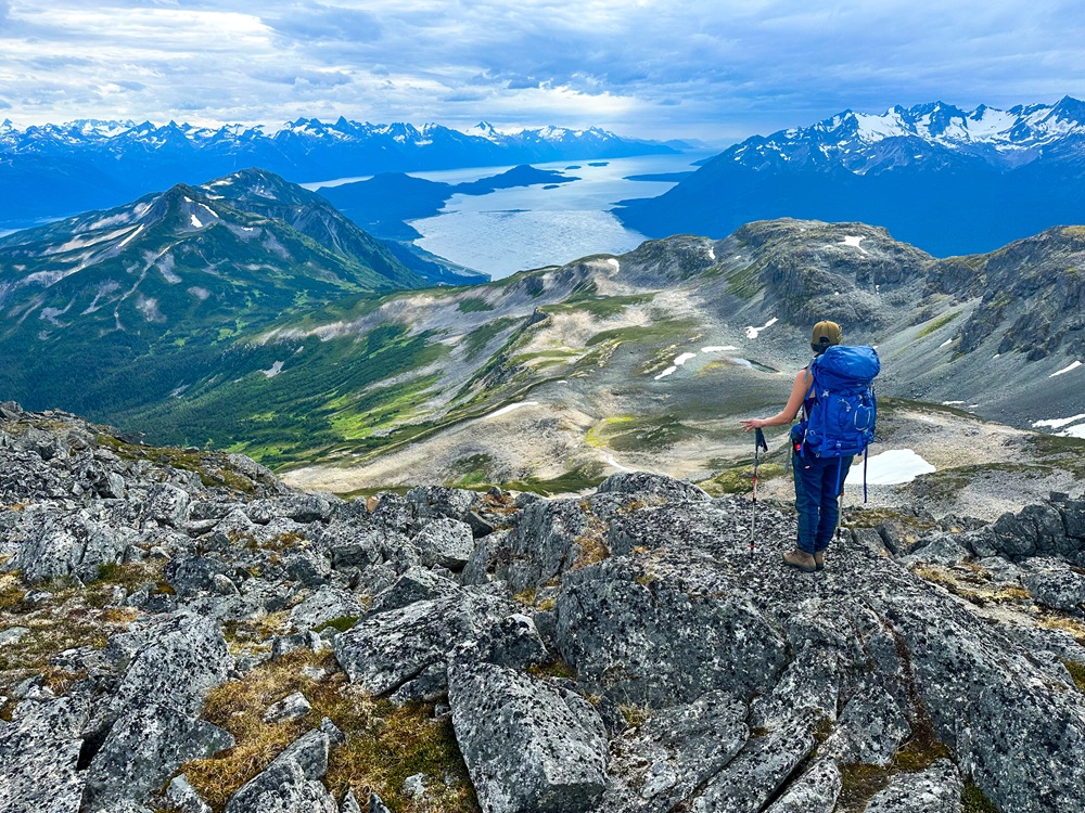
Views from the summit looking towards Haines and the Chilkat Inlet.
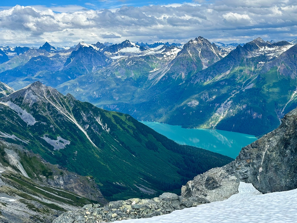
From the summit you can see a bit of Chilkoot Lake.
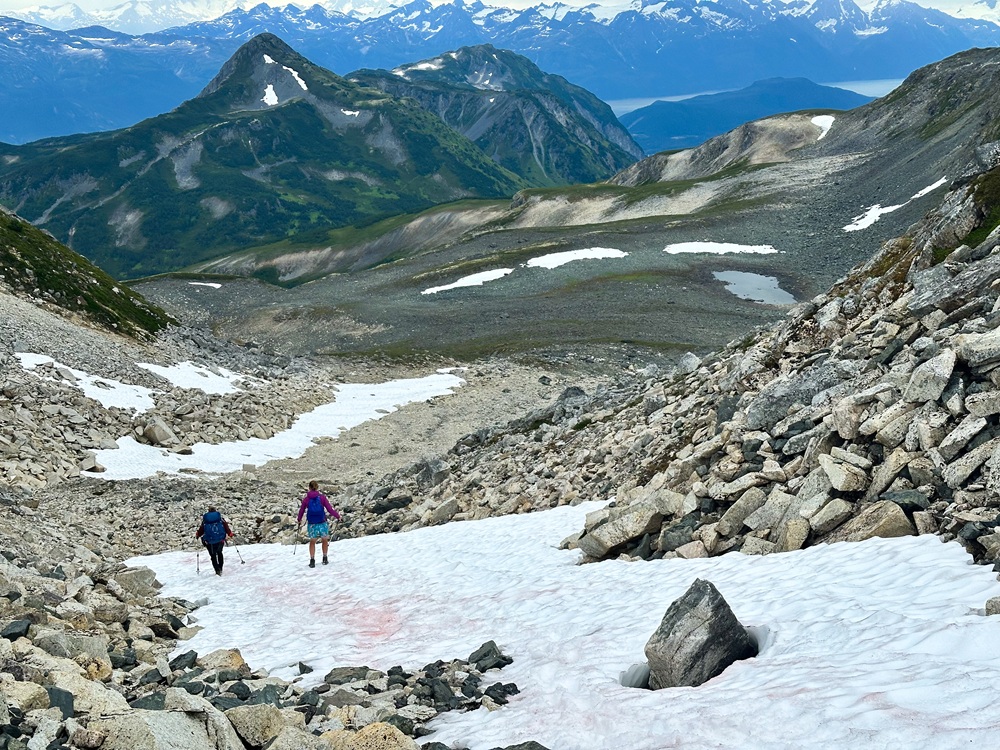
Descending down to the upper Lake.
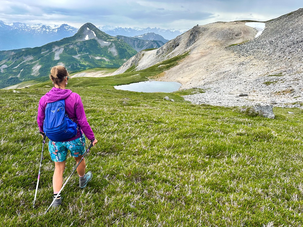
Approaching the lower lake, with the route back up the ridge to bypass the boulder field.