Total Distance: 7 km
Return Time: 4.5 hours
Elevation Gain: 956 m
Difficulty: Moderate
Region: Haines
Traditional Territory: CIA
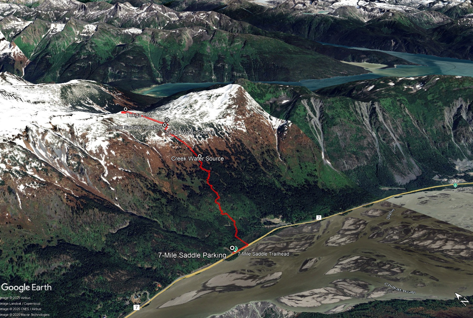
The hike to the Tukga Hut is short but very steep following the 7-Mile Saddle and Chilly Ridge trails near Haines, Alaska. The views from the hut are unparalleled and you have access to several day hikes from the hut (Chilly Ridge, Tukgahgo Mountain, and Shakuseyi Peak (aka Peak 3920). The hut must be booked through Haines Huts & Trails website. If you don't have the hut booked you can still do the 7-Mile Saddle Route as a day hike and tack on Chilly Ridge and/or Tukgahgo Mountain routes for a longer day hike.
The parking for the trailhead is located at Mile 7 of the Haines Highway, 7 miles (11.3 km) from Haines or 53 km from the US customs heading into Haines. There is a 'hiking sign' indicating parking. Note the trailhead is actually 200 m east.
Be prepared, this route is short but very steep. It can be very slippery when it rains and snow lingers in the alpine, long into the summer. Pack snowshoes for early season hiking in May and June.
From the parking area, head east along the highway and walk 200 m to reach the trailhead. The trail starts with a boardwalk that leads to the forest. You'll shortly reach a waterfall and trailhead sign with various trail distances. The elevation gain starts here and doesn't really end until you reach the hut!
Follow the trail up through the coastal rainforest. Marvel at the huge Sitka Spruce and Devil's Club and keep an eye out for ripe blueberries, black currants and salmonberries in August. You will leave the big trees behind after a long uphill slog, and enter the sub-alpine with scattered stands of stunted Western Hemlock and open meadows of wildflowers and alpine plants.
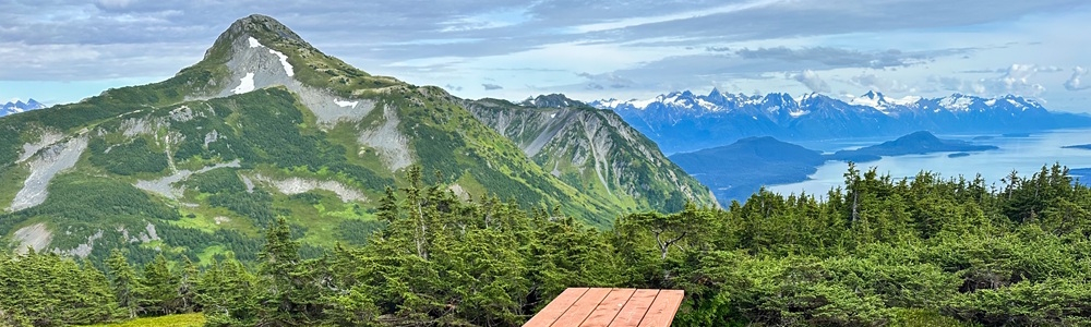
2.9 km from the trailhead you will reach a fork in the trail. The trail to the right goes to the 7-Mile Saddle, while the trail to the left goes to the Tukga Hut via the Chilly Ridge trail. Good news is you've done 80% of the elevation gain! Follow this trail the remaining 0.7 km to the hut with the remaining 177 m elevation gain. Note the worn trail ends when you have your first views of Tukgahgo Mountain and Chilly Ridge, while the hut is actually to your left about 80 m.
NOTES ON THE HUT
The hut must be booked through the Haines Huts & Trails website. The hut is fairly new (completed in 2024) and the group has been trying out various booking methods, including private and by-the-bunk bookings. The hut can sleep up to 8 adults comfortably (and up to 12 if you max out the space with people and gear). The rental includes an outhouse, a propane heater and cooktop, kitchen dishes and utensils, dish soap and dish cloths, tables and chairs, sleeping platforms (bunks and loft), and a picnic table outside with the most amazing view! Note dogs are not permitted at the hut during the goat kidding season, May 1st to July 15th. Goats in the area are very susceptible to disturbance during that period.
NOTES ON WATER
There is no immediate water source at the hut. Haines Huts and Trails recommends filling up either on your way up via the last water source before the trail fork with the 7-mile Saddle (see GPS points) or 400-500 m from the hut to the northeast, where you have to drop down to a small drainage. There are buckets you can fill for untreated water to bring back to the hut.
EXTENDED HIKES
For day hikes from the hut, check out the Chilly Ridge and Tukgahgo Mountain routes on the website. There is also a trail to Shakuseyi Peak (also known as Peak 3920 or Seven-mile Saddle Peak), which requires descending from the hut down to the 7-mile Saddle trail junction.
From the hut, Chilly Ridge is 3.3 km one way and 431 m elevation gain. Expect about 2 hrs to get to the end of the ridge. You can either return the same way or tag on the Tukgahgo Mountain route for the way back. Expect about 5 hours for Chilly Ridge to Tukgahgo Mountain and back to the hut.
For the Tukgahgo Mountain route, it is 3.5 km one way from the hut with 535 m elevation gain.
The hut is available to rent in the winter and there is some great terrain available for experienced splitboarders and backcountry skiers.
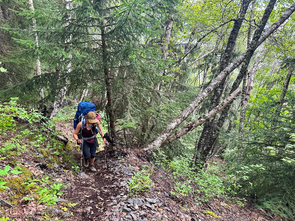
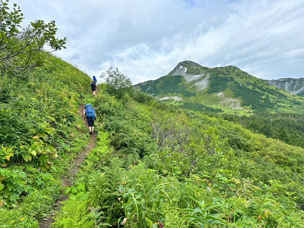
Hiking the steep 7-mile Saddle portion of the trail.
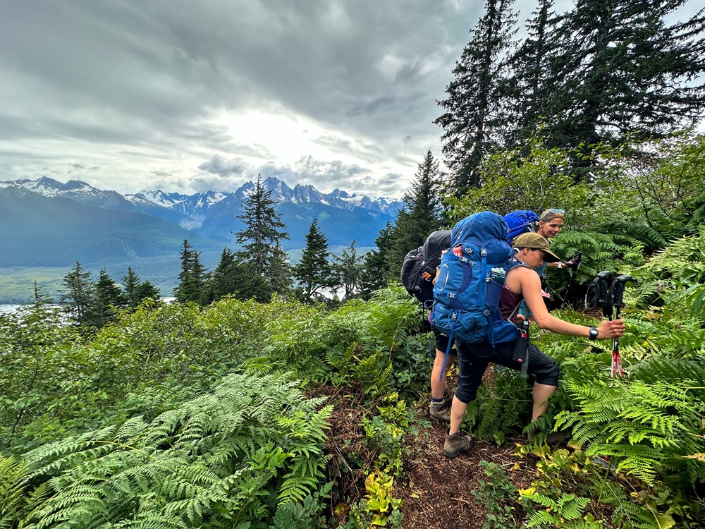
Gaining some elevation in the sub-alpine.
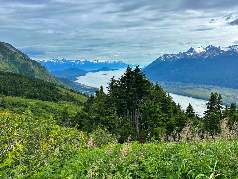
Views down the Chilkat towards Mud Bay.
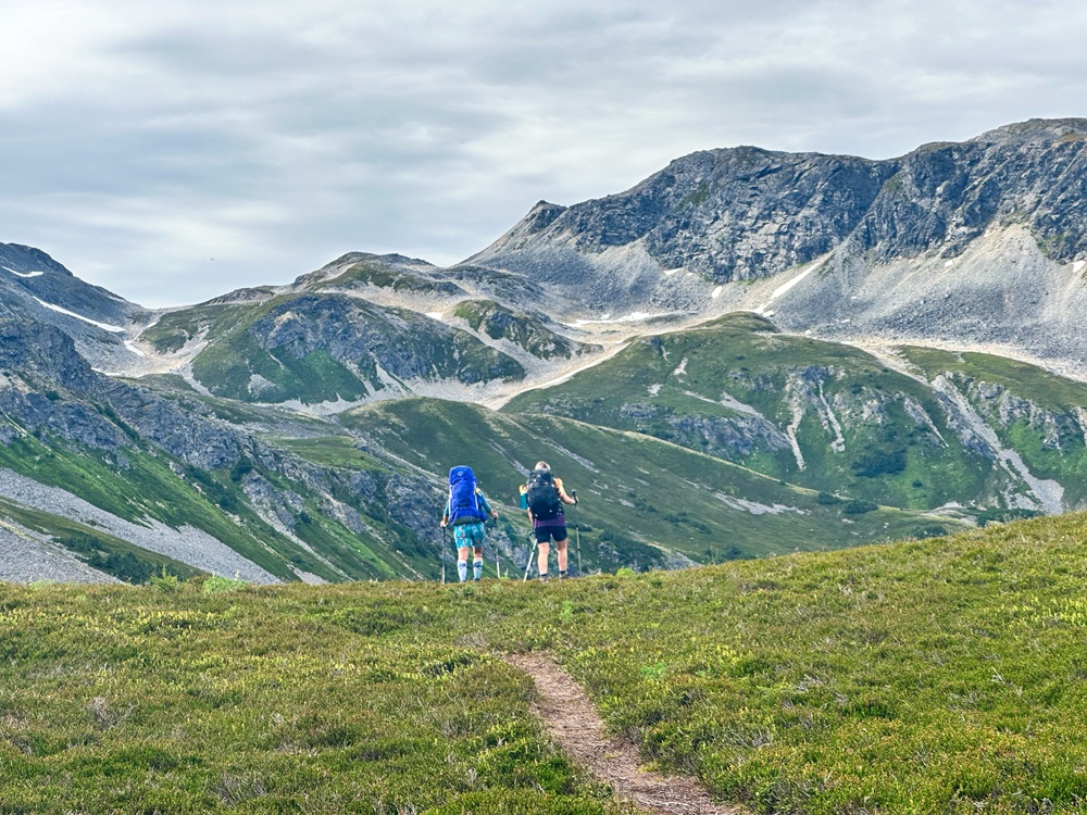
Getting up to the alpine on the Chilly Ridge trail after the junction with 7-mile Saddle trail. Note the peak in the background is Shakuseyi Peak (aka Peak 3920).
Reaching the alpine ridge with the first views of Tukgahgo Mountain. The hut is to the left in the trees.
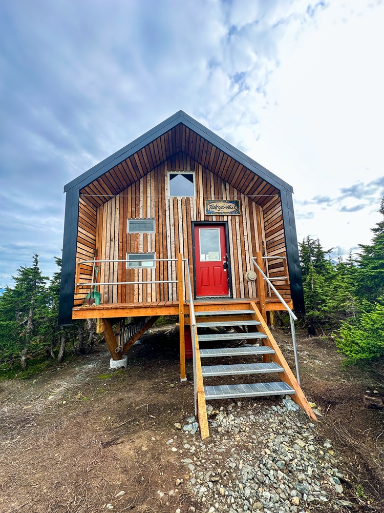
The beautiful Tukga Hut.
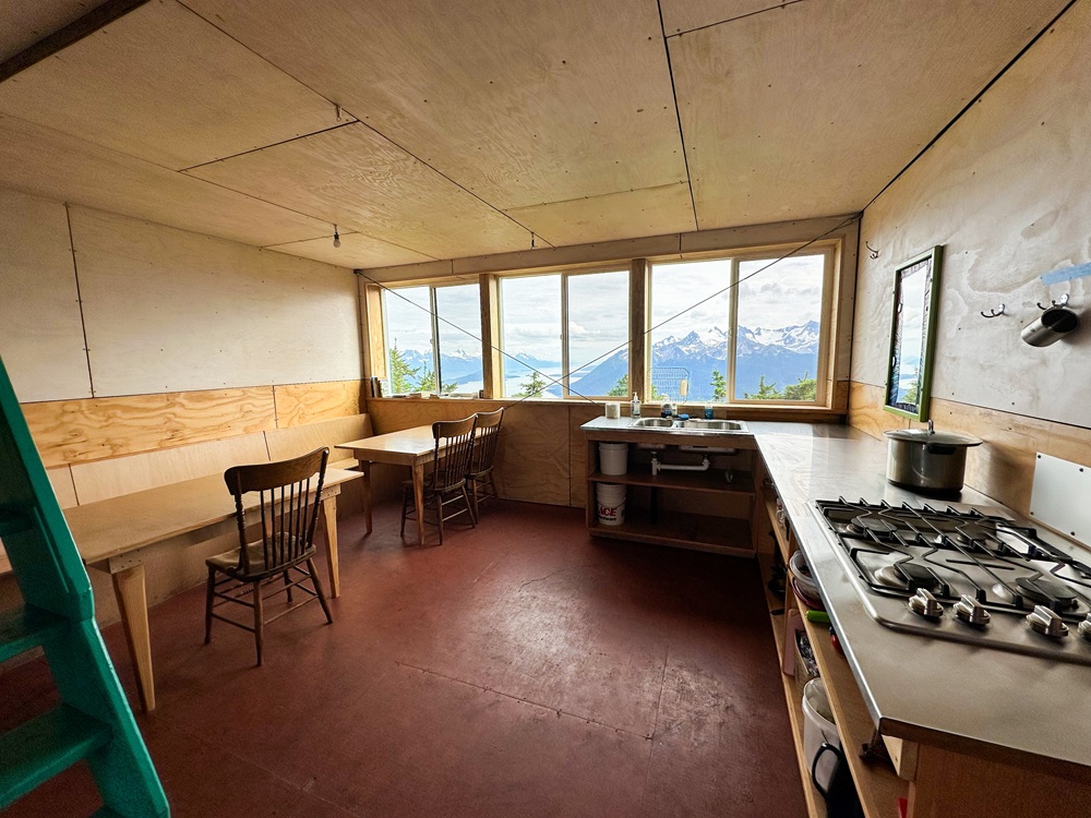
The main floor of the Tukga Hut with kitchen and seating. There are two large bunks to the left and a ladder to the second-floor loft.
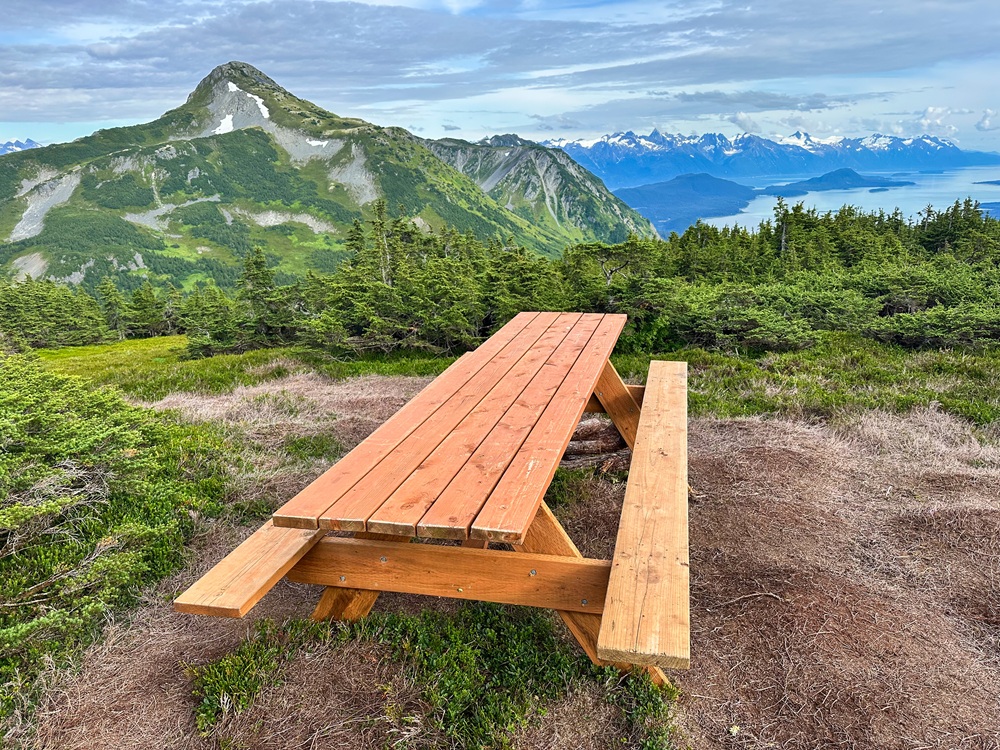
A picnic table with an incredible view.
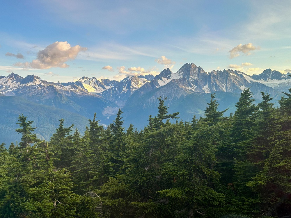
Views out the window to the south.
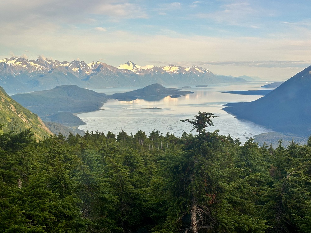
Views to the southeast of Mud Bay and Chilkat Inlet.