Total Distance: 14 km
Return Time: 8 hours
Elevation Gain: 1363 m
Difficulty: Difficult
Region: Haines
Traditional Territory: CIA
Chilly Ridge is an amazing ridge walk near Haines, Alaska, accessible from the 7-Mile Saddle trailhead. It is a long day hike with significant elevation gain. Ideally you can book the amazing Tukga Hut with Haines Huts & Trails and do the ridge as a day hike from the hut. Watch for Mountain Goats along the trail and leave dogs at home during the kidding season (May 1 to July 15)
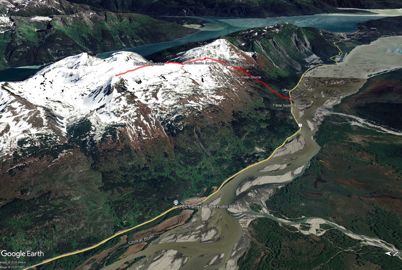
The parking for the trailhead is located at Mile 7 of the Haines Highway, 7 miles (11.3 km) from Haines or 53 km from the US customs heading into Haines. There is a 'hiking sign' indicating parking. Note the trailhead is actually 200 m east.
Note Chilly Ridge is Mountain Goat habitat. The Trails and Huts society asks hikers to reduce impacts to goats, by keeping your distance and maintaining at least 300 yards from any mountain goats when possible. If you stumble upon a goat unexpectedly, back away slowly. Dogs should not be in the area during the kidding season, from May 1 to July 15. Outside of that period, please keep your dog on a leash or leave them at home.
Be prepared, this route is very long with considerable elevation gain. The initial part of this route, via the 7-Mile Saddle Trail is very steep to get to the alpine. It can be very slippery when it rains and snow lingers in the alpine, long into the summer. Pack snowshoes for early season hiking in May and June.
From the parking area, head east along the highway and walk 200 m to reach the trailhead. The trail starts with a boardwalk that leads to the forest. You'll shortly reach a waterfall and trailhead sign with various trail distances. The elevation gain starts here and doesn't end until you reach the end of the ridge!
Follow the trail up through the coastal rainforest. Marvel at the huge Sitka Spruce and Devil's Club and keep an eye out for ripe blueberries, black currants, and salmonberries in August. You will leave the big trees behind after a long slog and enter the sub-alpine with scattered stands of stunted Western Hemlock and open meadows of wildflowers and alpine plants.
2.9 km from the trailhead you will reach a fork in the trail. The trail to the right goes to the 7-Mile Saddle, while the trail to the left is the Chilly Ridge trail and the trail to the Tukga Hut. It is another 0.7 km to the alpine and 177 m elevation gain. Here you'll get your first glimpse of Tukgahgo Mountain and Chilly Ridge.
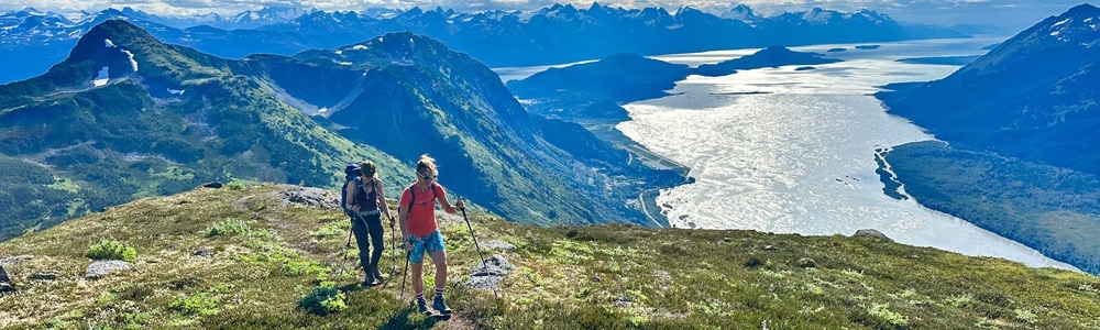
From the alpine gain the ridge to the west. You may be able to find some footpaths or goat trails along the way, but there is no trail marked so follow a well-worn trail when you can. The views to the southwest of the Takhinsha and the Chilkat Range are amazing the entire way, as well as the views southeast to the Chilkat Inlet and Mud Bay near Haines.
The ridge continues up and down, with many steep and exposed sections. There are some sections with loose rock, but the ridge is mostly vegetated. 6.1 km from the trailhead you will reach a high point with a radio repeater. You can continue on the ridge for another 800 m to the natural endpoint of the ridge (which descends slightly).
NOTES ON WATER
There are water sources along the route, either before reaching the 7-Mile Saddle or just below the ridge at the alpine lakes that are along the Tukgahgo Mountain route.
EXTENDED HIKE
From the end of Chilly Ridge you can tag on Tukgahgo Mountain and return on that route. The route will be a little longer but worth it if you have the time and energy!.
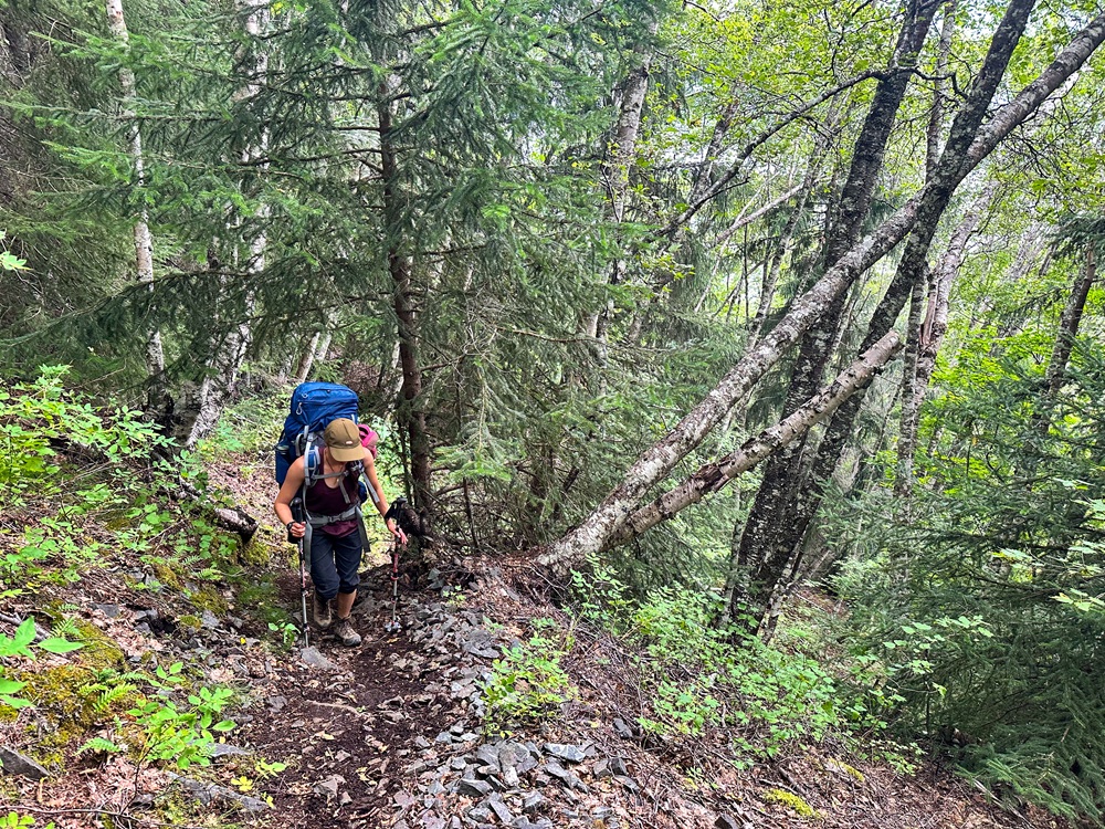
Hiking the steep 7-Mile Saddle portion of the trail.
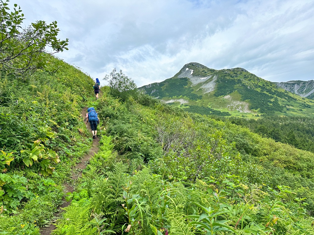
Getting up to the alpine on the Chilly Ridge trail after the junction with 7-Mile Saddle trail.
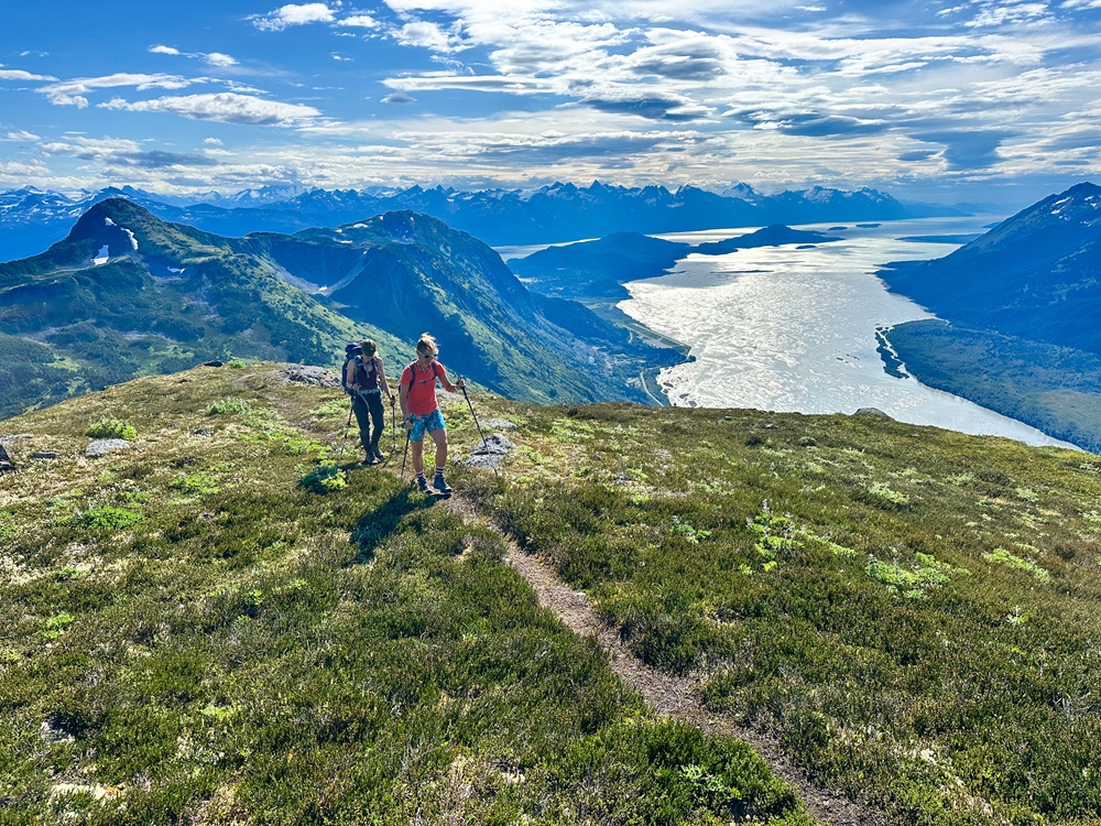
Gaining Chilly Ridge, above the Tukga Hut wiht views of Shakuseyi Peak, Mud Bay, and Chilkat Inlet.
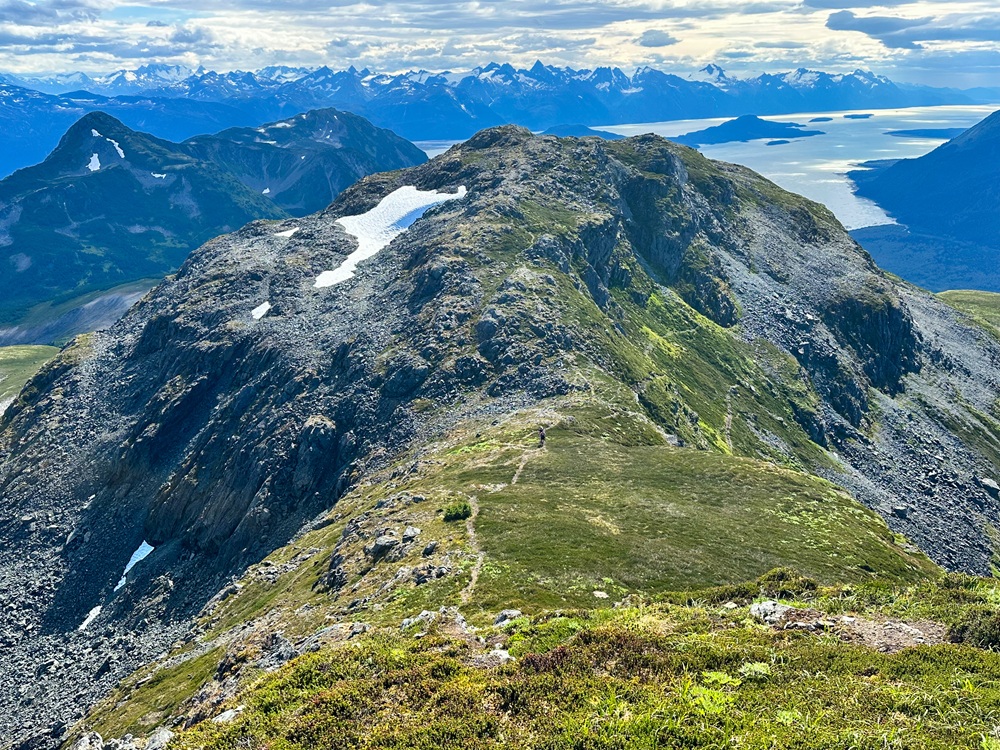
Views of the rocky ridge heading northwest. Watch for Mountain Goats and keep your distance.
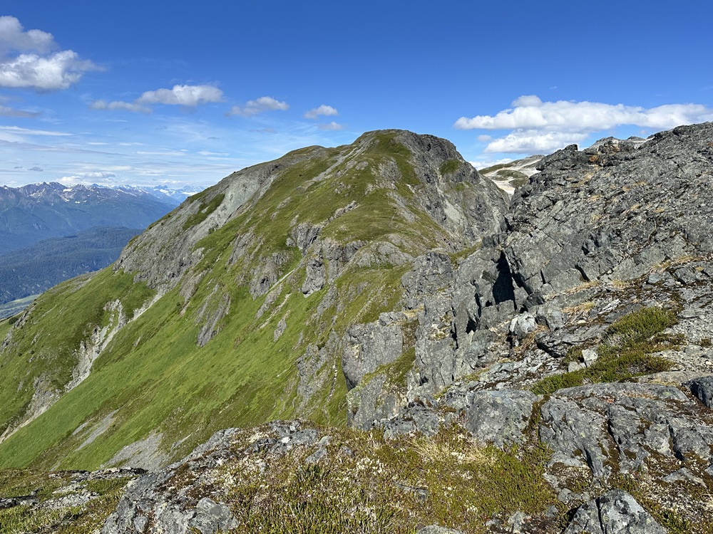
Looking back at the trail mid-way along Chilly Ridge.
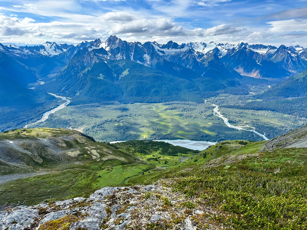
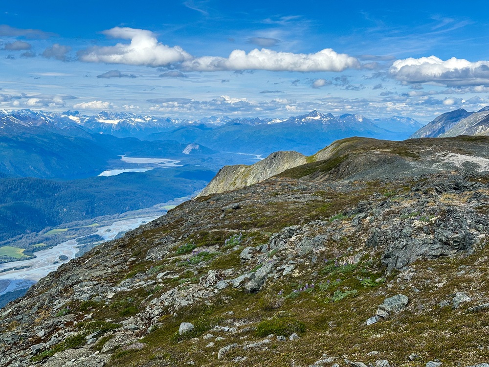
Views looking southeast to the Takhinsha Mountains and the Takhin River (right) and Kicking Horse River (left).
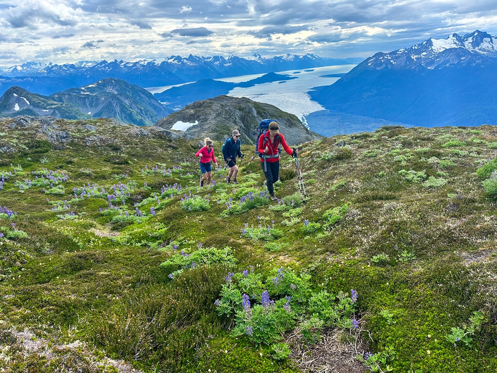
Continuing on the ridge through a small pocket of lupin.
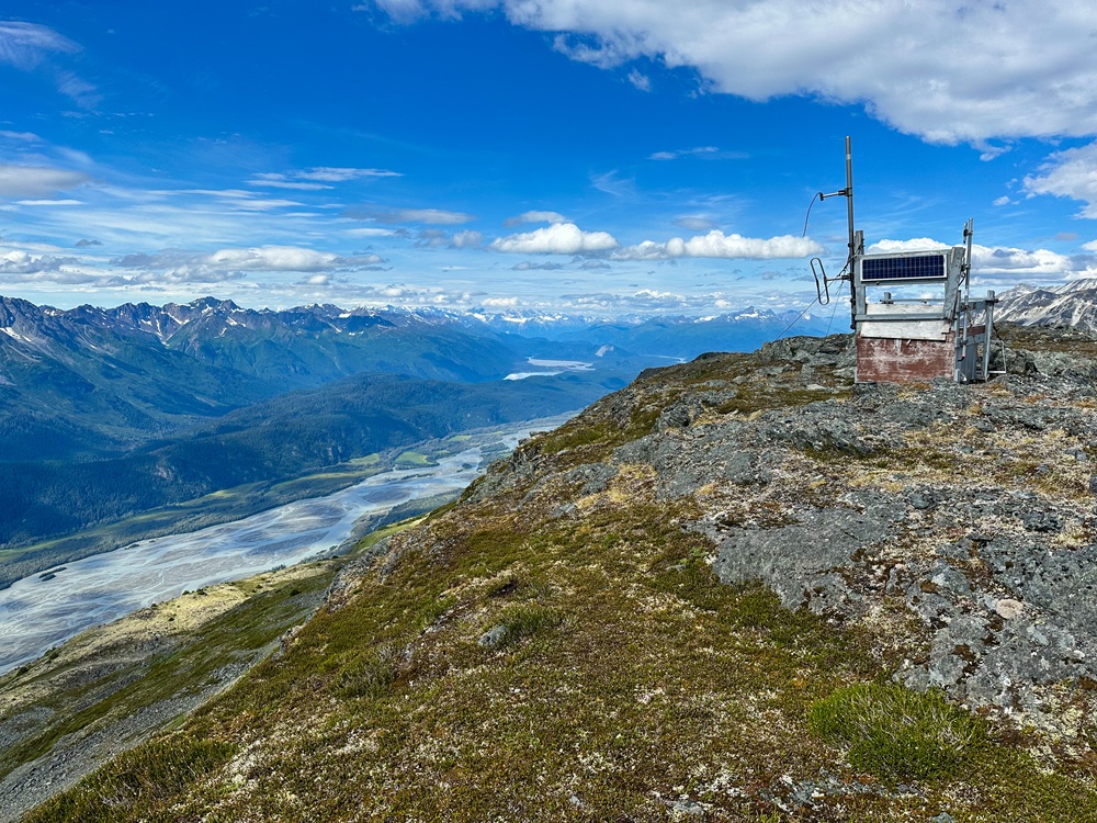
The radio repeater near the end of the ridge. Views looking northwest.
Looking towards the end of the ridge with the mighty Chilkat River below. In the background are Chilkat Lake and Tsirku and Klehini rivers.