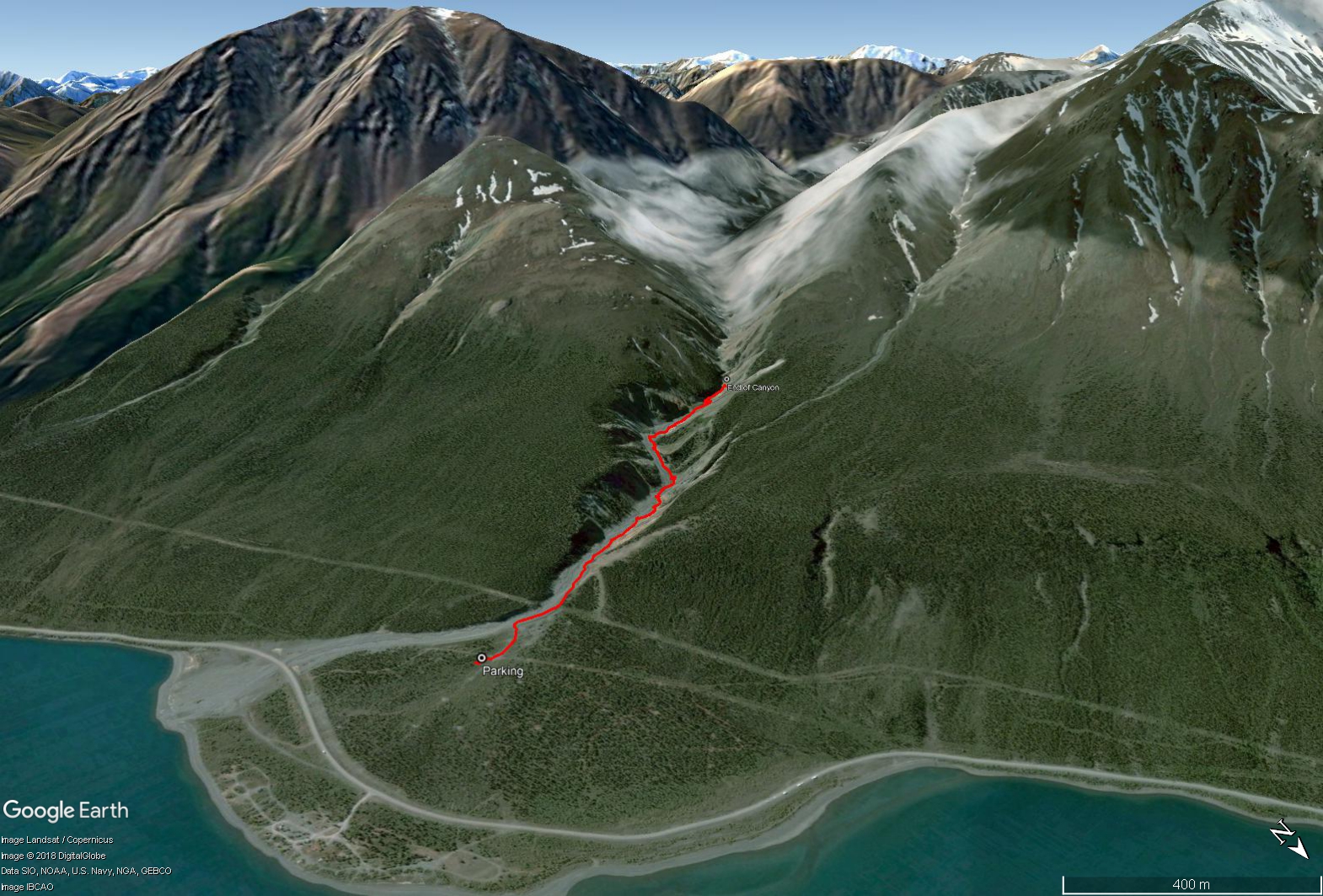
Total Distance: 4 km
Return Time: 2 hours
Elevation Gain: 214 m
Difficulty: Moderate
Region: Kluane
Traditional Territory: WRFN
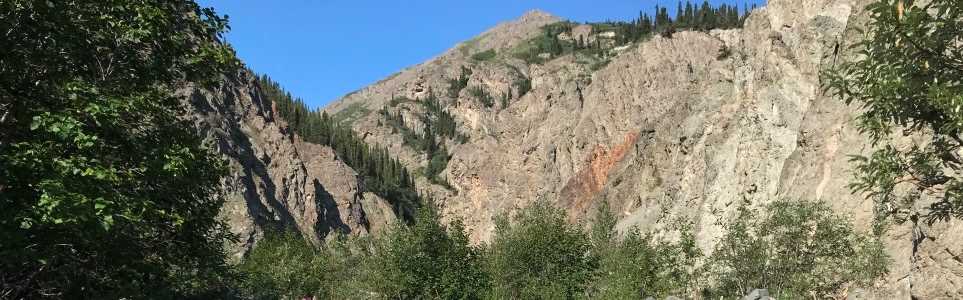
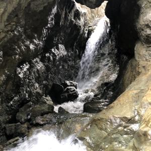
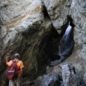
Williscroft Canyon is a spectacular and unique hike in the Kluane Lake area of Kluane National Park. Huge canyon walls reach up above a beautiful clear, cobble and boulder strewn creek. The reward at the end of the canyon is a huge boulder lodged within a narrowing in the canyon walls, with a small waterfall running below it. Under most water level conditions, be prepared to cross the creek regularly.
From Haines Junction, drive 79 km north on the Alaska Highway towards Destruction Bay and Burwash Landing. During this drive you will pass the Tachal Dhal Visitor Centre at Kluane Lake and a little while further (9 km) you will see a highway sign for Williscroft Creek. Just after the highway crosses the creek there is a dirt road that leads up to the left. Follow this road for a few hundred meters up to a gravel pit area. Park where it is flat near the top of the hill. This is the trailhead. The road does continue a little ways higher, but it becomes rougher and there is not as good of a place to turn around.
Note this route requires picking your own route up the creek bed. You should expect to be crossing the creek multiple times, though in most conditions you can find rocks to step across. Poles are a big help to steady yourself. Be aware of potential seasonal and weather conditions that could make the creek water levels higher and the route more challenging or dangerous. Expect higher water levels in late spring and early-summer, as well as during steady hot weather in the summer. Be particularly weary during heavy rain events as canyons are essentially funnels for the water and the canyon rock walls could become unstable with landslides or rock fall. Note early in the spring and summer there could still be snow in the canyon as it sees less sun.
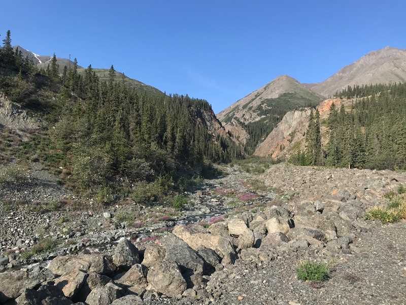
Start the hike by following the gravel road for a few 100 meters. Soon you will reach the embankment above Williscroft Creek near the start of the canyon. Keep to the right of the creek (heading upstream) for the first part, following along the rocky river bed. Keep an eye up ahead to see if and when you may need to cross the creek. As mentioned, expect to do this multiple times as you make your way up the canyon. The creek is braided for the most part and relatively easy to cross.
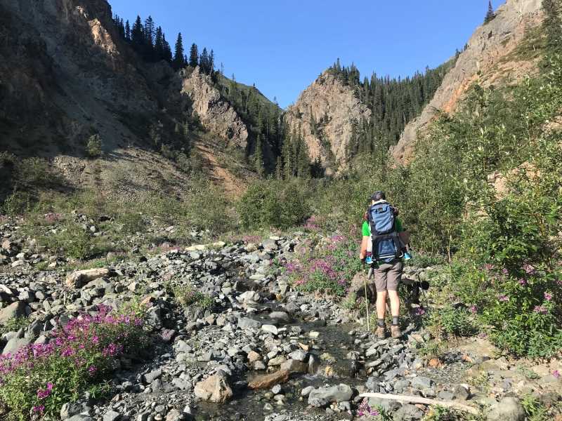
The hike is very gradual uphill and not very strenuous, just hard on the ankles with all the rocks. Poles come in handy again. There are some areas of willows and alder along the route, but no bad bushwacking.
After 2.2 km of hiking up the creek, you should reach the small waterfall chute and huge boulder lodged within the narrowing in the canyon wall. This is the end of the route and the most technical part with some larger boulder hoping and scrambling if you want to get closer to the waterfall and big boulder. During high water you may not be able to make it this far as the canyon walls are very narrow and the water concentrated in that smaller space.
Return the way you came up, enjoying another perspective of the canyon on your way down.
After continuing up the road from the parking area, you will reach the creek and embankment and the beginning of the canyon.
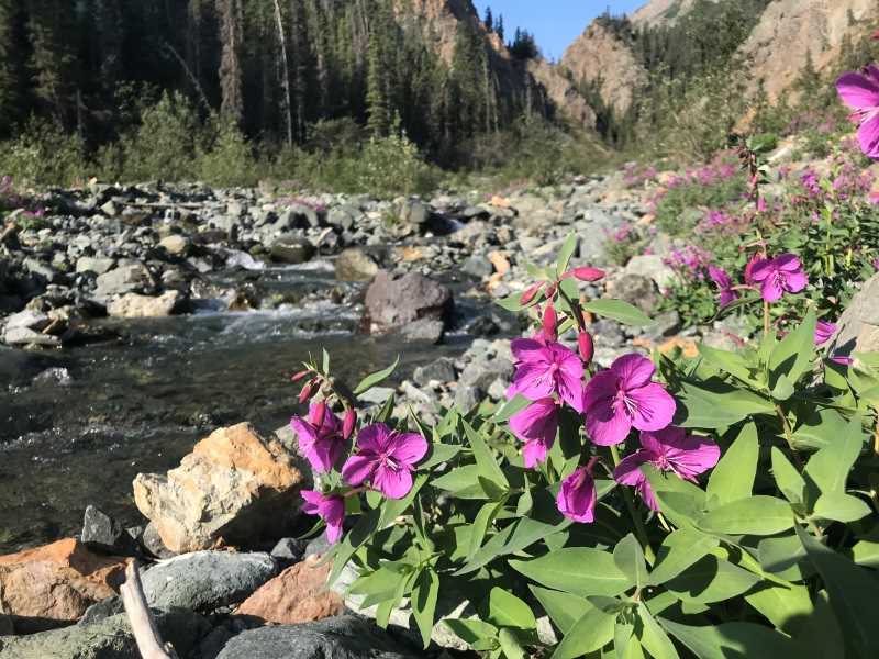
Watch for River Beauty (also known as Dwarf Fireweed) along the creek bed.
Pick your way up the right side of the creek (heading upstream) until you have to cross.
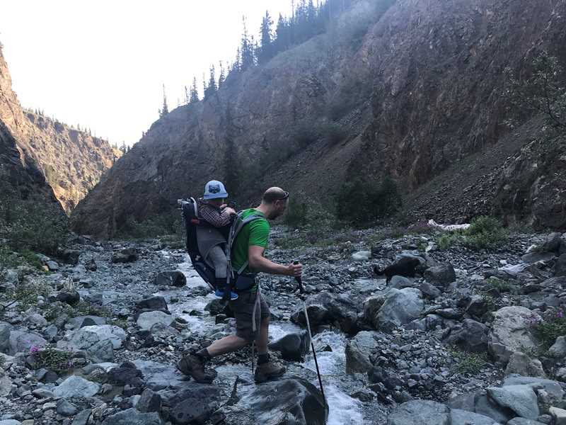
Hiking poles are a big help to steady yourself during the multiple crossings and over the rocky terrain.

At the end of the canyon you'll reach the picturesque boulder lodged between the narrow canyon walls with the waterfall running below.
Khush June 8, 2025
Hiked it all the way to the waterfall/large boulder on June 7. Water levels were low, crossed the creek multiple times. No signs of wildlife. Route description, return time, driving directions all bang on.

Aaron June 8, 2025
We went on the hike yesterday and really enjoyed it! Tons of little creek crossings, but we were able to keep our feet dry. The water was a little too high to get over the falls at the end (and we aren't experienced enough to climb the dry rocks, but could see the boulder wedged in the canyon from where we stopped.
Easy enough hike, less than 2 hours round-trip including breaks to enjoy the falls and the views.

Emmie Clements October 12, 2020
Great little hike! There are quite a few creek crossing area so waterproof shoes/boots may be best. We saw a huge bear track, bear spray and such may be needed. Definitely worth the hike!
Kyle September 24, 2018
Great little hike!
only 4km but takes you right to a nice waterfall that has water hammering down on the rocks like your exploring a cave.
About 3/4 through the hike too you'll notice to your right that there are several steep caribou/sheep made trails that lead to the top of one side of the canyon. I suggest taking this, it is steep but you are rewarded at the top with sweeping views of Kluane lake.
Murray Lundberg August 21, 2018
What a spectacular place - the hike a great way to spend a couple of hours. It must be incredible at high water levels.
Laura King August 14, 2018
We did this trail today.Perfect time for it.it was a quick little jaunt up the creek.crossing a few times.lovely falls at the end.
Miss e August 6, 2018
Hiked trail earlier in June this year and could not pass creek in final 500 meters due to swift currents and high waters. Glad to hear it was passable later in the year!
