Total Distance: 3 km
Return Time: 1 hour
Elevation Gain: 76 m
Difficulty: Easy
Region: Faro
Traditional Territory: RRDC
This is a short hike in Faro with a great view of the beautiful Van Gorder Falls, which plunges out of a rocky canyon. It starts right from town and is a great way to spend an hour.
The community of Faro is located along the Robert Campbell Highway via the North Klondike Highway from Whitehorse. It is a 358 km from Whitehorse.
From Whitehorse, head north on the Alaska Highway out of town to the junction with the North Klondike Highway, just over 11 km from downtown. Follow the North Klondike Highway for 166 km, passed Carmacks to the junction with the Robert Campbell Highway. Take a right onto the Robert Campbell Highway.
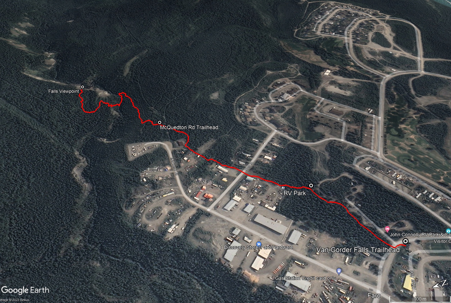
After about 167 km on the Robert Campbell Highway you will see a sign for Faro, indicating to turn left onto Mitchell Road. Mitchell Road is the access road to Faro. Follow it for about 10 km, and turn right onto Campbell Street, the main entry to Faro.
Head to the Visitor Centre in the middle of town on Campbell Street. There is ample parking here. If you want an even shorter hike, start from the cul-de-sac at the end of McQueston Road.
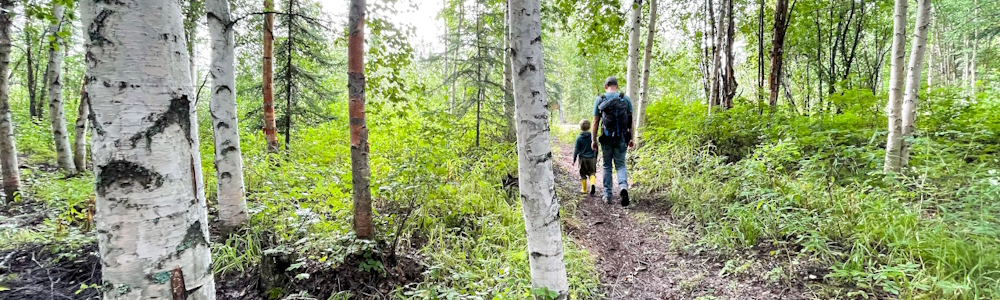
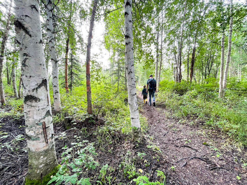
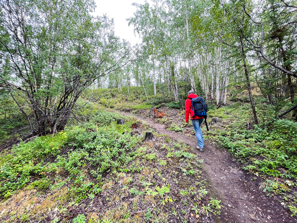
From the Visitor Centre, the trailhead is located back at the John Connolly RV Park and Campground (just 100 m north on Campbell Street from the Visitor Centre). Watch for hiking signs along the way. The trail leaves the RV park and heads into a beautiful mixed forest with birch and spruce trees. Shortly, the trail crosses Ross Road and then back into the forest beside several commercial/industrial properties. After about 700 m on the trail you will reach the junction with the other trailhead at McQueston Road. Look for the smaller hiking footpath to the falls.
Now that you are on the main trail, it is a pleasant short hike to the falls. You will head up a small hill and then down through an old wildfire area. There are interpretive signs along the way. After crossing a bridge over Van Gorder Creek, the trial heads steadily uphill until you reach the viewpoint of the falls. There is a viewing platform here where you can rest and take in the falls.
Return the way you came.
This trail would be enjoyable in the winter. Bring snowshoes in case you need to break trail.
Pick up the trail from the RV Park right in the centre of town.
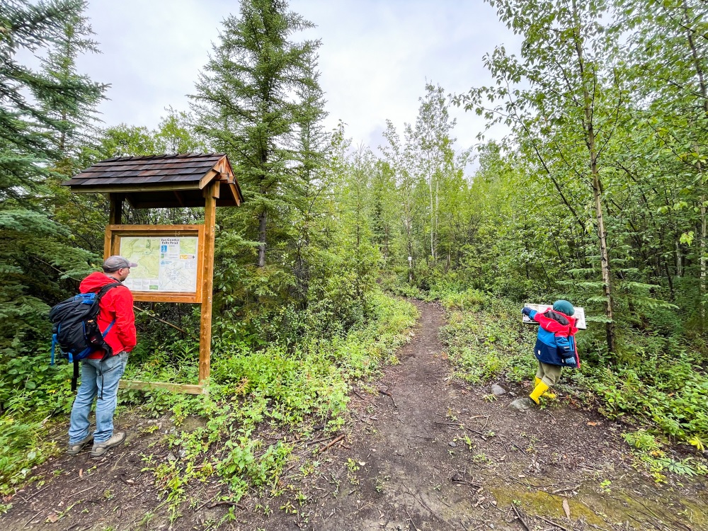
After winding your way through town, you'll reach the junction with the trailhead at McQueston Road. Pick up the hiking footpath from there.
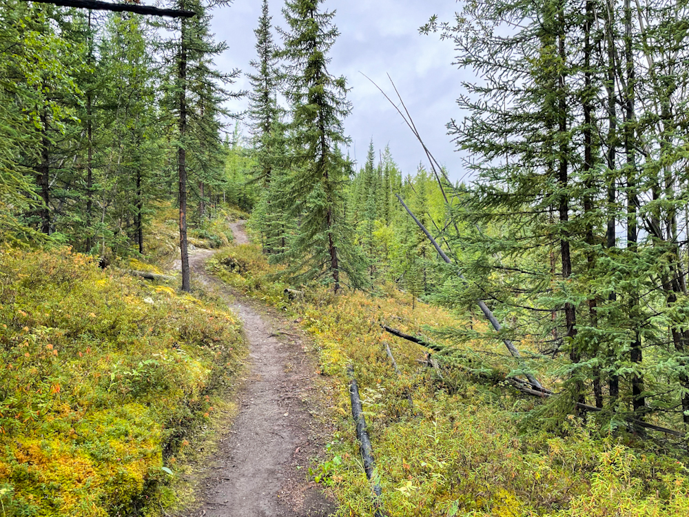
The trail starts up through an old wildfire burn.
The trail then heads down through the forest to a bridge over Van Gorder Creek.
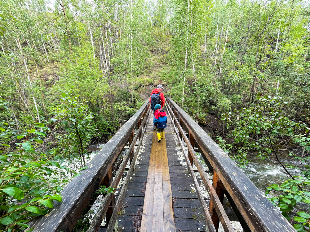
Crossing the bridge.
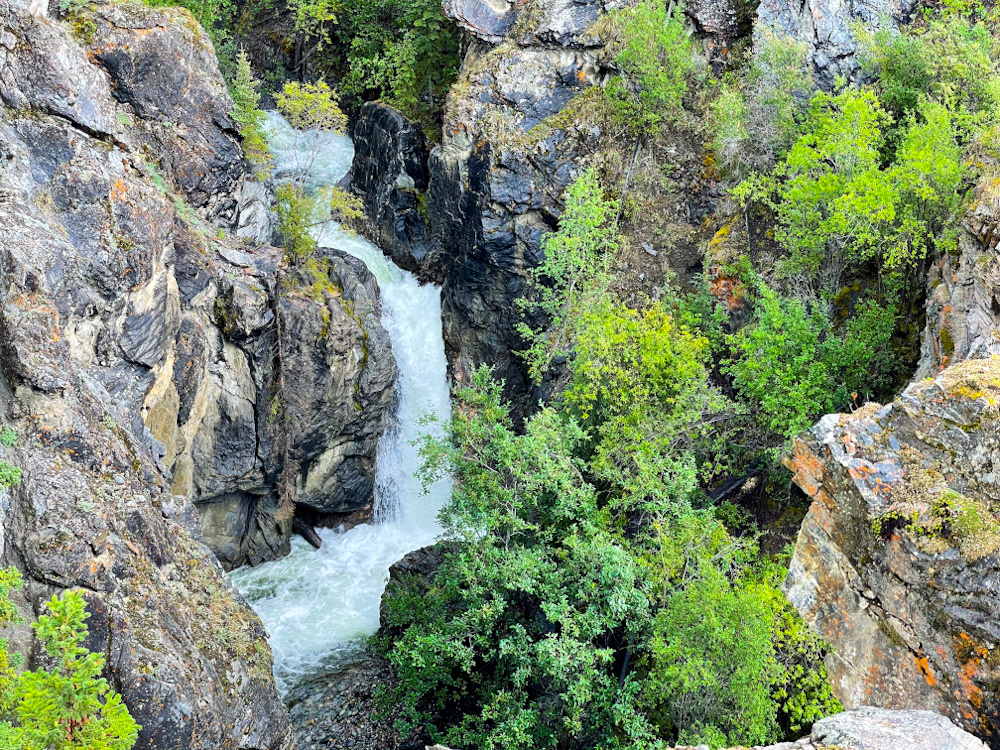
The view of the falls from the viewing platform.