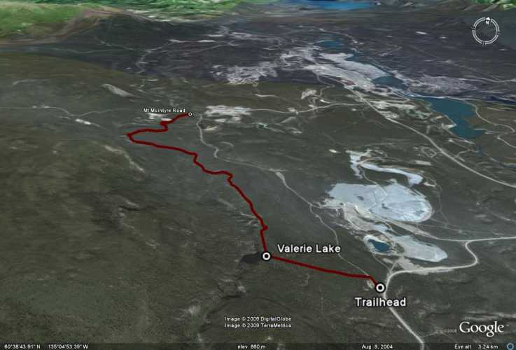
Total Distance: 14 km
Return Time: 4 hours
Elevation Gain: 100 m
Difficulty: Easy
Region: Whitehorse
Traditional Territory: KDFN, TKC
This trail is part of the Trans-Canada Trail system around Whitehorse. It is a nice forest walk close to Whitehorse with views over small lakes and cool canyons. In the winter, snowmobilers use this trail, which helps pack down the snow so that snowshoes don't have to be worn.
From Whitehorse, drive south along the Alaska Highway towards Mount Sima (the local ski hill). Look for the sign for the ski hill and take a right off the highway onto Mount Sima Road. Drive 2.4 km to a large pullout and gravel road on the right and park here. This is just over 500 m after a large gravel pit on the right.
To find the trailhead, walk down the wide gravel road (Copper Haul Road) until you see a Trans-Canada Trail marker on your left in the trees. This is the trailhead. Turn left and continue along the trail, staying to the right.
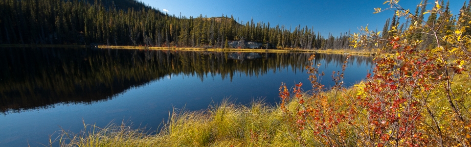
Valerie Lake is the first stop along the trail - just under 1 km into the route. There is a picnic table and a canoe at the lake. From the lake, continue along the trail. At one point you will walk under power lines across a small clearing. Stay left as the trail to teh right follows under the power lines and heads down to the Copper Haul Road again.
Shortly after Valerie Lake there is another neat viewpoint of a large rocky canyon. Watch for it on the left.
Other than that, the trial is mostly through spruce and aspen forest with moderate ups and downs. At the end of the trail you will come to Mount McIntyre Road and an outhouse. You can either turn around and follow the same route back, or turn right onto Mount McIntyre Road and follow the Copper Haul Road back to the trailhead (another right) to make a loop.
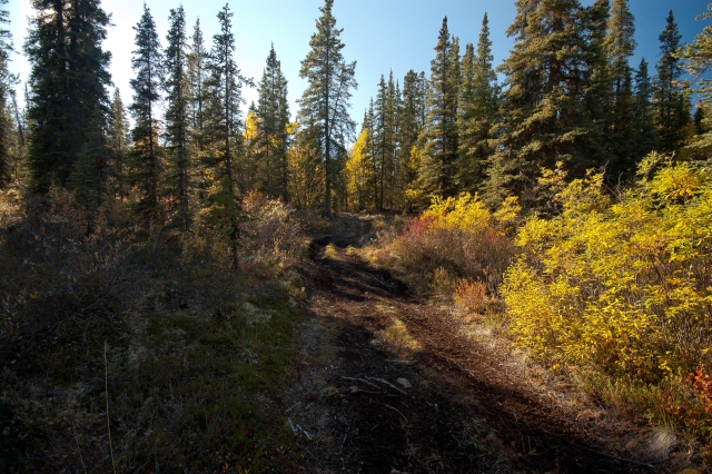
The path follows an ATV/snowmobile trail.
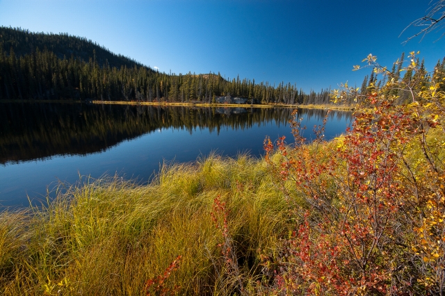
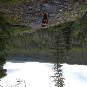
Valerie Lake in the autumn.
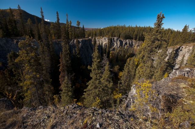
Rocky cliffs border a small stream below.
Shailyn October 1, 2025
Ran with a friend on September 27th. Lovely trail for the autumn colours.
There is definitely permanent flooding on the trail in two sections (one which people have clearly been going around as there is a faint trail in the bush) and the other that is near the end (around km 6.8). We decided to do an out-and-back, instead of going back along the road. The total elevation gain for this out-and-back was 378m, making me think that the 100m in the trail description is not accurate. It is closer to 200. There was no wildlife, and no recent signs of bears either.
Frenchie June 5, 2025
Completed the described route, June 4th, taking the Copper Haul Road back to the trailhead to create a loop.
Aside from some wet and muddy sections, in the areas heavily rutted by ATV tires (the worst being roughly 6.8 kms from trailhead), the trail is dry and easy to navigate. A few bugs at Valerie Lake, but not noteworthy beyond that.

WW June 3, 2021
Ran this trail until the McIntyre road and followed the Copper Haul back. The first section that follows the cliff edge is dry and in good condition. Unfortunately, as you drop down into the valley it seems the local stream has decided to use the trail as it's new channel. If you can hop-scotch across the trail, you'll be rewarded with a nice view after climbing out of the valley. Always worth stopping at Winterlong on the way back out from the trailhead.
C. June 4, 2020
Real nice trail. I made the mistake of pulling over at the pullout right after the gravel pit, parking, and walking down a bit there til I realised it was not the trail (though the gravel pit pond back there is kinda cool looking). The real pullout is just after - According to my odometer, it's closer to 3km after the turnoff, rather than 2.4. Just a note for anyone else who might get confused!
Had a lovely time at the lake and walking along the trail after. I'll return for sure!
Mark Wallace February 16, 2019
I ran the trail today, the trail is well packed. At the far end of the trail there is some over flow.
FrozenFella December 12, 2015
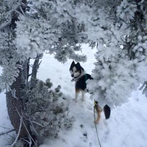
Halo and I hiked from the Valerie Lake trailhead up by Polar Lake to the Maclean Lake trailhead and return on Dec 11. Trail is well packed with a skiff of snow so easy walking. There are a couple of large trees that have come down or are hanging over the trail, but nothing too serious.
Was beautiful with all the hoar frost on the trees, perfect temp at -10C
R. September 21, 2015
Did the trail a day ago. Beautiful hike with many changes in scenery (lakes, views from the river banks, variations in forest vegetation). Closer to the end of the trail, where the trail hits the road where some very muddy sections. Walked back along the Copper trail road, which is shorter than walking back through the forest.
Saw bear tracks by Valerie Lake and markings approx. halfway into the trail.
Steve August 3, 2014
Did the loop on Monday with the pup. Made it in 2.5 hours. Came back the copper trail. Nice hike.
SueD May 18, 2014
Hiked into Valery Lake today with Liz. What a nice little hike! The terrain is so varied and lots of interesting things to see in the forest. Saw the hugest porcupine I've ever seen sauntering along. It was super muddy so I'd like to come back later when its dry. There were some grizzly bear prints in the mud so we just kept on walking and decided to walk the road back just in case...and we didn't feel like walking back in the mucky mud. Fun little walk in the woods.
