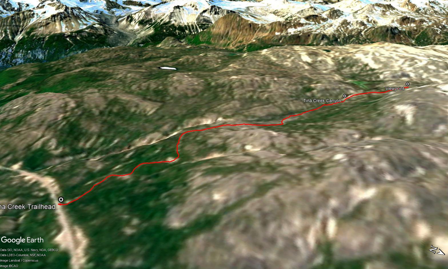
Total Distance: 7 km
Return Time: 3 hours
Elevation Gain: 313 m
Difficulty: Easy
Region: Haines Pass
Traditional Territory: CAFN
The Tina Creek route provides awesome access to the alpine with lots of room to explore. The route described here follows an old mining road into the alpine, all the way up to some alpine lakes. There are awesome views of glaciers, the Three Guardsmen Peak, and Chilkoot-esque rocky ridges along the way. Choose your own adventure from there or bring your overnight gear to spend time exploring.
From Haines Junction, it is a 156 km drive south on the Haines Road to the trailhead. Note this hike is in BC. Watch for Three Guardsmen Lake (on the left), as a landmark and the trailhead is about 2.8 km past the lake on the right. The highway has a wide shoulder here and there is ample room to park safely.
Pick up a footpath from the highway that leads into the bush. The road is slightly overgrown at this point, but gradually opens up into the subalpine and alpine, and is easy to follow. There are a few little creek drainages that cross over the road, but nothing serious. After about 2 km, much of the elevation gain is done and the road crosses the open valley beside Tina Creek. There are beautiful views of the Three Guardsmen/Glave Peak area on the way up.
After about 3 km you reach a small canyon. Just before the canyon, the road splits to the left (to keep along the canyon) or heads slightly right and around the canyon area. Either option takes you to the same spot beyond the canyon, to a large open alpine area where several valleys converge with some alpine lakes. Here there are some additional road junctions. One road leads to the left (south) along the lake up to some rocky ridges, the middle road goes along the right side of the lake and up another alpine valley, while the third goes up the ridge to the right. For the route described here, take the road to the right and head up slightly to a nice viewpoint and some tors (rock formations). Take the same route down or take some extra time to explore and get even better views.
This is a great access route in the winter for a beginner backcountry ski tour and/or winter camping trip. The route follows the same general GPS track as in the summer (see above description) though you can't just follow the road as it is buried in snow. You can cut off some of the distance by taking a more direct route in the winter. Use the same trailhead or start 50-100 m further down the highway towards Haines, Alaska.
The majority of the elevation gain (2/3rds) is at the beginning of the route. It is relatively low angle and easy to pick a safe route up, avoiding any gullies or terrain features (convex slopes) that could increase avalanche exposure or triggering risk. After the main elevation gain, it is easy going along a wide-open valley.
The area around the small lake above the Tina Creek canyon has many good locations for camping. The slopes around the lake have easy options for ski touring.
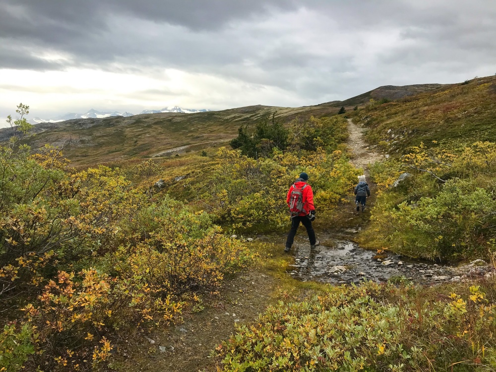
The route follows along an old mining road into the alpine.
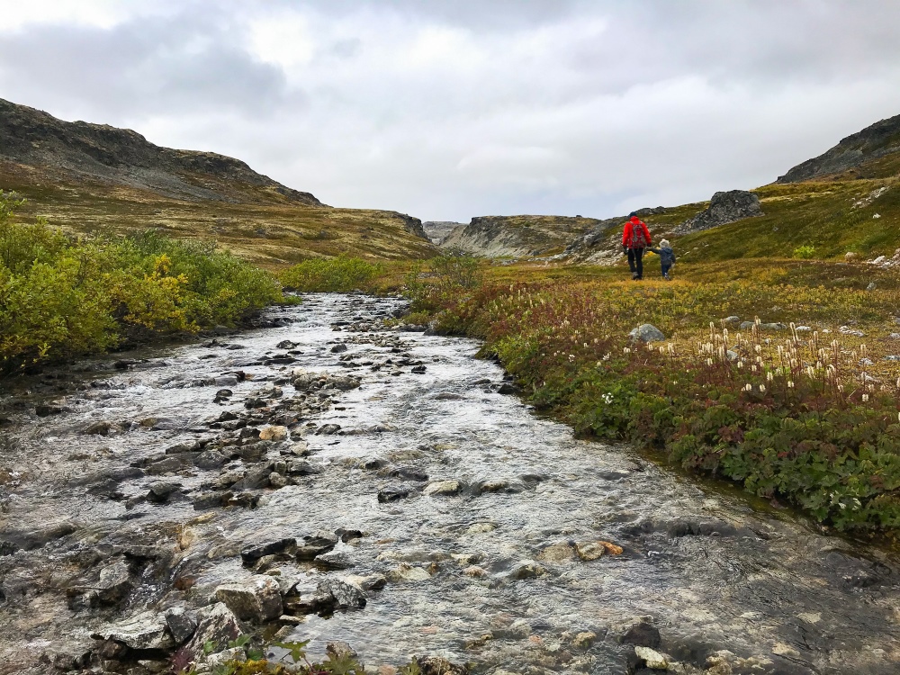
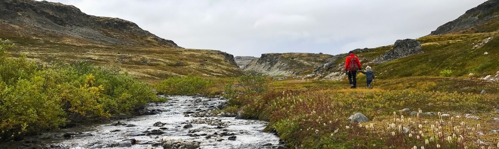
Walking along the namesake waterway, Tina Creek.
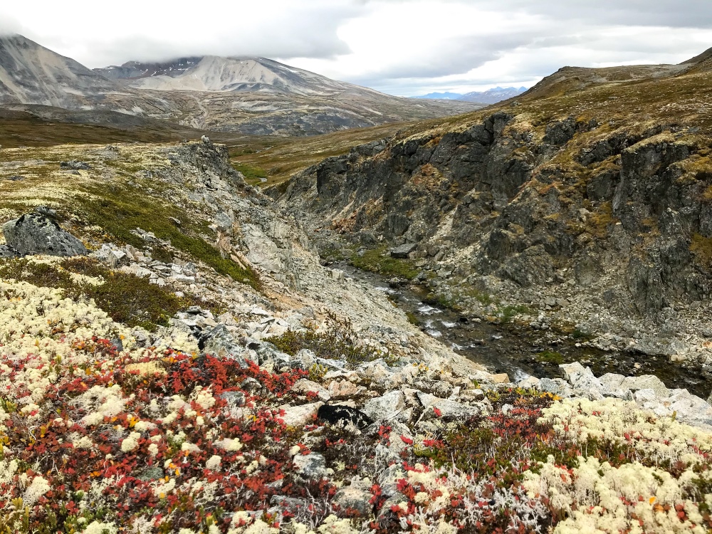
Looking down the little canyon of Tina Creek, near the end of the route.
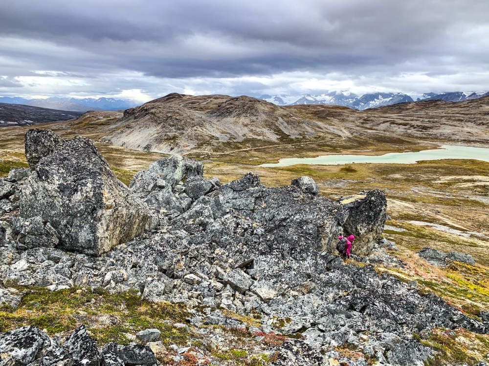
The view of one of the alpine lakes from the tor viewpoint.
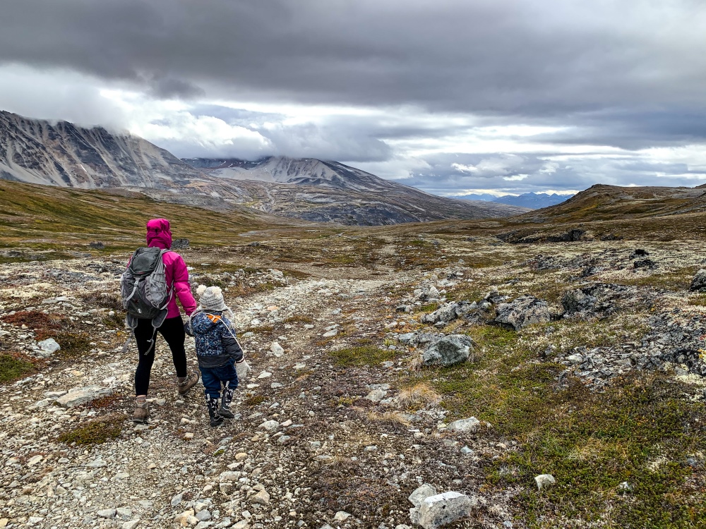
Walking back down the valley along the mining road.
Andy November 13, 2023
Hiked the area on July 2/23. Left the trail and hiked the rocky hills to the north. Easy open hiking. Lovely country, although the cloud cover discouraged any view of the surrounding mountains. And, the drive down from Haines Junction was also lovely.
Jess September 3, 2023
Overnighted September 1-2. Easy trail with lots of room to explore. Camped near a small lake and took a little trip to the tower before heading out in the morning. Weather changed frequently in this area with rain, fog, and breaks of sunlight. Tonnes of blueberries, moss-berries and some cranberries. Didn’t see much wildlife. Personally a bit hesitant of water sources given that it’s an old mining site. Chose to drink what I brought rather than treat the water there.
Nico August 10, 2023
beautiful, easy hike. Lots of good soft and even spots to set up camp. mining raod splits up in different trails, much to explore. view can be limited during humid, foggy weather
