Total Distance: 7 km
Return Time: 3 hours
Elevation Gain: 196 m
Difficulty: Easy
Region: Atlin
Traditional Territory: TRTFN
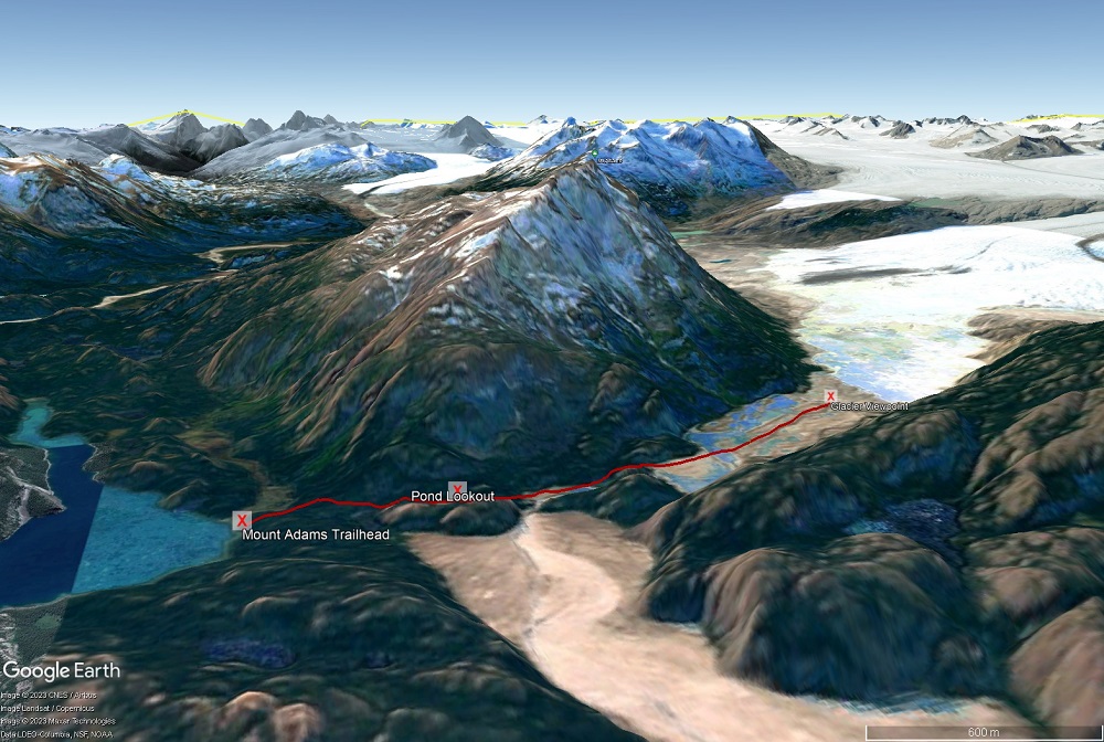
This is a spectacular hike at the southern end of Atlin Lake to a view of the mighty Llewelyn Glacier. It is a very remote hike requiring either motorized boat access, floatplane access or kayak/canoe access on the largest natural lake in British Columbia! The hike itself is on a trail maintained by BC Parks. The trail travels over varied terrain, taking you through balsam fir forests, to viewpoints of a beautiful little lake, along a turquoise blue creek and across glacial valleys to a very spectacular viewpoint. There is a good amount of ups and downs, with little overall elevation gain. Great day hike or overnight trip.
The trailhead is located at the southern end of Atlin Lake, in Sloko Inlet. It is within the Atlin/Áa Tlein Téix'i Park (BC Park). Access to the trailhead is by boat about 60 km down the lake from the Atlin boat launch (motorboat, charter, kayak/canoe/packraft) or charter float plane. See trailhead coordinates for location. You will want to ensure you have a good weather window for reaching the trailhead by boat, as this is a very large lake where weather can change quickly and large waves can slow progress and be dangerous. Research the route ahead of time, check weather and wind forecasts, and know where to safely harbour and wait out bad weather. There is a trail marker at the trailhead.
From the trailhead, the trail goes into the conifer forest. It is easy to follow and may have a bit of deadfall along the trail to climb over or hike around. The elevation gain is gradual as you head up through the mostly balsam fir and lodgepole pine forest. You will pass a small lake to your right through the trees and then the trail will head a little steeper up to a rocky bluff overlooking another small lake. This lake lies right below the northern face of Mount Adams itself and is about 1.1 km from the trailhead.
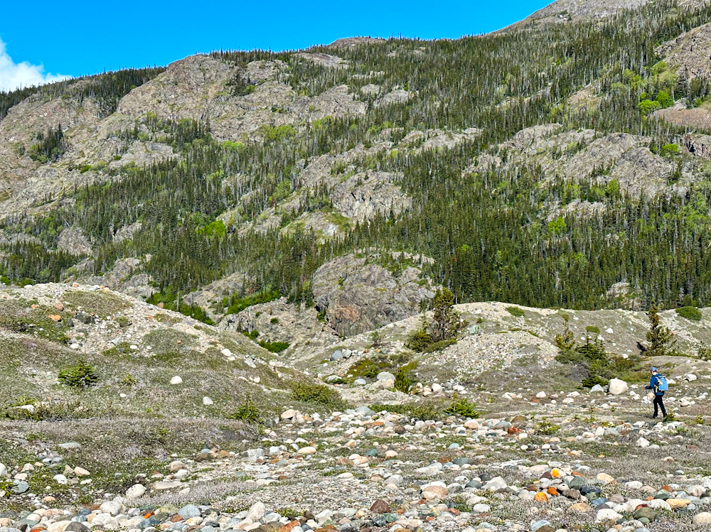
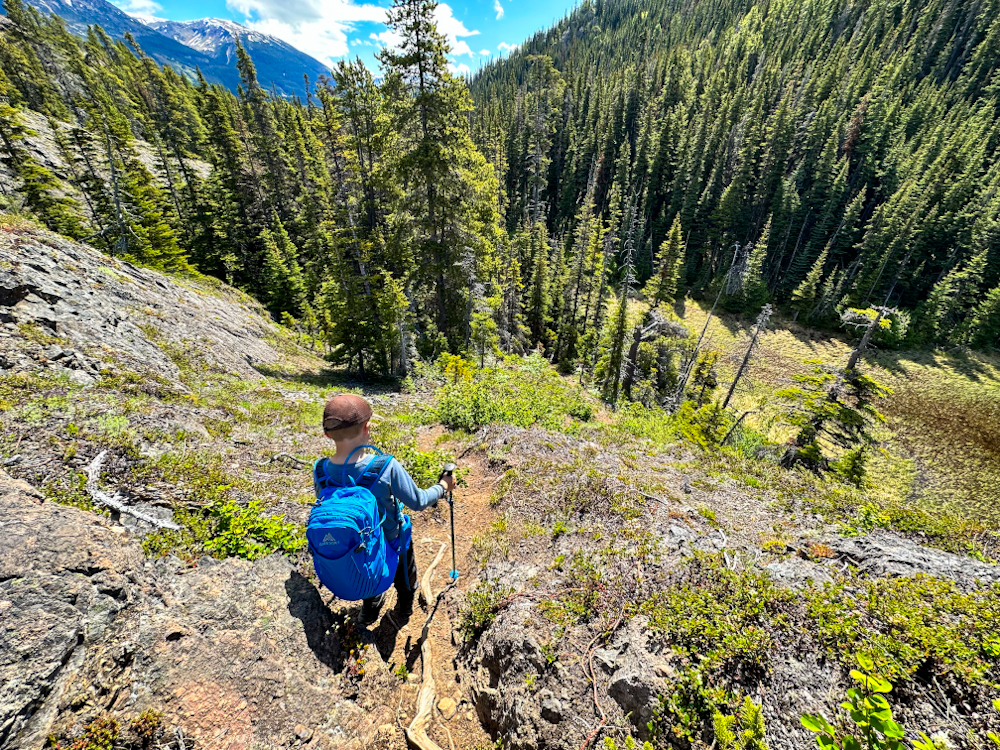
After the rocky bluff the trail heads steeply back down through the forest and in about 300 m opens up into a small creek valley. The valley bottom is essentially a gravel floodplain with embedded cobble and boulders and sparse shrubs. Watch for rock cairns and head in the direction of the small rocky canyon. You will soon approach a beautiful creek and hike over some exposed bedrock. Pick up the trail that heads back into the forest - this is just before the little rocky canyon.
Once in this final stretch of forest, the trail climbs up steeply, levels out, and drops down again steeply to reach a large, expansive glacial valley. Head west, southwest either watching for cairns or staying on the southern edge of the valley. In a couple hundred metres, after leaving the forest, you should get your first glimpse of the Llewellyn Glacier and the beautiful snowy peaks in the distance. Soon, you may also need to cross a section of the creek. It is quite shallow here, and you should be able to use rocks to cross without getting your hiking boots wet.
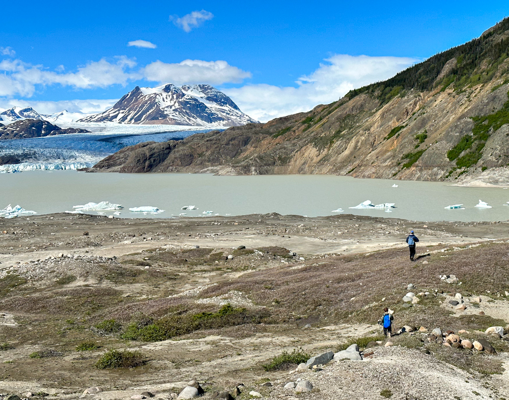
After crossing the creek, continue for 1 km southwest towards some glacial mounds or moraines. It is easy, flat walking across the gravel and cobble strewn glacial valley. Climb up the moraines for a great view of the glacial lake, complete with icebergs and views of the glacier and surrounding peaks. We recommend not going any closer to the lake, as there are little sinkhole lakes surrounded by finer glacier deposits that could collapse.
Enjoy your time in this beautiful place and follow the same route back. There is potential to backcountry camp with a clean water source at the creek you crossed.
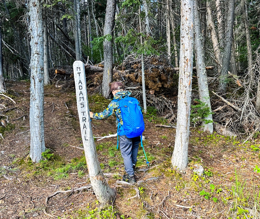
The trailhead sign from the lakeshore. Access is by boat, kayak/canoe, or floatplane.
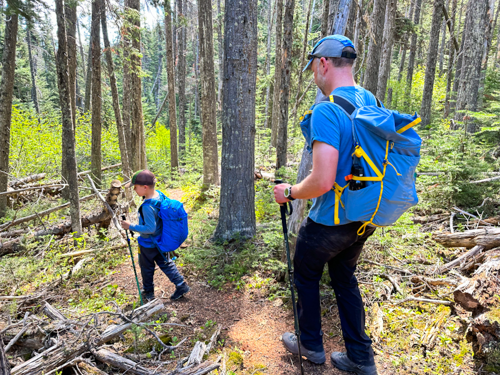
The trail starts out in the balsam fir and lodgepole pine forest.
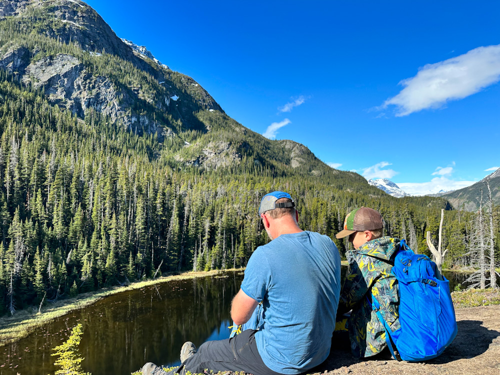
Viewpoint over the small lake from the rocky bluff.
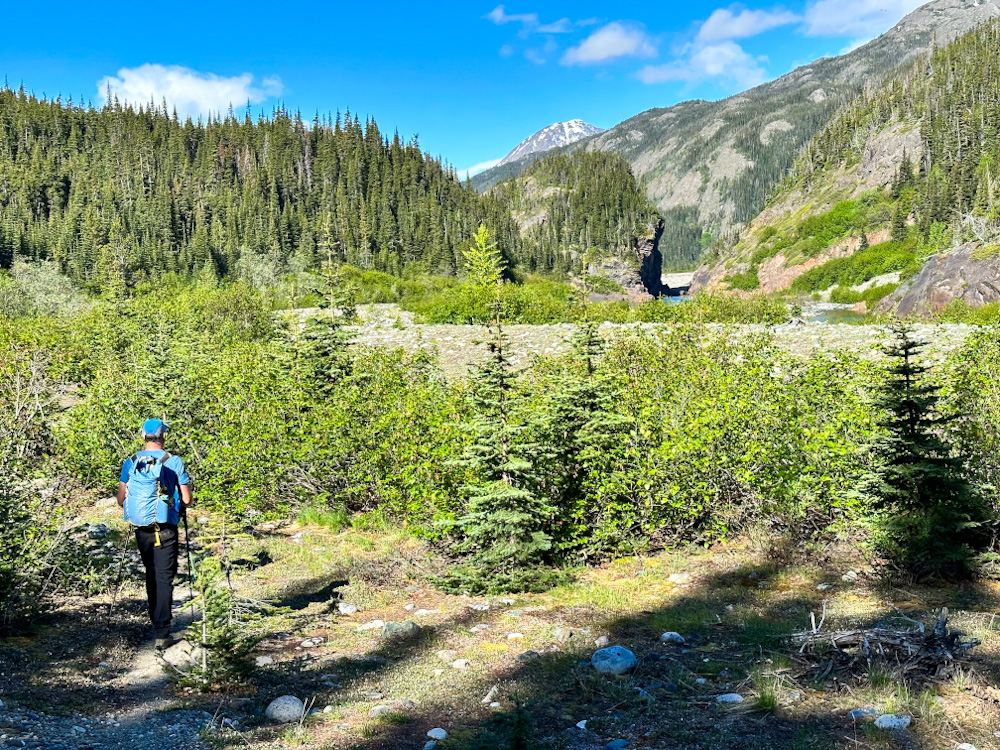
Leaving the forest and reaching the first small creek valley with small rocky canyon.
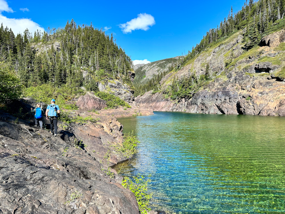
Hiking along the beautiful green - blue waters of the creek.
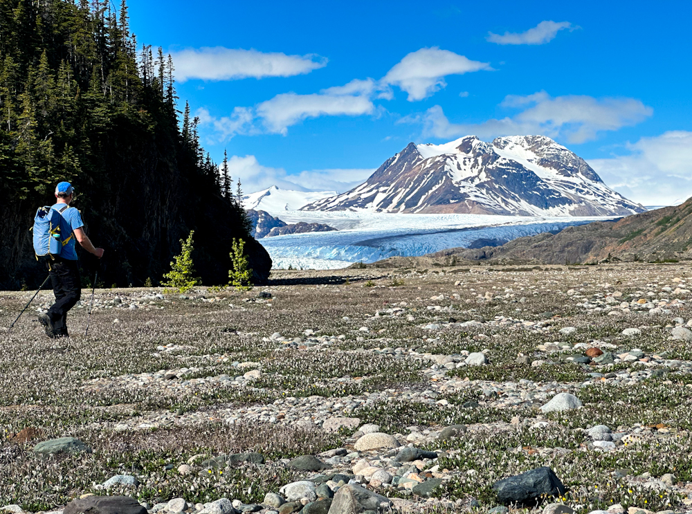
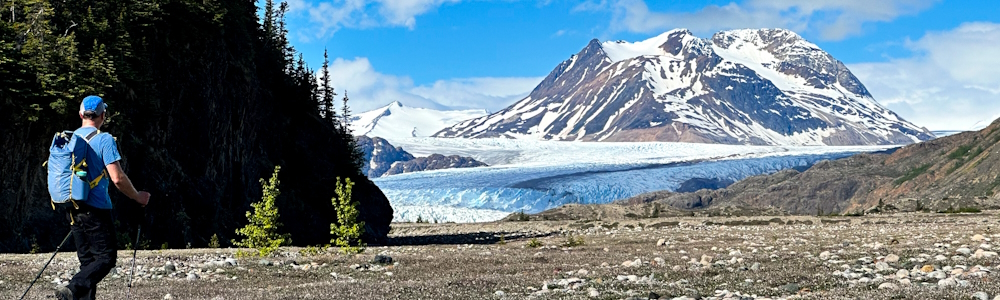
Reaching the expansive glacial valley with the first view of the glacier.
Head over to the glacial mounds to reach the final viewpoint of the glacier.
Finding the best picnic spot to enjoy the view.
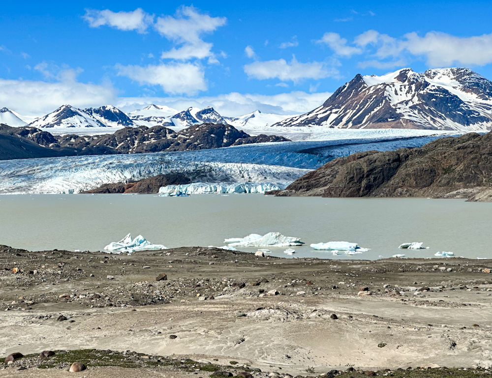
Marvel in the majesty of the Llewellyn Glacier, the surrounding peaks, and the glacial lake complete with icebergs.
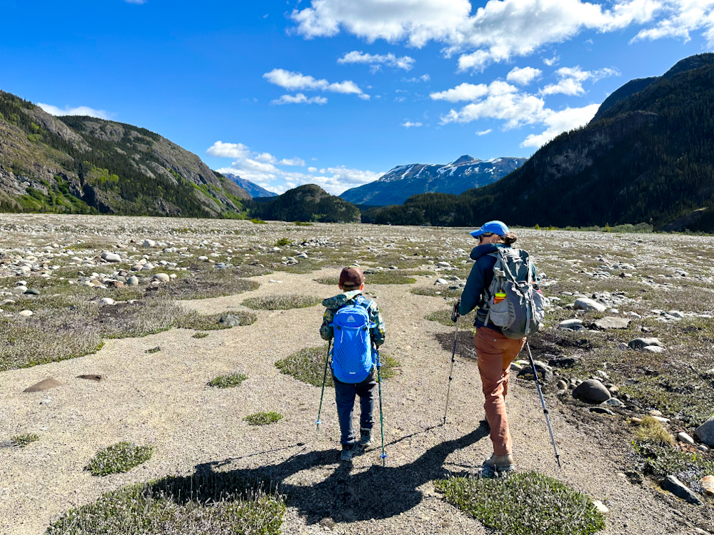
Heading back across the expansive glacial valley to meet up with the forest trail.
Descending the steep part from the rokcy bluff and little lake.