Total Distance: 4 km
Return Time: 1.5 hours
Elevation Gain: 225 m
Difficulty: Easy
Region: Whitehorse
Traditional Territory: KDFN
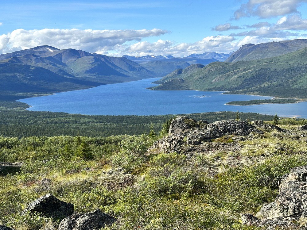
This is a nice short hike close to Whitehorse with great views of Fish Lake. While it is short in distance it makes up for in steepness and is sure to keep your heart pumping. The views are great early on of Fish Lake and even better from walking along the ridge. You can hike along the ridge as far as you like or simply enjoy a rest on the summit with beautiful views all around. This hike is beautiful in the fall months with the autumn colours and can be done in the winter too with snowshoes or a packed trail.
From the intersection of the Alaska Highway and Hamilton Boulevard/Two-Mile Hill in Whitehorse, drive 3 km north on the Alaska Highway and turn left on to Fish Lake Road. Follow the Fish Lake Road for 14.7 km. Watch for a rougher road on your left, about 470 m past a gravel pit (also on the left). If you have a higher clearance 4x4 vehicle, drive this road for another 520 m until you reach a parking area on the left by the trailhead. Ensure you are parked well off the road, to allow other vehicles to pass.
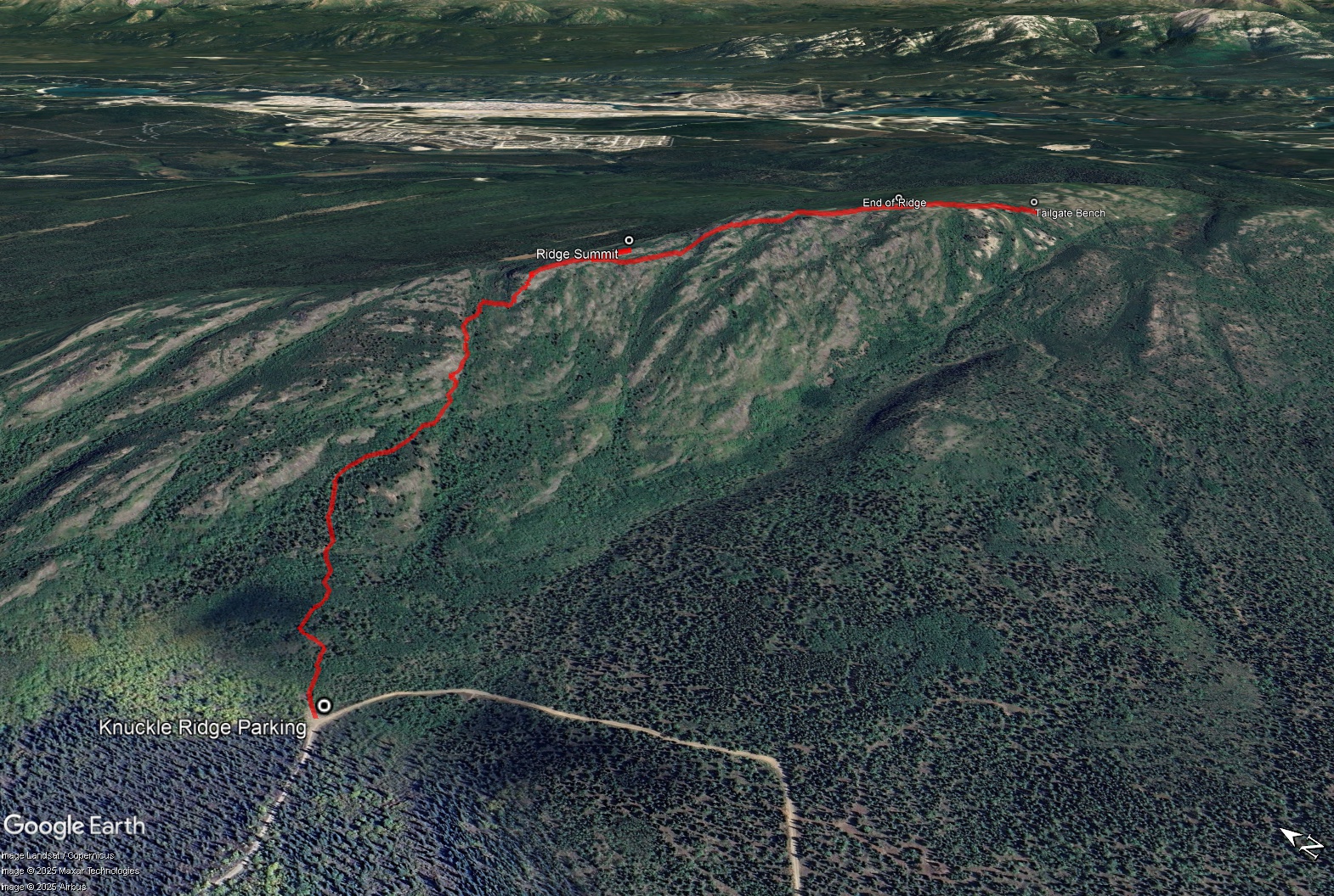
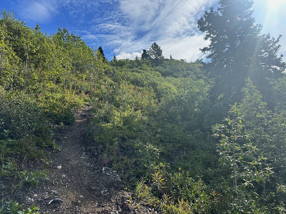
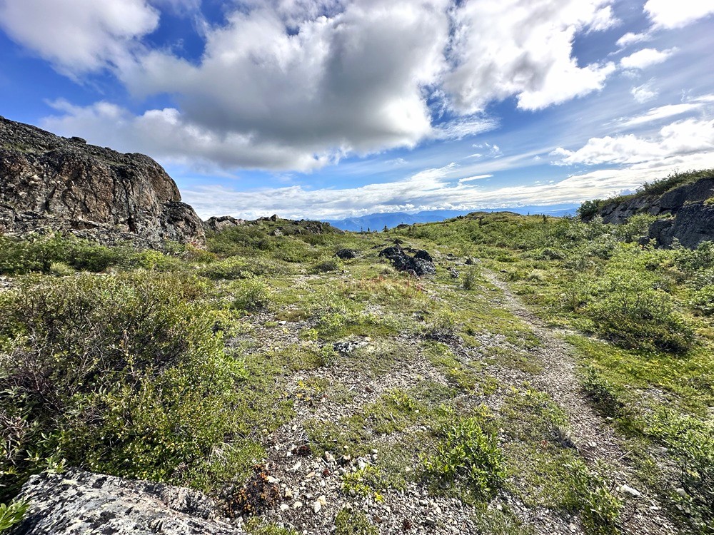
From the parking area, the trail starts along a wide-open ATV-sized trail and then shortly narrows to a singletrack hiking trail. It climbs steeply and steadily up through the mixed forest of aspen, pine and spruce. You soon get some views of Fish Lake. The trail continues steadily uphill until the trees start to thin and it becomes bushier and rockier. There are some rocky sections ahead and steep switchbacks, but nothing too technical.
Soon you will reach the lower end of the ridge in the alpine (about 700 m from the trailhead). A lighter trail leads to the left to a little rocky knoll area that you can explore with nice views of Fish Lake and Whitehorse. The main trail continues to the right, up a bigger knoll to gain the ridge.
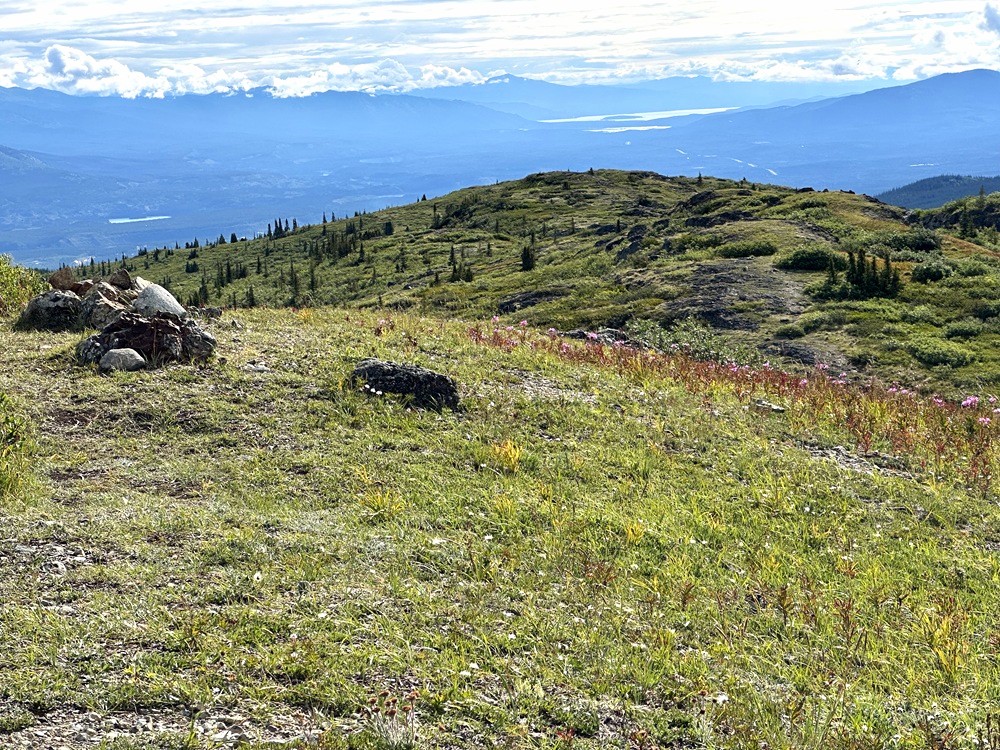
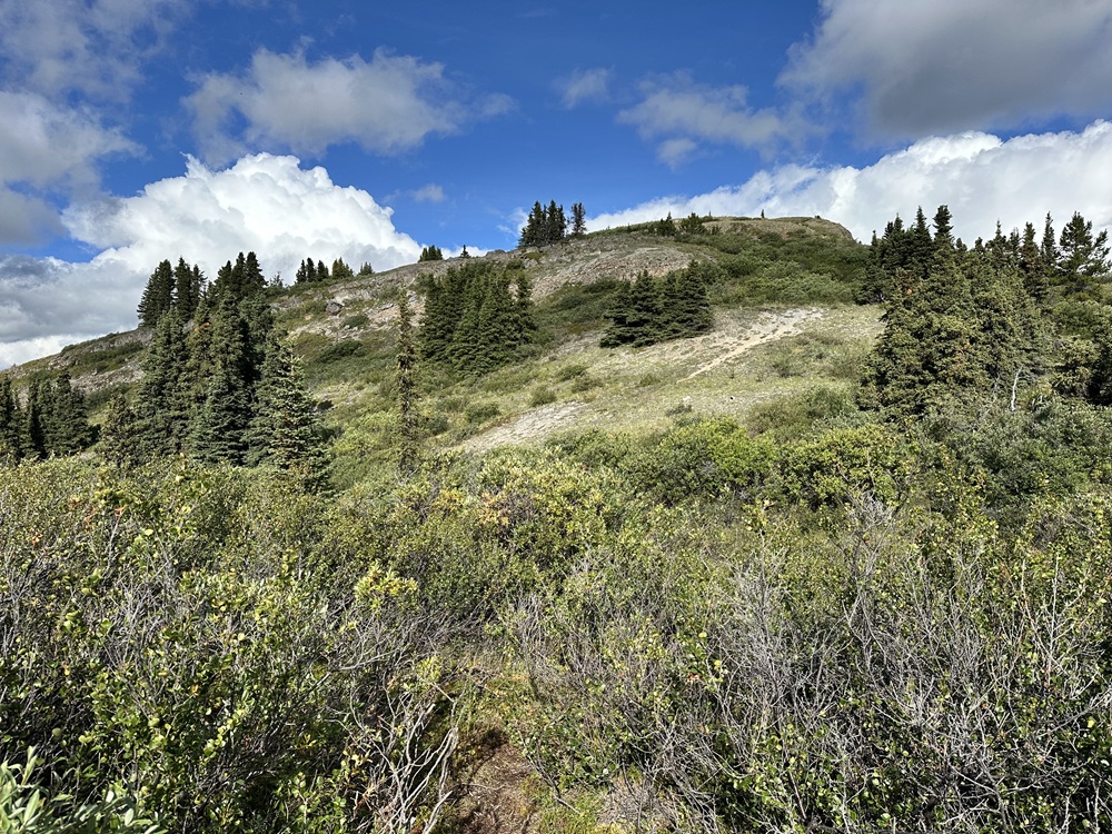
Once at the top here, you will see a higher point along the ridge. This is the summit and there is a spur trail that you can follow. To continue on the ridge you will have to follow the summit trail back down slightly, and pickup another trail that continues below the summit. The trail is varied with small ups and downs along the ridge, with little rocky outcrops and different views along the way.
The trail does continue down from the end of the ridge and does join up with the Starbuck's Revenge mountain biking trail. There's a metal bench here made from an old tailgate. Return the way you came or consider a longer loop, see below.
EXTENDED HIKE OPTION
You could connect to the Starbuck's Revenge mountain biking trail, going north and then loop back on the Skyline Trail to the left which takes you back to the Fish Lake Road for a loop of about 10 km round trip. Though much of the Skyline Trail is in the trees with little views.
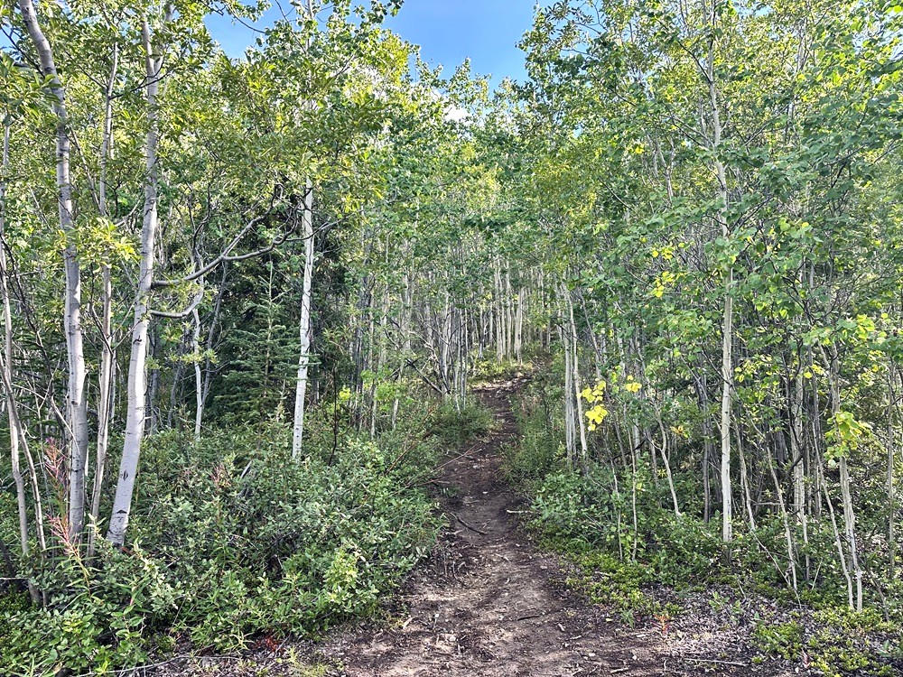
Hiking up the start of the trail.
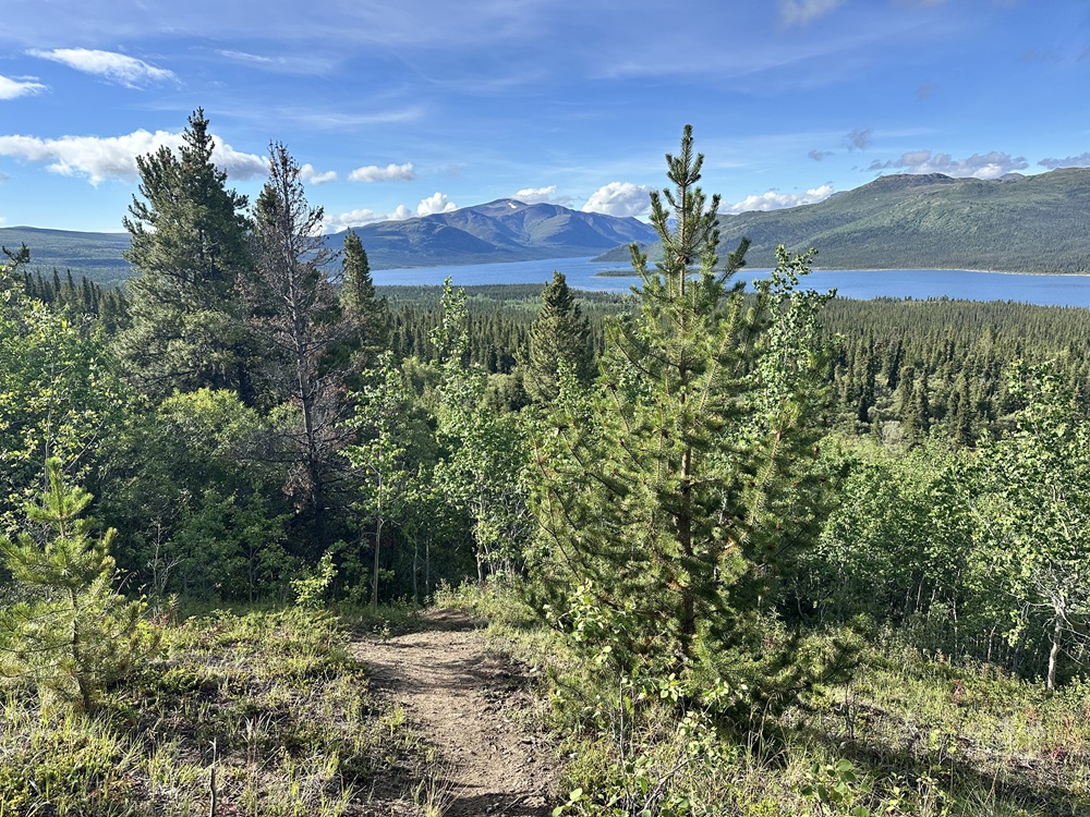
You soon get some views looking back at Fish Lake.
The trail is steep as you gain the ridge.
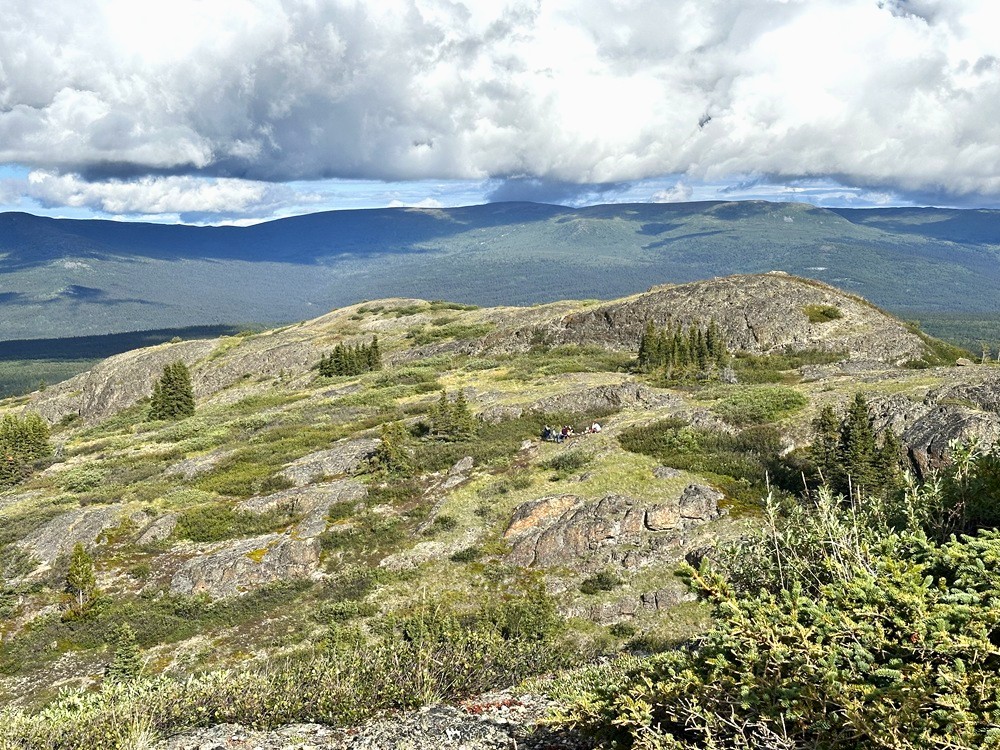
Looking back at the rocky knoll area at the start of the ridge.
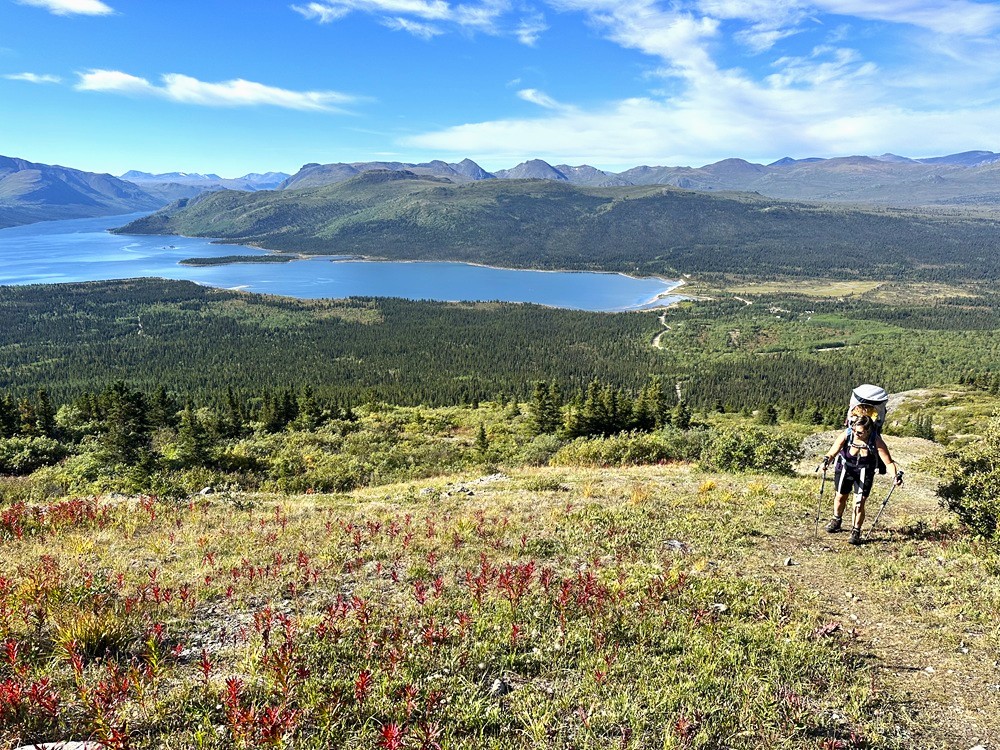
Hiking up the trail to the main ridge, towards the summit.
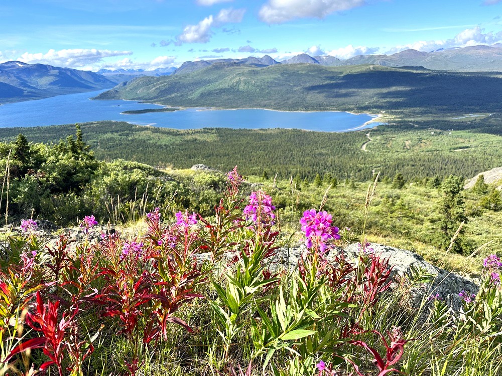
Views of Fish Lake.
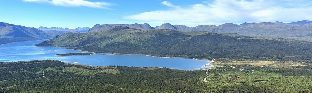
Views from the summit looking east towards Marsh Lake.
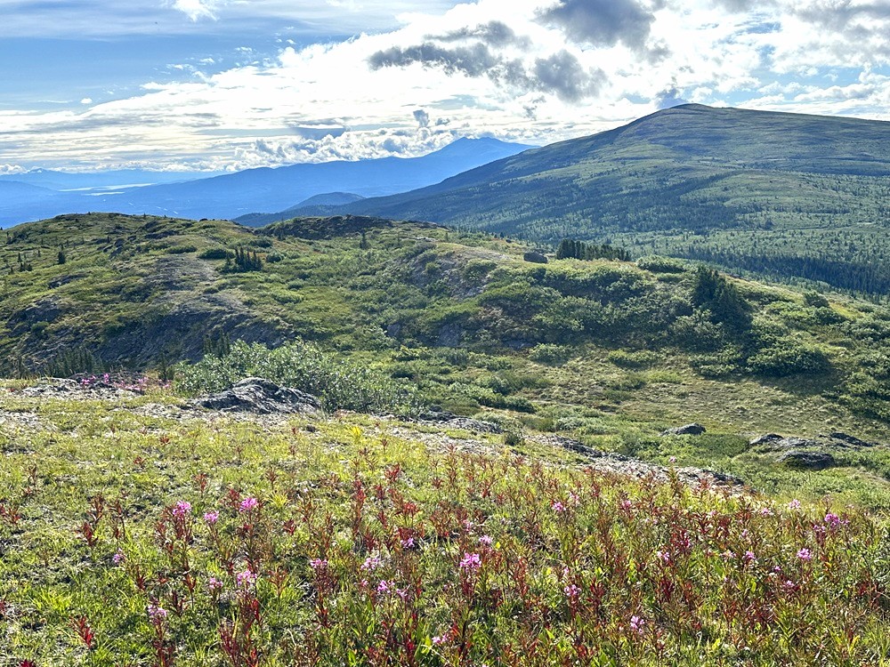
You can hike along the ridge as far as you like.
Alpine views of Fish Lake.
The trail along the ridge takes you along rocky outcrops and great picnic spots.
Looking back at the end of the ridge, as it drops down to meet up with the Starbuck's Revenge bike trail.
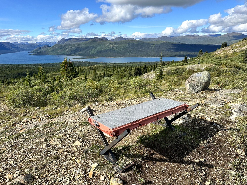
The tailgate bench at the end of the trail, where it meets Starbuck's Revenge.