Total Distance: 5 km
Return Time: 2 hours
Elevation Gain: 279 m
Difficulty: Easy
Region: White Pass
Traditional Territory: TRTFN
The easy hike to Fraser Lake (officially known as Bryant Lake but known to locals as Fraser Lake) has much to offer as a day hike or backcountry trip. Being so close to the highway it is a good introductory backcountry trip for young families or those people new to backcountry camping. There is much to explore from the lake if you want a longer hike. As a bonus in the fall, there are many blueberries to pick!
From Whitehorse, drive south on the Alaska Highway to the Carcross Cutoff and turn right onto the South Klondike Highway. After 120 km on the South Klondike Highway, you will reach Canada Customs. About 1 km after Customs, there is a large parking area on the left side of the highway - park here. The trailhead is on the other side of the highway, about 100 m back towards Canada Customs.
If you do not have a passport to cross back into Canada, or do not wish to cross the border, take a right on the road immediately before Customs. Follow this road to the end and park near a large highway maintenance garage and gravel pit area. Pick up a trail in the northwestern part of the open gravel area which leads to an old road. Follow this road to the west for about 900 m until you reach a large metal gate (see trail description below).
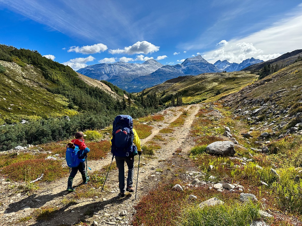
The trail starts in the trees along a fairly wide old road with gradual elevation gain. After about 600 m, you will be at the intersection of another road. Turn left and continue along the road, walking around a metal gate, which is locked during the summer to stop people from driving in the area in order to protect important caribou habitat.
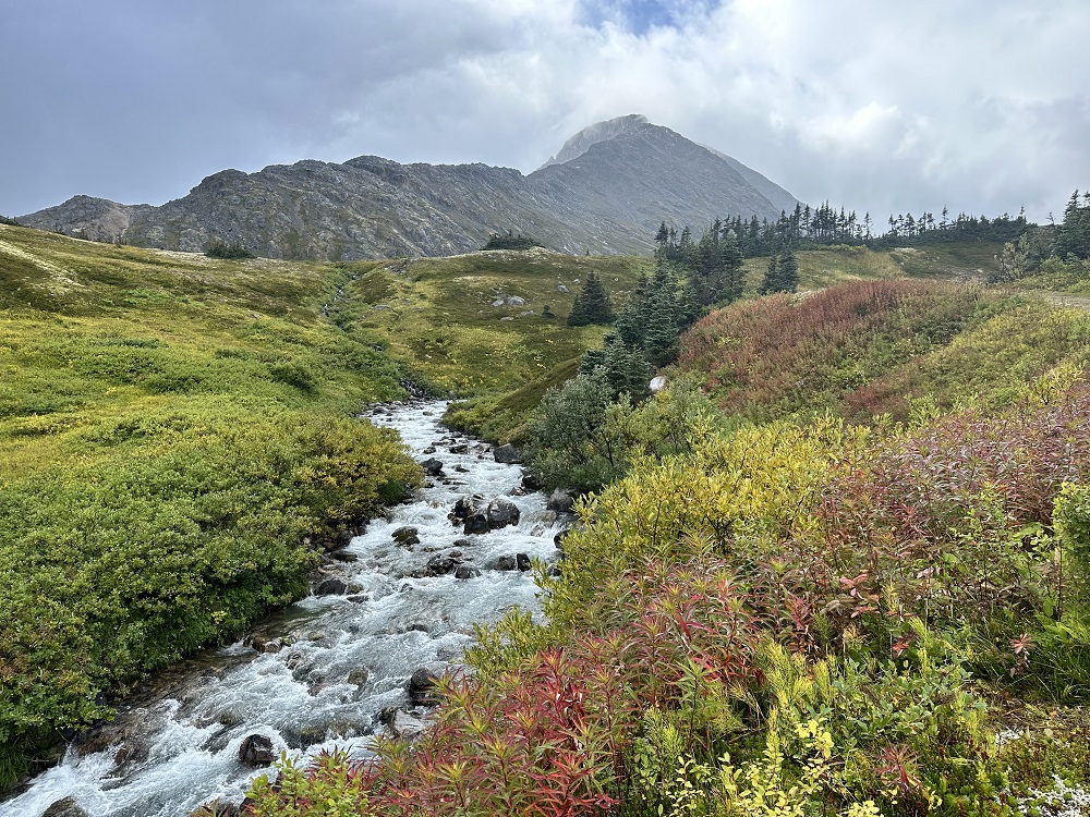
As you walk on the road, you will notice a large creek on your left - don't worry, there is a 'bridge' across the creek. The bridge is 1.5 km down the road from the gate and is quite narrow, not very level, and has no handrails. That's because the 'bridge' is actually just wooden housing around a water pipeline, so if you are uncomfortable walking across it, this is also the best spot to cross on foot, as the creek is quite shallow and slower moving here.
On the other side, continue on the road, which heads a bit more directly uphill and you'll shortly reach the lake. There are many areas where you can camp if you wish to spend a night or two in the area. Check out the Fraser Peak hike or enjoy wandering around the many small alpine lakes (tarns) and consider the Extended Hike options below.
EXTENDED HIKE
To hike to the other end of the lake to the west, there is a trail that goes around the left side (south shore of the lake). There are a few boulder sections that cover the route along the lake, from old avalanche tracks. Going to the end of the lake adds 2.6 km one-way to this route and not much elevation (about 50 m). There are areas to camp at the west end of the lake, and more exploration to do from there, either towards the Chilkoot Trail (at Crater Lake) or towards the mighty glacier of Taiya Peak.
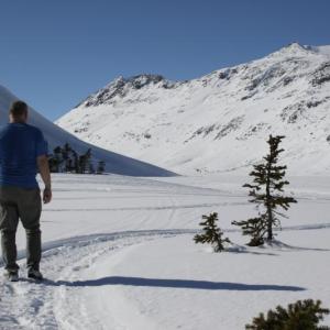
Fraser Lake is a popular winter recreation area as well. It is an easy ski or snowshoe in to the lake with a well packed route thanks to the many snowmobiliers. Follow the same route as the summer, described above. Being so close to the highway it is a good introductory winter camping destination as well as avalanche training area. There is lots of simple terrain to navigate as well as more complex and challenging terrain.
Hiking up the trail with views of Fraser Peak.
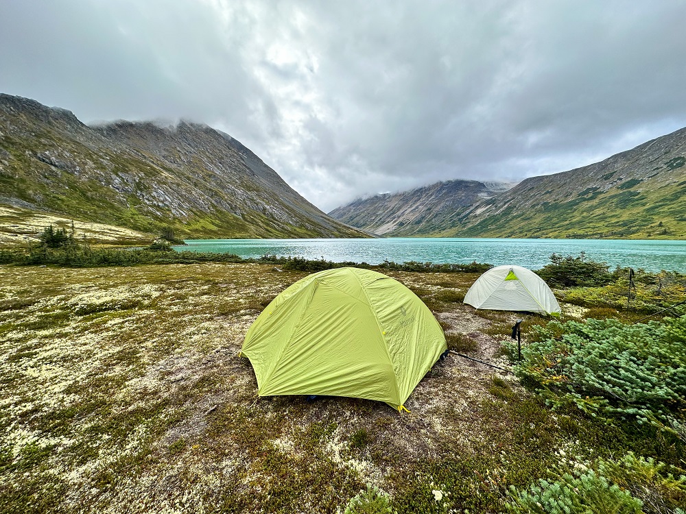
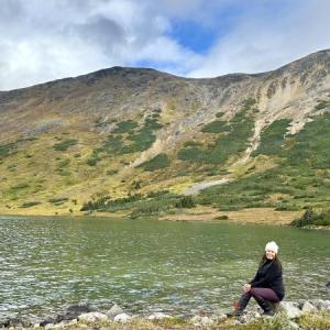
Setting up camp by Fraser Lake (Bryant Lake).
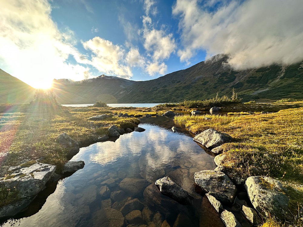
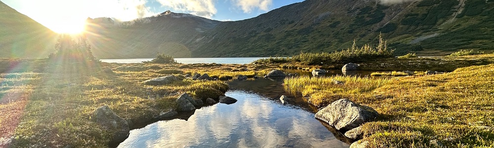
There are lots of tarns in the alpine area to explore with beautiful reflections.
Hiking back out you get enjoy the many peaks to the southeast.
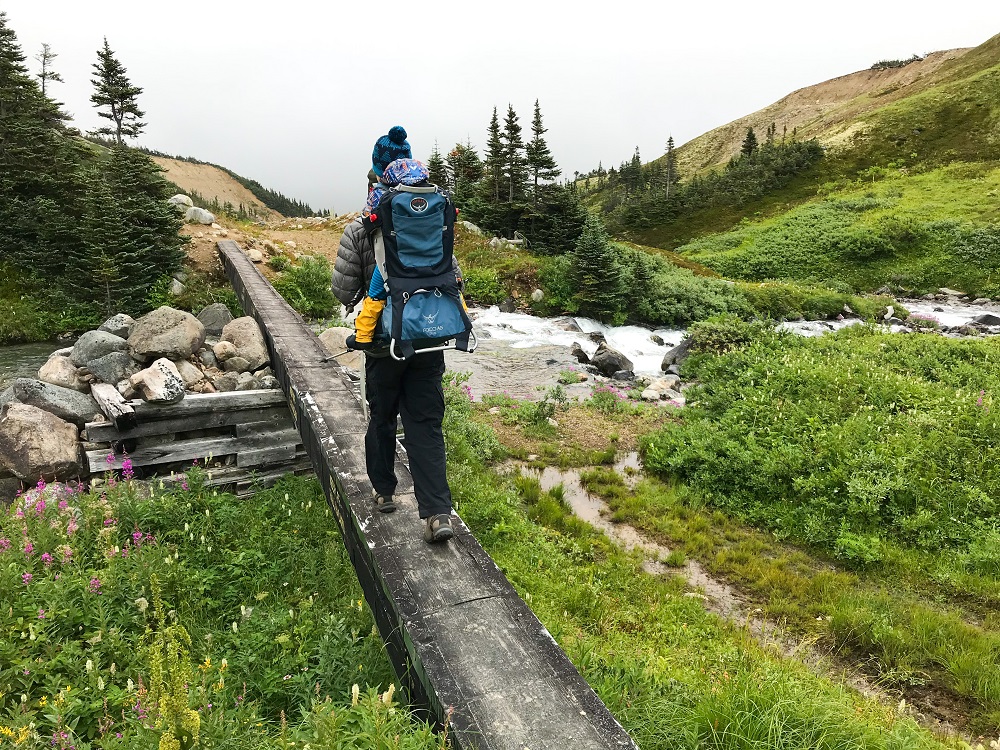
Crossing the old pipeline casing 'bridge' over the creek.
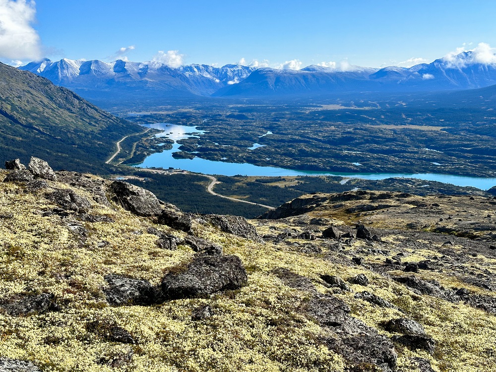
You can gain great views of the highway and Fraser Customs area from exploring the ridges to the southwest, below Fraser Peak.
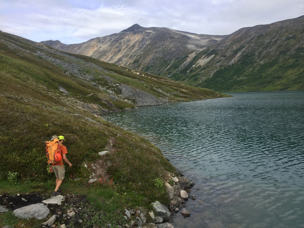
To extend your hike, continue on the trail that heads left around the lake.
Jane March 31, 2025
In September 2024, my friends went there. The hiking trail was remarkably easy and enjoyable. The scenery was stunning, and the temperature was not overly cold. Berry picking was another enjoyable activity.
Murray Lundberg March 30, 2025
It's also a superb hike in the Spring (I did it March 29th), with snowmobile tracks making an excellent trail.
Aaron Weber July 1, 2024
Hiked the trail on June 23. Conditions are good along the trail and the description is accurate. We turned around at the creek crossing as it was quite high and fast-flowing after a couple of days of rain, and with the pipeline box being tilted and wet. Bring creek crossing gear if going early in the season, or go later in the season when the creek is lower.

