Total Distance: 11 km
Return Time: 4 hours
Elevation Gain: 663 m
Difficulty: Moderate
Region: Tombstone
Traditional Territory: THFN, NNDFN
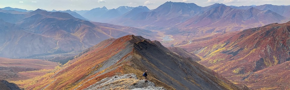
The ridge beside Charcoal Creek is one of the closest hikes to the Tombstone campground - it is right across the road. Charcoal Ridge itself is a very pleasant hike with sweeping views.
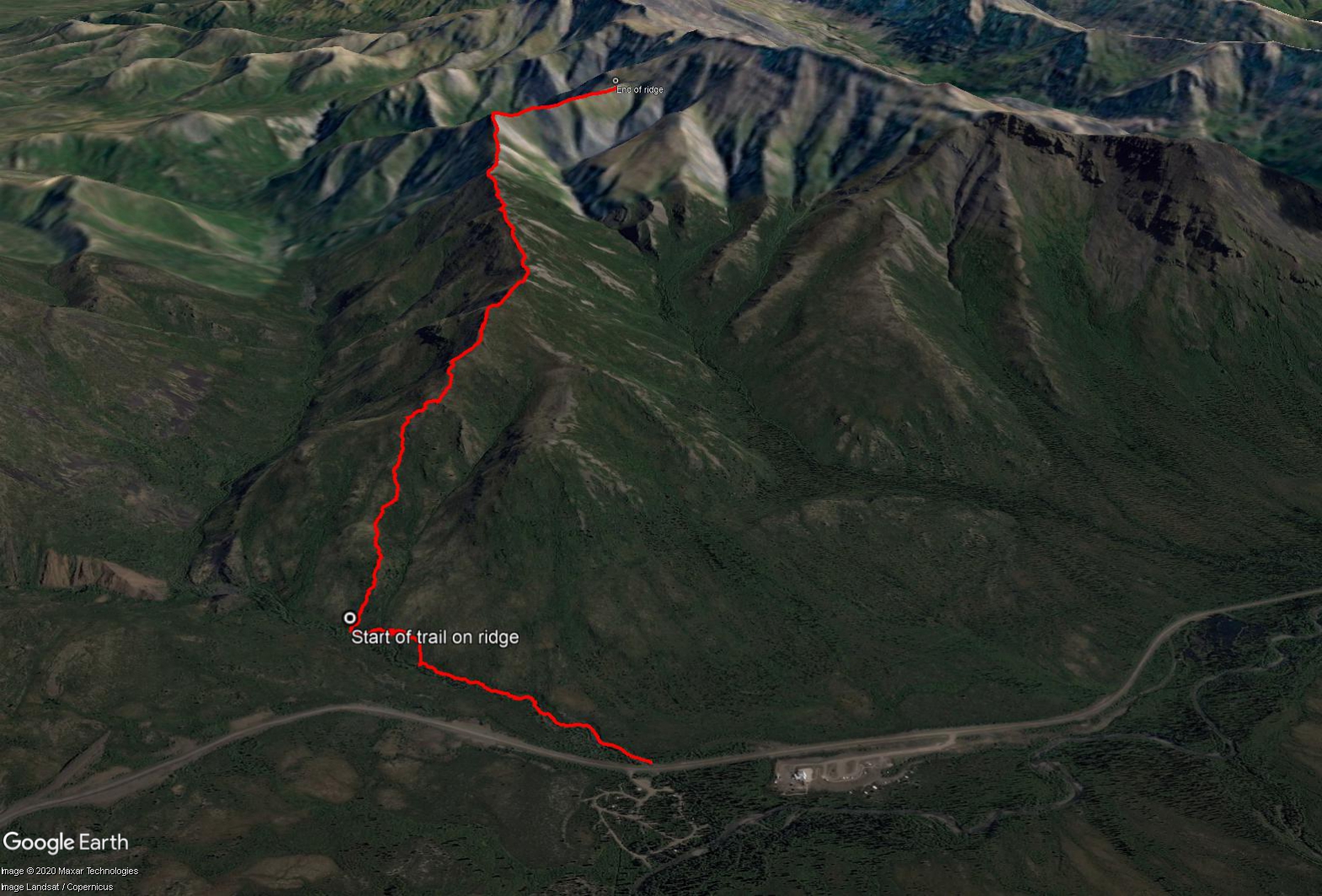
The trailhead is directly across from the Tombstone campground on the right side of Charcoal Creek across the highway.
Follow the right side of Charcoal Creek for about 1 km. The trail starts as an easy to follow trail, but soon you will have to pick your way through the bushes for a few hundred meters. You are aiming for the little ridge on the left. You can alternate following the creek and walking through the bushes on the hillside. Once you get to the base of the ridge, hike up it an look for a worn trail. From here, there is no more bushwhacking.
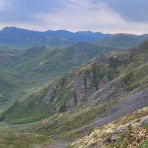
Follow the trail up the gradual ridge. After about 1.5 km on the gradual ridge, you will reach Charcoal Ridge proper. This section is a fun hike, as you following the narrow (but very safe) ridge as it works its way higher and higher. At the end of the ridge, you can turn around, or you can continue and hike up Mt. Chester Henderson.
EXTENDED HIKE OPTION
To continue to the summit of Mount Chester Henderson, head southeast from Charcoal Ridge continuing up towards the small summit. It is a 300 m elevation hike
over 1.6 km distance to the summit.
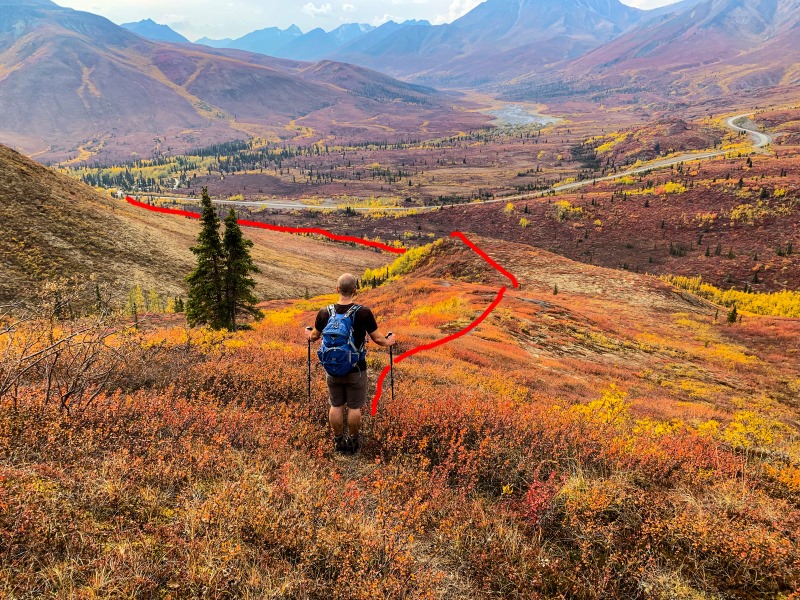
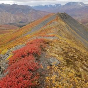
Looking down the gradual ridge back towards the Tombstone campsite. The red line follows along the creek until reaching the base of the gradual ridge.
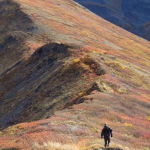
The start of the ridge is broad, but quickly narrows.
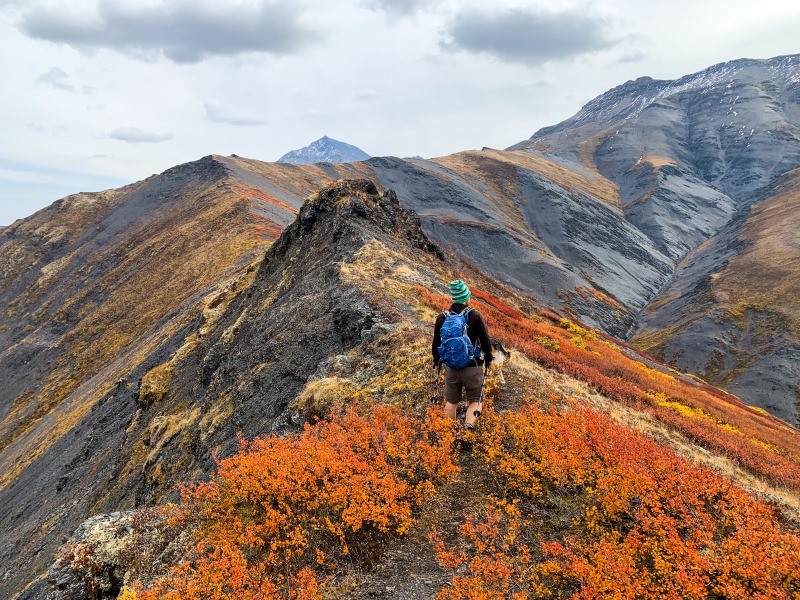
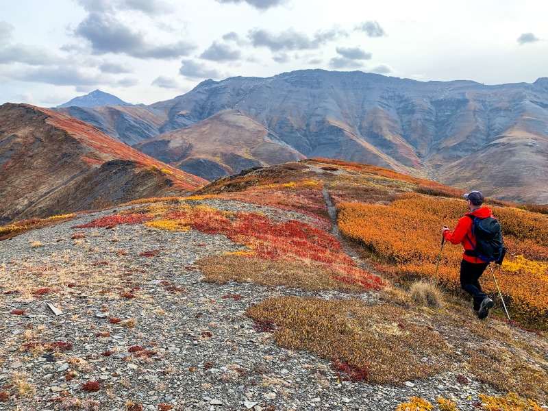
An easy to follow trail along the ridge, with Mt. Chester Henderson on the top right.
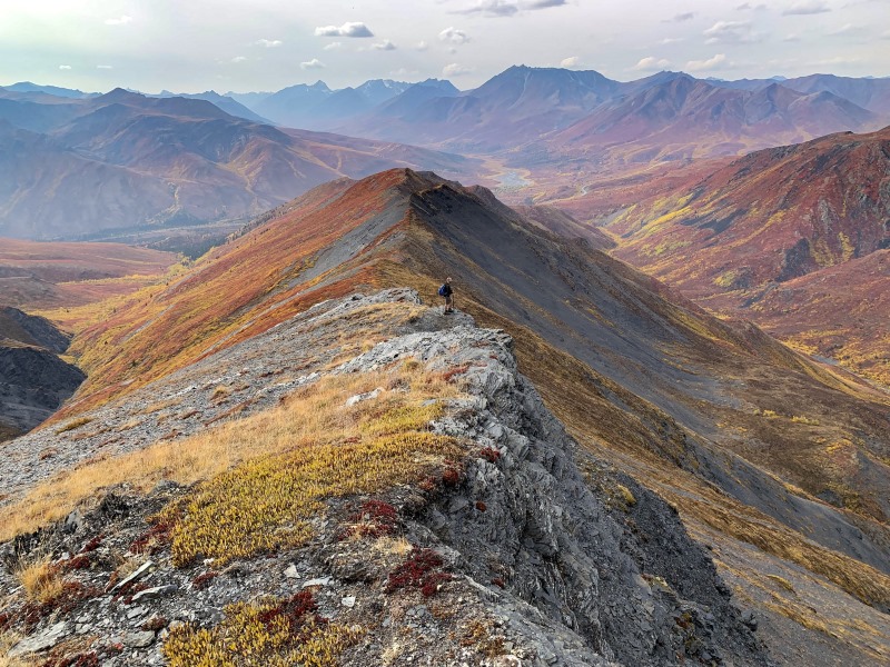
Looking back down along Charcoal Ridge.
LizB June 29, 2025
My partner and I hiked Charcoal Ridge and up to Mount CH on June 28. We followed the trail along the creek and picked our own way up "Blueberry Hill", which is the steep face to the right of the gradual ridge mentioned here. Blueberry Hill is very steep and covered in soft moss so going up was a grind but it definitely cut some distance off the hike. Once you get up to the ridge, the hiking is great. Easy trail to follow and stunning 365 views. Mount CH was a bit harder since there were still some snow patches above Charcoal Ridge, some of which were up to our waists. We did a choose your own adventure to get to the top. All in all a wonderful day hike if you have the time, highly recommend!
Freya July 1, 2020
Stunning trail!
Found a pair of sunglasses on the trail 30th June. Leave a comment if they are yours.
Kyle September 3, 2019
Saw some dall sheep at the summit :)
Hiked Aug 28
Chris and Heather June 27, 2019
We actually went up on Charcoal Ridge twice during our stay in Tombstone in June 2019 - that is how amazing it is from the ridge. The views are stunning in all directions. The wind can get very strong as you gain elevation. Watch for a small cairn off the side of the highway about 100m south of the "72" km highway marker. Follow the trail down to the creek. Go upstream a few meters until you see a 2x6 laid across the creek. Cross there and keep going straight and slightly left towards the little ridge. There you will see a fairly overgrown track going up the ridge. It was not easy to find the first time. Follow this track all the way up to the ridge and keep going and going. Watch for bears along the creek. We saw some nice prints in the mud!
Josee Leclerc September 9, 2017
Beautiful hike. Hiked the trail as recommended here and it was lovely. I thought I would add some fall pictures in your collection.
Alex Campbell May 25, 2014
Hiked this trail on May 24...and I'm glad I did! After an initial bushwhack for a few hundred meters it was smooth going. Once up on top of the ridge there was a few large sections of snow, but they could all be traversed easily or avoided altogether. Beautiful, 360 degree views, and the ridge was incredibly easy to maintain. Highly recommend this trail if you're looking for great views in a hurry. In theory you could travel east on the massive ridge for hours.