Total Distance: 8 km
Return Time: 6 hours
Elevation Gain: 772 m
Difficulty: Moderate
Region: Tombstone
Traditional Territory: THFN
This route follows one of the many ridges that lead up to an open alpine plateau and a rocky ridge above two picturesque alpine lakes. There are often caribou on the plateau, and you get amazing views all the way up the ridge.
The trailhead is accessible from a parking area on the west side of the Dempster Highway at kilometer 66.5. If you are driving south from the Tombstone Campground, the parking area is on your right, immediately after the highway crosses the Klondike River, at a gravel pit.
This route is one of many ways to get to a viewpoint of the alpine lakes. Alternatively, if water levels are low, you can also cross the North Klondike River from the actual campground and head up any of the ridges visible from the campground.
NOTES ABOUT BAKCOUNTRY TRAVEL OFF-TRAIL IN TOMBSTONE TERRITORIAL PARK:
This is a route, not a trail. It is advised that you are experienced in route finding, backcountry travel, and are well prepared and self-reliant. Choose durable ground and spread out to prevent creation of new trails on the fragile tundra vegetation and permafrost. Avoid wet or muddy areas where possible and stick to higher group and follow ridgelines.
Registration is mandatory for camping within the park. Please visit the Tombstone Interpretive Centre to acquire the correct park permits, and receive up-to date information on trail conditions, closures and wildlife activity.
Park approved bear-resistant canisters are mandatory (only hard shell, not soft bags) for all backcountry camping. Dogs must be on a leash at all times and fires are not permitted.
----------------------
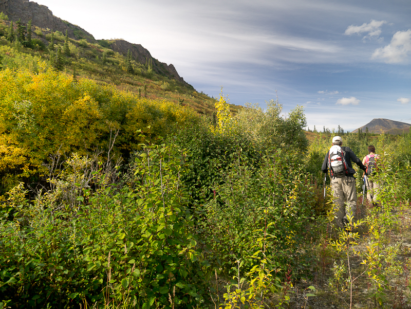
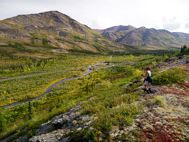
Look for an old road on the north side of the gravel pit, which parallels the North Klondike River. There are some large boulders at the beginning of the old road. The road is slightly overgrown with trees, but is still fairly easy to walk along. Another option from this trailhead is to follow some game trails directly above the gravel pit, but these disappear shortly and you will be left bushwhacking through very dense vegetation that is above head-height for about half an hour.
Follow the old road for about 450 m, or until you find a sufficiently less-bushy spot to start your short bushwhack up to some rocky cliffs above. You will have to bushwhack uphill in waist to chest high brush for about 100 m until you reach the rocks above. Skirt around the north side of the first rocky band, and then boulder-hop up through a gully to a low-point in the next rocky cliff.
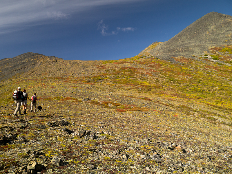
Once above the second cliff of rocks, you will leave the bushwhacking behind and start a nice ridge walk. The ridge has a few sections with boulders at the beginning. Make your way up the ridge, aiming for a low saddle directly to the south of the rocky peak above.
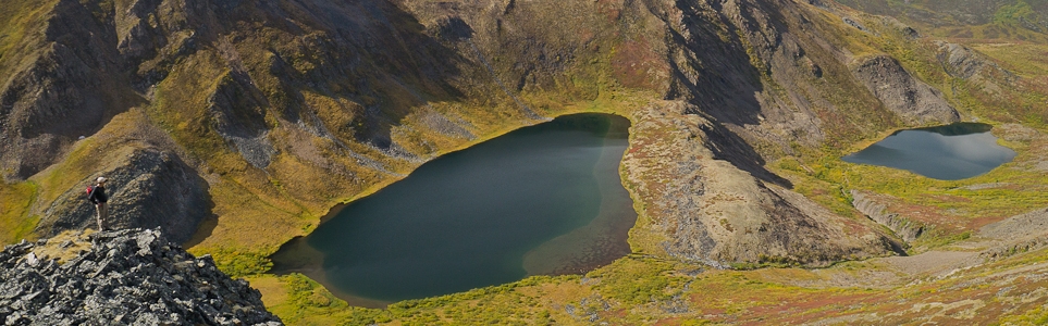
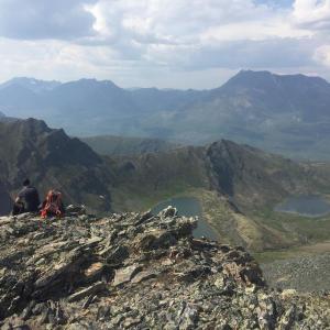
When you reach the saddle below the rocky peak, you will see a large alpine plateau and cliffs to the northwest. Walk directly across the plateau, aiming for another saddle on the ridge in front of you, to the left of a larger peak. When you are on the saddle, turn south (left) and walk out to a rocky outcrop where you can get a good view of the beautiful alpine lakes nestled below.
You can follow the same route back down, or you can walk down one of the northeast ridges which overlook the Tombstone Campground. If you descend one of these ridges, you will have to cross the North Klondike River just before you reach the campground.
Find the old road on the north side of the gravel pit along the Klondike River.
After bushwhacking up through the brush, you'll find yourself on a nice open ridge.

Once on the alpine plateau, keep your eyes peeled for curious caribou.
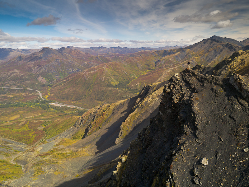
The cliffs to the northwest offer views over the Tombstone Territorial Campground and to the mountains beyond.
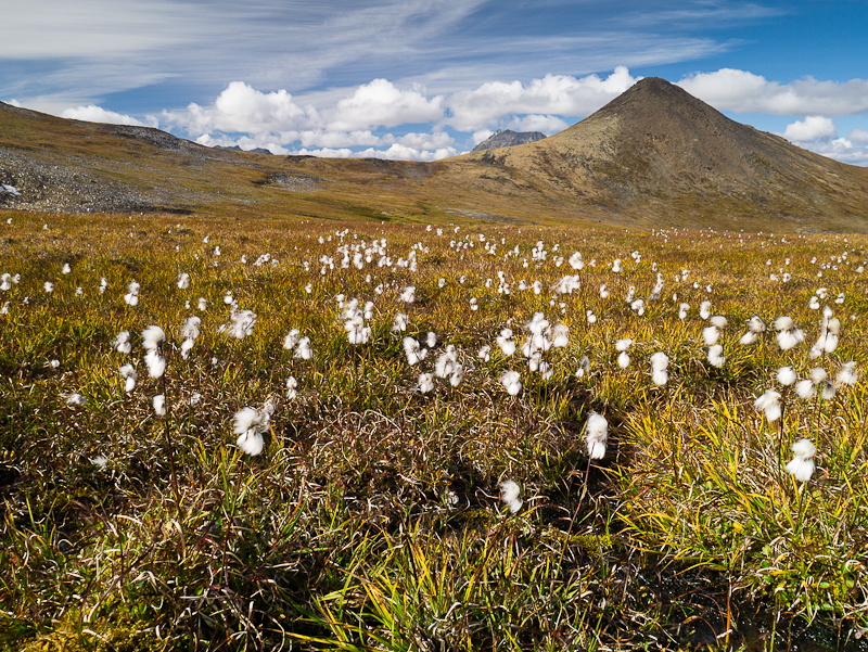
Cottongrass on the plateau.
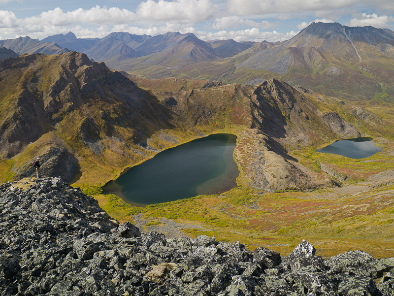
Enjoy the views of the Alpine Lakes from the viewpoint.

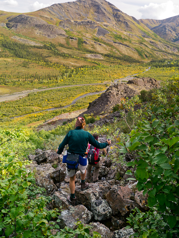
Hikers leaving the viewpoint and continueing down from the alpine plateau.

The views looking southeast down the highway.
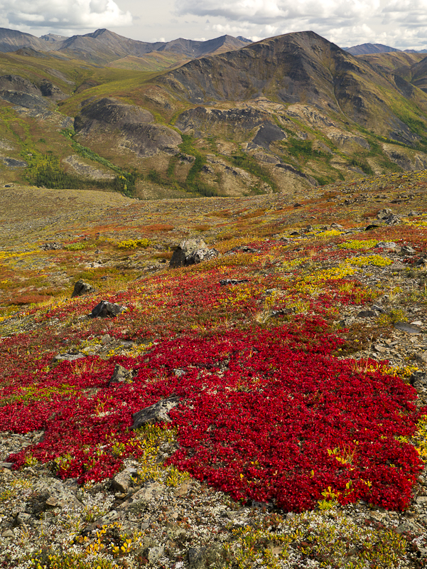
Fall colours on the tundra.
Hiking down through the rock banks.
Descending down to the Klondike River and the trailhead.

Josie August 19, 2025
I hiked this trail on August 17, 2025, and the current description needs an update. The section previously described as “slightly overgrown with trees, but still fairly easy to walk along” is no longer accurate. The beginning of the route is now completely overgrown and quite difficult to pass through. Vegetation has reached nearly six feet in height, making it challenging to see and identify a good route for climbing up.
I would strongly recommend bringing a GPS for navigation, as we ended up taking a long detour due to the lack of a clear trail. On the positive side, there are plenty of delicious blueberries and cranberries along the way, which made the effort a little more rewarding. And amazing views once you are in the open plateau.
Marc July 8, 2017
Did this July 5th. Took 4.5 hours round trip to the viewpoint and back. I was able to find it thanks to my GPS. I highly recommend starting from the gravel pit and not the campground. I tried last week starting from the campground and even with a GPS, it was hard to understand where I was heading. Starting at the gravel pit will require a good half hour of no-fun bushwacking through very dense and tall forest before getting to the subalpine. But the viewpoint is nice.
Uwe July 27, 2015
After some strenuous climbing and bushwhacking we (my dog and i) hiked over ridges to the beautiful lakes. The views are stunning up there and worth the hike. Lots of opportunities to explore the plateau. We saw some Pikas, Marmots and Caribous. Even my dog found something interesting :)
Stephanie Dragoman July 23, 2014
Would've been lovely if we could have found it. Directions were very general and we figured it would make a little more sense once getting up there, but everything is completely overgrown, ended up bush-whacking for 2 hours through really tall dense growth. Couldn't find what the directions were talking about.
