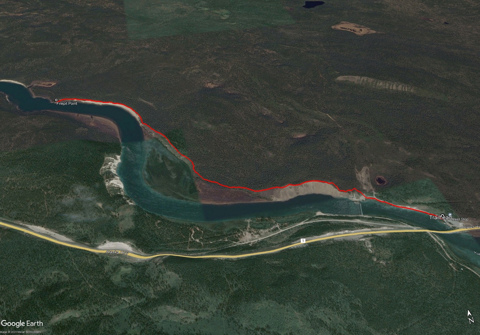
Total Distance: 6 km
Return Time: 2 hours
Elevation Gain: 54 m
Difficulty: Easy
Region: Whitehorse
Traditional Territory: KDFN, TKC
An easy hike south of Whitehorse along the beautiful Yukon River. The trail traverses along the high embankment of the river with great views. This trail drops down to the river at the end, where there is a bench and firepit. Caution is required along some parts of the trail where it gets very close to the edge. NOTE: The hike falls within Category B Settlement Lands of the Kwanlin Dun First Nation. Please respect their rules and land.
From Whitehorse, drive south on the Alaska Highway. Once you reach the blue bridge over the Yukon River (beside the Lewes River Dam), immediately take the left into the Marsh Lake Dam Rest Area. Park near the far end of the parking area. There is a road that continues but is blocked off to vehicles - this is the trailhead.
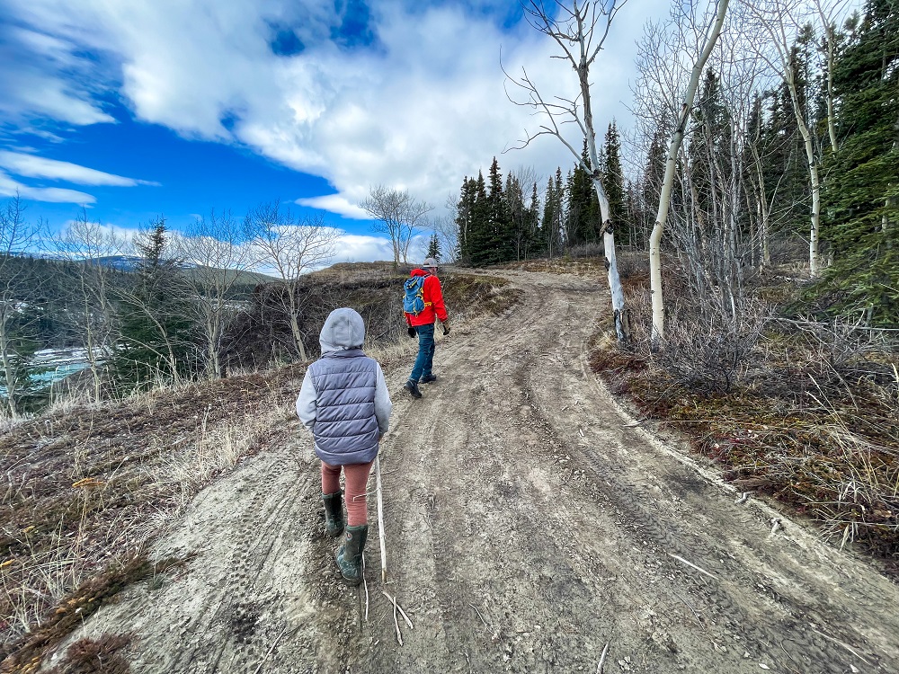
Follow the road that parallels the river and leads from the parking area towards the hydro control structure. Continue to the larger gravel opening where several trails/roads meet. Follow the dirt road that heads uphill, and slightly left, to gain the ridge.
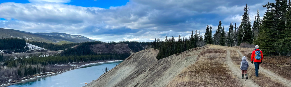
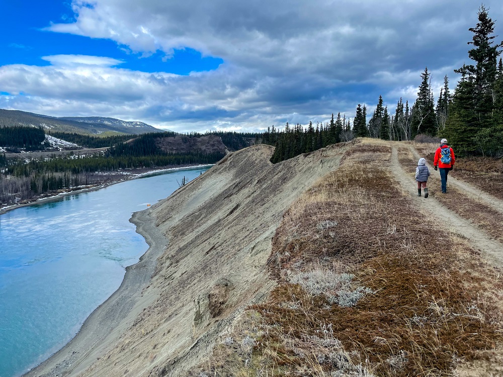
You get quite high up on the embankment over the river, and there are beautiful views looking east and west. Eventually the dirt road becomes a narrow footpath and takes you all along the embankment. There is a little exposure along the way, where the trail hugs the edge of the cliff. In some more dangerous sections where the trail has nearly eroded into the river, detour into the forest-side on some less-trodden trails away from the cliff edge.
The trail is relatively flat once up on the cliffs, with some ups and downs and sections through the forest. At the end of the main trail, you pass some hoodoos, and the trail drops down to the river's edge to a nice picnic spot at a gravel point on the river. There is a log bench and a small firepit here.
Return the way you came.
Hiking up the road from the gravel opening.
Once you reach the ridge, the road continues for a bit before turning into a footpath.
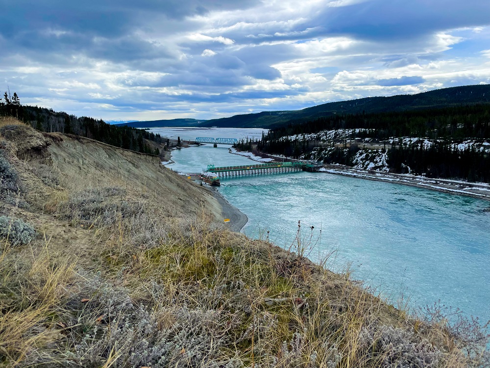
The views looking east back towards the Rest Area and the Marsh Lake Control Structure.
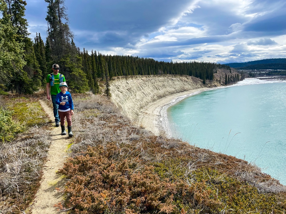
Easy walking along the embankment over the beautiful Yukon River.
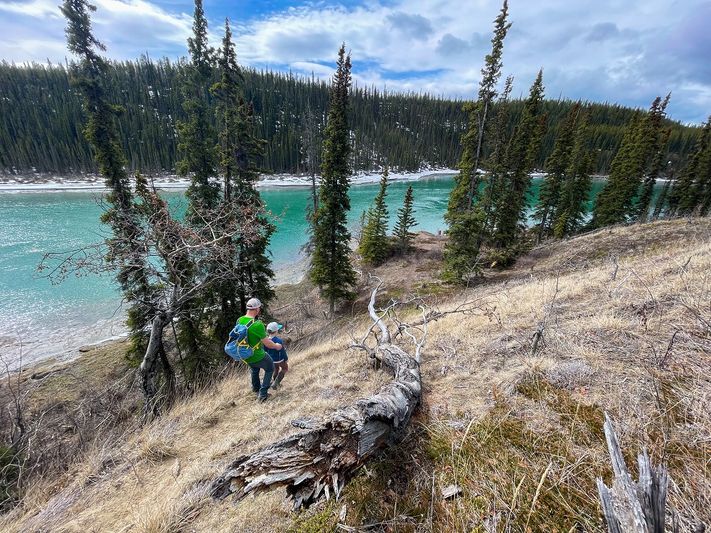
Near the end of the hike, the trail drops down to a point along the river with a firepit and small log bench.
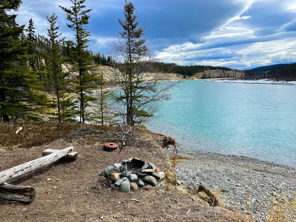
Great spot for a snack and rest, before heading back.
Frenchie June 8, 2025
Travelled this route yesterday (June 7th) and it was as windy as the Dickens!
(Bugs had no chance!).
Well established paths veer away from the cliff edge where erosion is worst, so footing is pretty good. Easy, fun, and numerous breathtaking views above the Yukon River!

Virginie May 9, 2025
I recommend being careful with dogs off leash when leaving the parking lot. The current of the river near the dam can be dangerous if they jump in! I run there quite often in the summer and I've seen people panicking while their dogs are swimming away more than once. Otherwise, gorgeous spot with amazing view of the Yukon river!!
