Total Distance: 6 km
Return Time: 1.5 hours
Elevation Gain: 64 m
Difficulty: Easy
Region: Whitehorse
Traditional Territory: KDFN, TKC
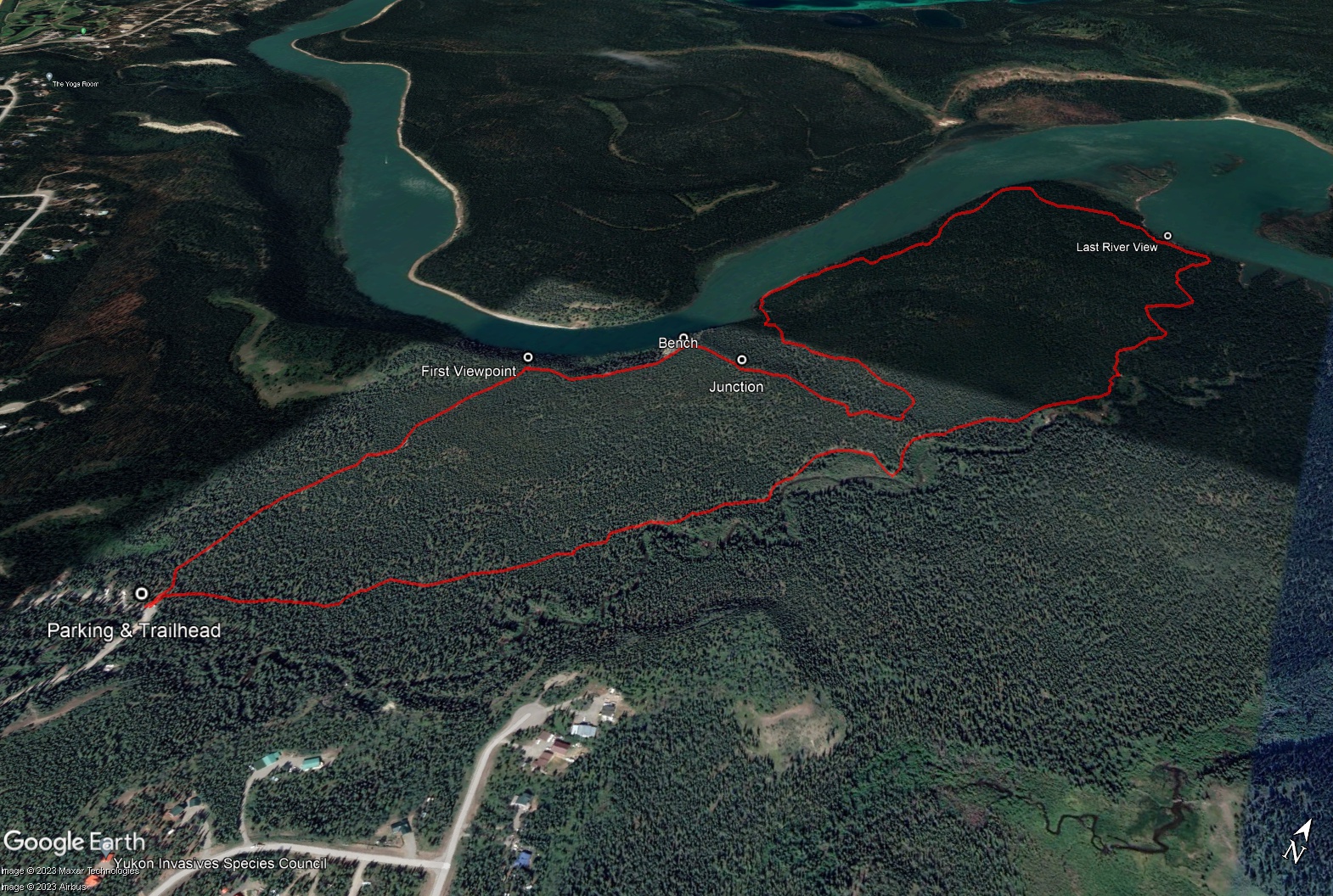
Starting from the Wolf Creek Campground, near Whitehorse, the Wolf Creek Loop is an easy 6 km hike with views over the Yukon River. The trail weaves through different forest types with expansive views along the Yukon River. It is a popular trail year-round and used by many different types of recreationalists, so make sure to share the trail.
Drive south on the Alaska Highway from Whitehorse and take a left into the Wolf Creek Campground. The campground is just over 11 km from the intersection at Robert Service Way and the Alaska Highway. Drive into the campground, past the first gate. Keep left at the day use area (where there is a picnic and playground area) and follow the road over the creek. Continue until you see a parking area on the left with an outhouse, trail and sigange (just before another bridge over Wolf Creek).
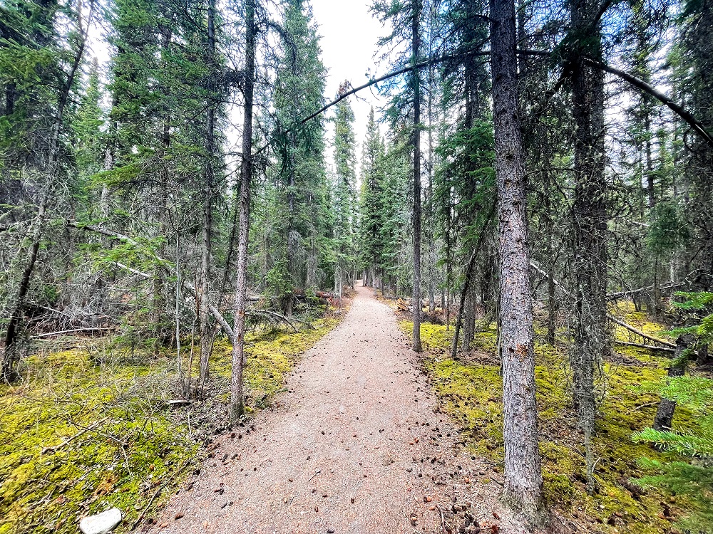
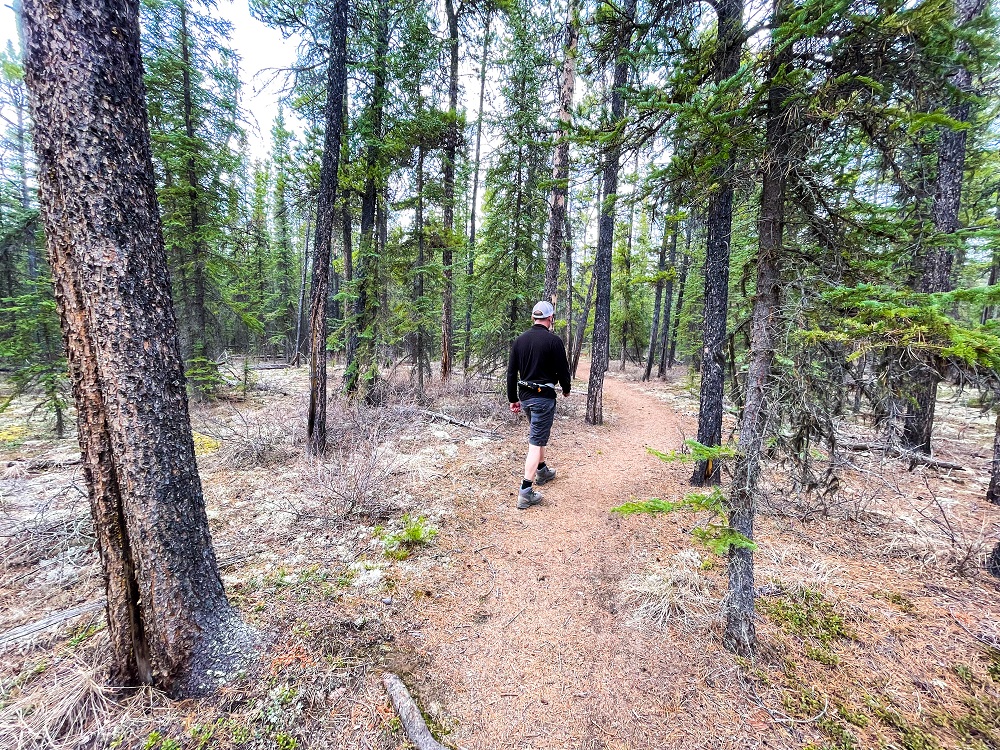
From the parking area, follow the main gravel trail, which is wheelchair accessible for the first 850 m. It is marked at the start by a trail marker bearing the traditional name of 'Taga shro'. There are great interpretive signs along the way about local First Nations and the plants and animals of the area.
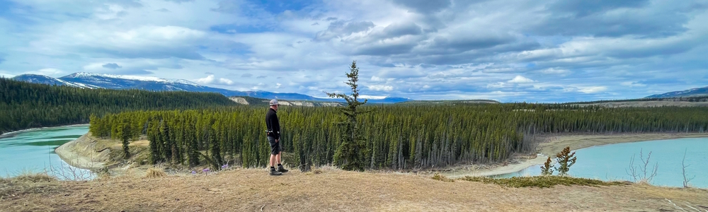
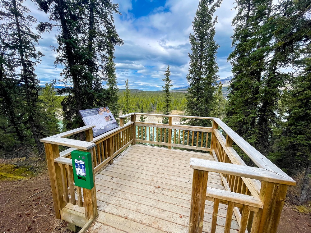
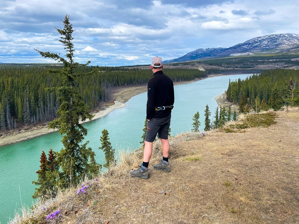
After about 750 m from the trailhead you reach the first lookout over the Yukon River, which is a wheelchair accessible ramp and platform. After this, follow the trail to the right through the forest. The trail will come out to a picnic area with open views of the river again. After this, the trail becomes slightly narrower and rougher (with roots and rocks), and opens to another high view with a beautiful bench.
From the bench, the trail heads right, into the forest. About 140 m after leaving the bench, you will come to a junction (marked by another trail marker ('Tagaya'). Follow the trail to the left to complete the longer loop (described here). Note the trail to the right is a shorter loop bringing you back to the trailhead.
From the junction the trail heads east and then zig zags around to the west, losing elevation as you come down closer to the river's edge. The trail follows along the bank of the river to the northeast. It is quite close in some places to the eroding riverbank, so keep your distance from the edge. The trail then heads east into the forest a bit, before again popping out to look over the river. This is just past the halfway point of the trail (about 3.3 km from the trailhead), and the last view of the Yukon River.
The trail then heads generally southwest through the forest heading back to the campground. Keep on the main trail. It will pass a few points looking out above Wolf Creek. The loop trail rejoins the main trail just near the beginning. You've made it.
Starting out on the main trail from the trailhead. The trail is wide and well graded for wheelchair access.
After 750 m you reach the first viewpoint over the Yukon River.
Keeping right from the first viewpoint you will reach several other expansive views lookind over the Yukon River.
After the trail junction, the loop takes you down through the forest towards the rivers edge.
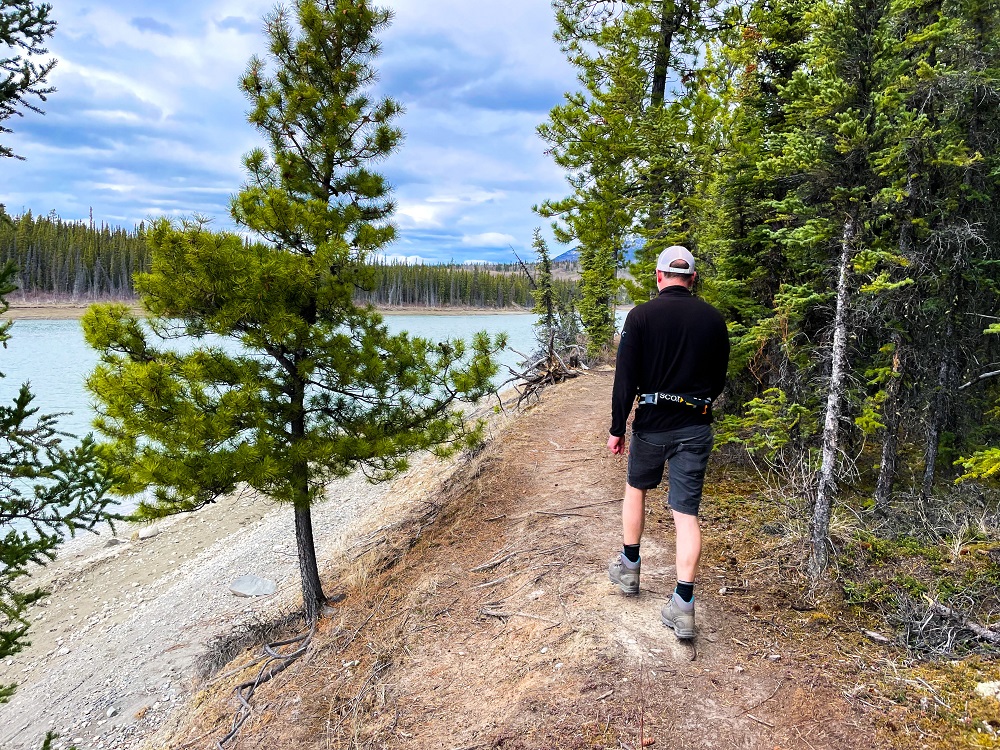
The trail follows along the edge of the riverbank.
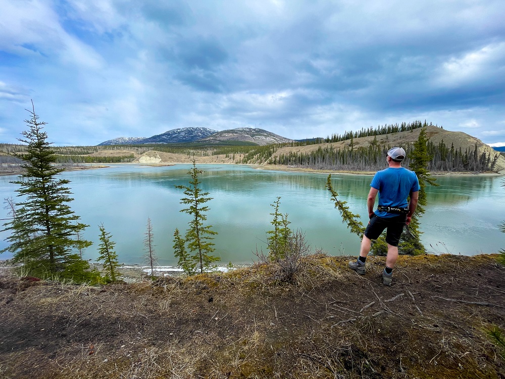
Just past the halfway point you get your final view of the Yukon River before turning back into the forest.
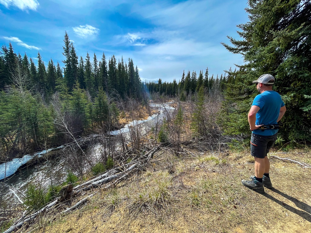
Towards the last stretch of the loop, there are several little viewpoints over Wolf Creek.
Frenchie June 5, 2025
Completed the described trail today, while adding some of the loops to the north of the main lookout deck. Conditions are great and the views are wonderful. There are some side trails throughout the northern portions of what I added today, which seem to lead to private residences, so be sure to maintain the actual trail, lest you find yourself in someone’s yard. No bugs yet!

Yukon Hiking May 27, 2025
Trail is in great condition and the crocuses are unreal right now! There's nearly 'fields' of them. Enjoy this 1.5 hour loop close to Whitehorse!
