Total Distance: 7 km
Return Time: 5 hours
Elevation Gain: 780 m
Difficulty: Moderate
Region: Haines Pass
Traditional Territory: CAFN
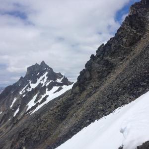
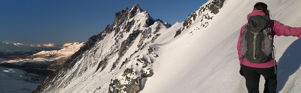
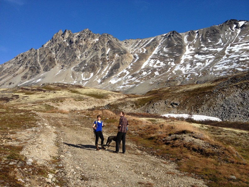
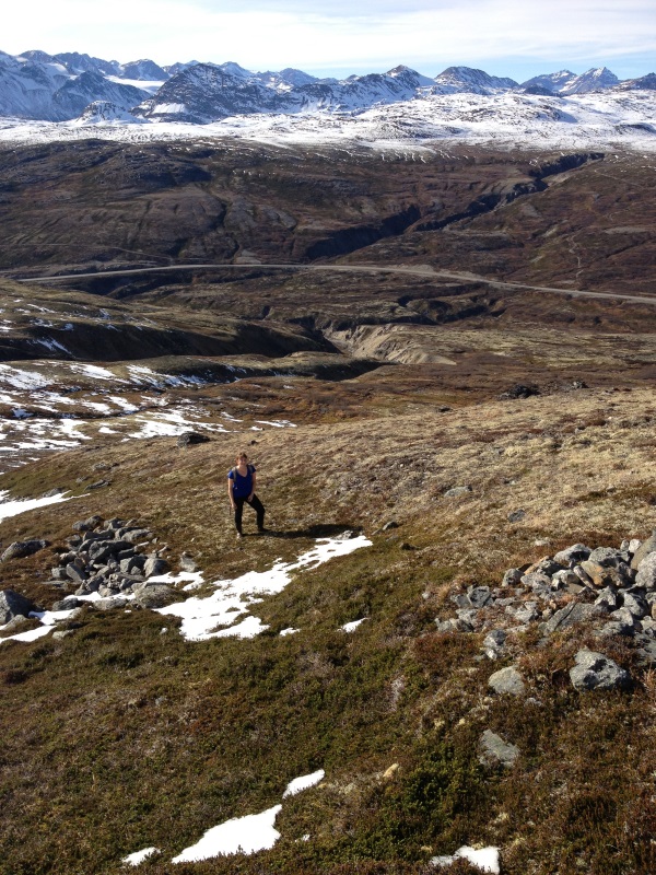
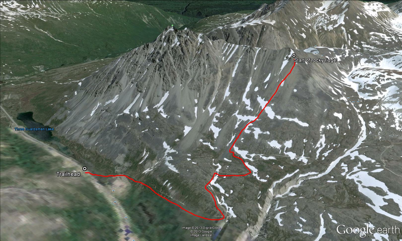
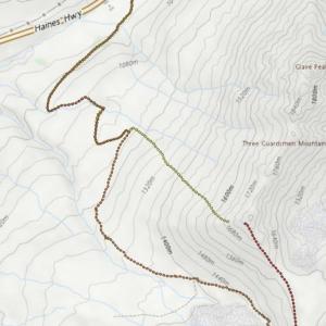
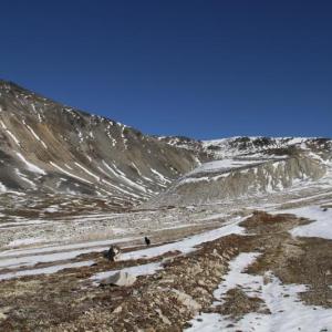
Three Guardsmen Mountain is a beautiful and challenging hike in the Haines Pass Area with stunning views across to the mountains of the Tatshenshini-Alsek Park. The highest of the rocky spires of Three Guardsmen Mountain is called Glave Peak. The route follows an old exploration road for the first few kilometers, and then takes a steeper, more direct approach to gain the ridge. This route currently ends at the beginning of the main rocky ridge. It is possible to follow the ridge if you want a longer hike and fun scramble.
From Haines Junction, drive south on the Haines Highway towards BC and Alaska for 154 km. Just past the Three Guardsmen Lake (on the left), find a suitable spot on the highway shoulder to park. This hike is in BC.
The summer and winter route is roughly the same. From the highway, you will have to drop down to a somewhat marshy area to get onto the exploration road. Pick your way across the wet area, by simply staying on top of rocks and grassy mounds until you reach the road. You may have to move through a few bushes, but it is very minimal.
Follow the road as it switchbacks up the hillside. After about 2.5 km, you will need to leave the road and head up to the ridge. The road continues for another 5 km to an alpine cirque, which is another option if you want a less steep, alternate hike.
Choose your way up the slope to reach the southern end of the ridge. The views are beautiful along the entire route, and get better and better as you gain elevation. This route description ends at the beginning of the main rocky ridge, which leads to Glave Peak. It is possible to continue along the ridge, but it becomes more challenging and technical as you reach the rocky spires. Add additional time and distance if you continue on the ridge.
The route starts along an easy-to-follow exploration road for the first 2.5 km.
After leaving the road, head directly east and up to the start of the rocky ridge.
Louise August 12, 2024
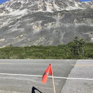
Hiked this last week, we found the trail easily. ~350m past the end of three guardsmen lake there is a flag on the right of the highway. If you park here there’s an easy route down to the marshy area on the opposite side of the highway (before the guardrails). Once down there look for recent tire tracks leading towards the right and they bring you right to the exploration road. Beautiful hike. Enjoy!
Danette M August 27, 2023
Did this hike yesterday. The view up top was one of the best I've ever had in any hike, anywhere. Just incredible! However, getting up was not easy. I couldn't find the old mining road (I think it's grown in quite a bit since last post), so I just had to make my own way up, which involved going over many boulder fields, with VERY loose rock. I had to do some scrambling as well. I eventually did get high enough to see the old mining road, but by then I was higher up. I basically went straight up from the lake, but then made my way over to the south ridge, & diagonalled up to the ridge. It was awful! I did fall at one point. The rock up there is horribly unstable, & the bit of scrambling I had to do was not fun, as a result. When I got to the top described here, I took a look at the ridge & decided not to continue. I'm pretty sure-footed, but the exposure combined with loose rock I thought wasn't worth it. I had dreams of doing the full ridge & going down the other side, but I couldn't see a route up to or past the Ģuardsmen. I went down the ridge on your right as you're going up (route described by Ronnie below). It was great, & much easier I'm sure than going down all that steep, loose rock! I did connect with the old mining road route described here, & therefore was able to find the "trailhead" at the end of my hike. You can see it from the road once you know it's there - it cuts along the bank but is bushy & grown in. It starts maybe 1/4 km from the end of the lake, & starts at a kind of open, sandy area. I def wouldn't recommend going the way I did. But the views are super worth it if you can find an easier route up! I scouted whether you could go up the other (north) side of the Guardsmen, but couldn't see a route. Maybe around the backside? If I ever go scope it out, I'll report back here.
All in all, my hike took just under 7 hours.
Ronnie September 10, 2019
Hiked this on September 8. Followed the route as described to the peak. Instead of returning the same way, we continued down the ridge heading roughly southeast, along the saddle and then down across the edge of the rock glacier. We picked up the mining road again next to the rock glacier and took it down.
Made a nice loop. 7 hours from start to finish with about 45 minutes of rest throughout.
Cole Fischer August 6, 2019
Awesome hike, amazing views for a not too difficult hike. Took us 5 hours round trip, with a few stops for snacks and radlers at the top.
We followed the old mining road until the first branch off up to the left (about 4km in) at the base of the ridge, and went up from there through a billion blueberries and cranberries. There's a few little vegetated plateaus up the ridge that make good rest stops, and provide nice view points. We just went to the first peak on the right, and didn't feel comfortable continuing further down the ridge.
Marc July 26, 2017
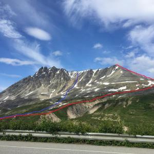
Great hike. Just found the old route described here and shortly after picked a way and went straight up. Took 3.5 hours round-trip. Definitely on the harder side than moderate (especially with route we took in blue). Involved some climbing. But if you follow the traditional route (in red), it will be easier. You just end up being a little lower in elevation, therefor you probably don't get the best view of the Three Guardsmen. Amazing view of the Haines Pass and never ending mountains on the other side of the ridge, too.
Jo October 11, 2016
Hiked the Three Guardmen on Sat Oct 8th. We went up the right side of the obvious main drainage on the way up, then cut across a short boulder field and up again to meet the road higher up. We then hiked on the E side of the SW ridge and found some unstable boulders on the way up. It gets a bit scrambly at the top and we made it to GR 199069, basically the South sub-summit of the more higher and more impressive rock formation to the North (The three guardmen). On the way down, we opted to stay on the ridge and then descend W of the SW ridge which was better ground/better travel. We beelined for a low point in the road back to our vehicle.
If you have more time for a half day stroll in Haines Pass, we also hiked from Haines pass Summit GR115166 in a SW direction to a knob overlooking Samuel Glacier at GR088151. About 7 km and 270m elevation change. You will have to ford the creek early on. Great walk!
Murray Lundberg October 2, 2016
On October 1st, I hiked up to the cirque and did some exploring. I topped out at 1,387 meters. As I hit snow just below the cirque, I'm looking at this as a reconnaissance for future, longer trips. It's an absolutely superb hike, with almost 180 degrees of constant incredible views. Ruins of a mining camp from probably the 1950s, and extensive exploration work over the southern half of the cirque, has me intrigued enough to try to find out who they were. No large animals were seen, though some very old grizzly scat was on the road/trail not far from the cirque. There's no need to slog through the marsh at the start - the little creek that drains it has "stepping stones" a cross it in at least 2 places. The trail starts at the northeast corner of the gravel pit, and has a couple of tape flags marking it. A lot of work has been done clearing brush along the lower trail.
Justine June 12, 2016
I did this hike with a friend May 27th, it was beautiful and sunny, but still quite a lot of snow. In order the hit the mining road we had to cross a quick-moving stream (took off our hikers) and quite a large marsh area. My friend's feet were wet because she was wearing hiking shoes, not boots.
The road was still mostly covered with snow but visible, and we walked beside it, then cut up the south side of the mountain.
The rocks become really unsteady as we approached the ridge, making us feel like we were on a stair climber, but the view was so worth it! We stopped and had lunch at the first rocky ridge.
The way down was a little rough on my ankles so I was walking in the snow took and tumble and then realized I could slide quite a bit of the way down on my bottom (not a recommendation, but it worked for us and expedited our return).
Total time was approximately 3 hours return (including lunch).