Total Distance: 3 km
Return Time: 2 hours
Elevation Gain: 239 m
Difficulty: Easy
Region: Carmacks
Traditional Territory: LSCFN
A nice hiking trail for the whole family, with views of the beautiful Carmacks area. The well-built trail takes you through mixed forest and up to a grassy knoll with rocky bluffs looking out over the Nordenskiold River Valley. The valley stretching south to north is dotted with wetlands, farms and rolling hills with the North Klondike Highway below.
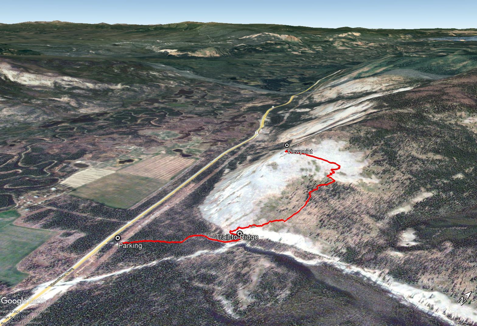
From Whitehorse, head north on the Alaska Highway out of town to the junction with the North Klondike Highway. Drive on the North Klondike Highway for 149 km. Here the highway crosses a small creek (culvert not a bridge) with large excavated gravel banks. Shortly after this there is a side road to the right which leads to an open parking area. There is also a large wooden sign for the Plume Agate trail (though obscured slightly by the surrounding vegetation) off the highway marking the road. If coming from Carmacks, this road is 13 km south of Carmacks on the left. Park in the large opening underneath the power lines.
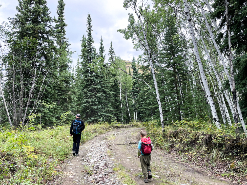
From the parking area, a wide dirt road continues northeast through the forest. The road ends at a large opening next to the creek on your right. Look for a small trail on the left side of the clearing that takes you up slightly and parallels the base of the grassy slope heading west.
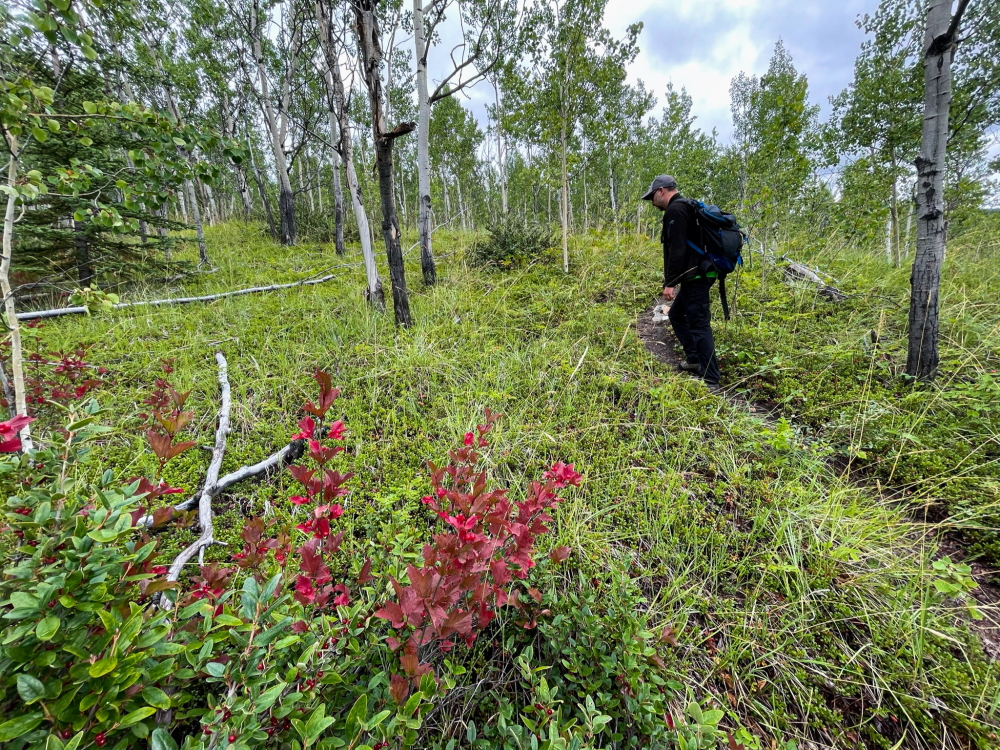
Follow this trail as it zig zags up the hill, eventually heading east again up through an aspen forest with soapberry and high-bush cranberry understory. The trail takes you on a nice gradual route to the viewpoint. Eventually you'll leave the trees and switchback gradually up the grassy slopes, which are abundant with grasshoppers and birds of prey scouring the grass for rodents.
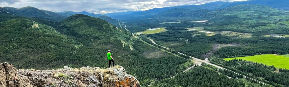
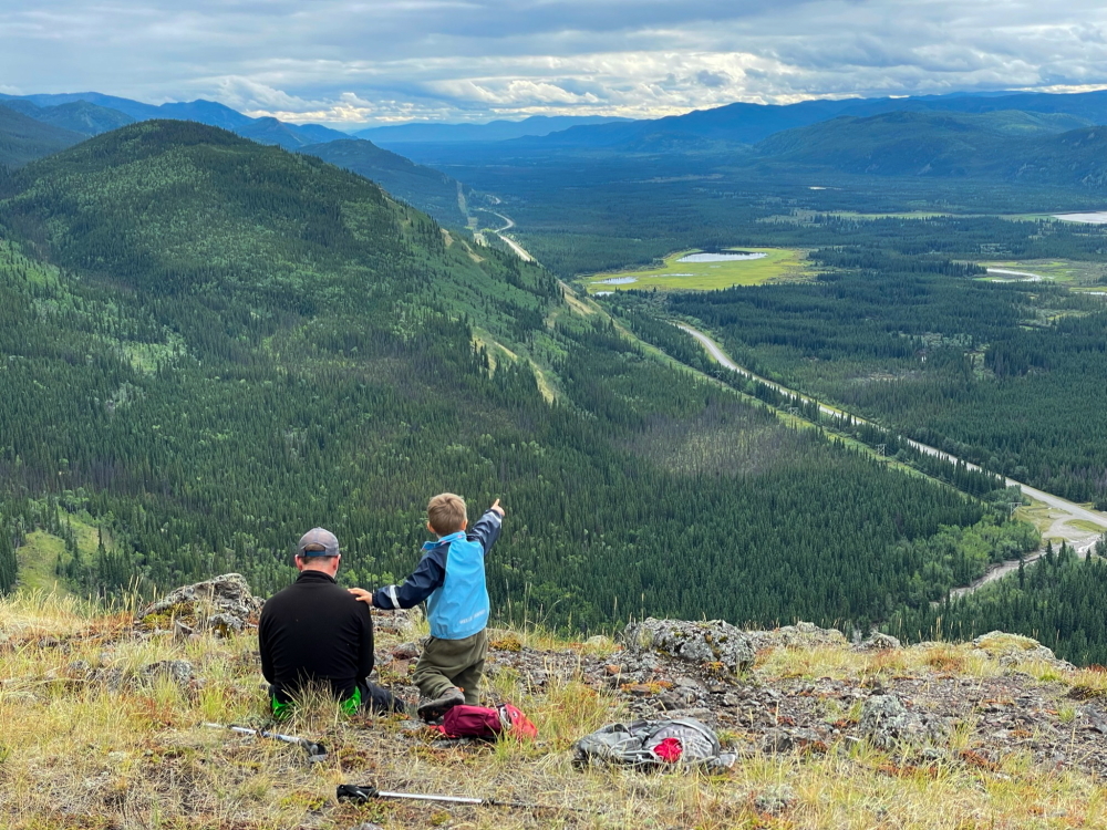
The viewpoint is on the west edge of the hill with some neat rocky bluffs. You get a beautiful view of the Nordenskiold River Valley below extending south to north with its wetlands and lush green farms. The river and wetland area is within the Tsâwnjik Chu Habitat Protection Area. It is recognized as an important traditional hunting and fishing area for the Little Salmon/Carmacks First Nation people as the wetland complex provides habitat for a bounty of fish and wildlife species.
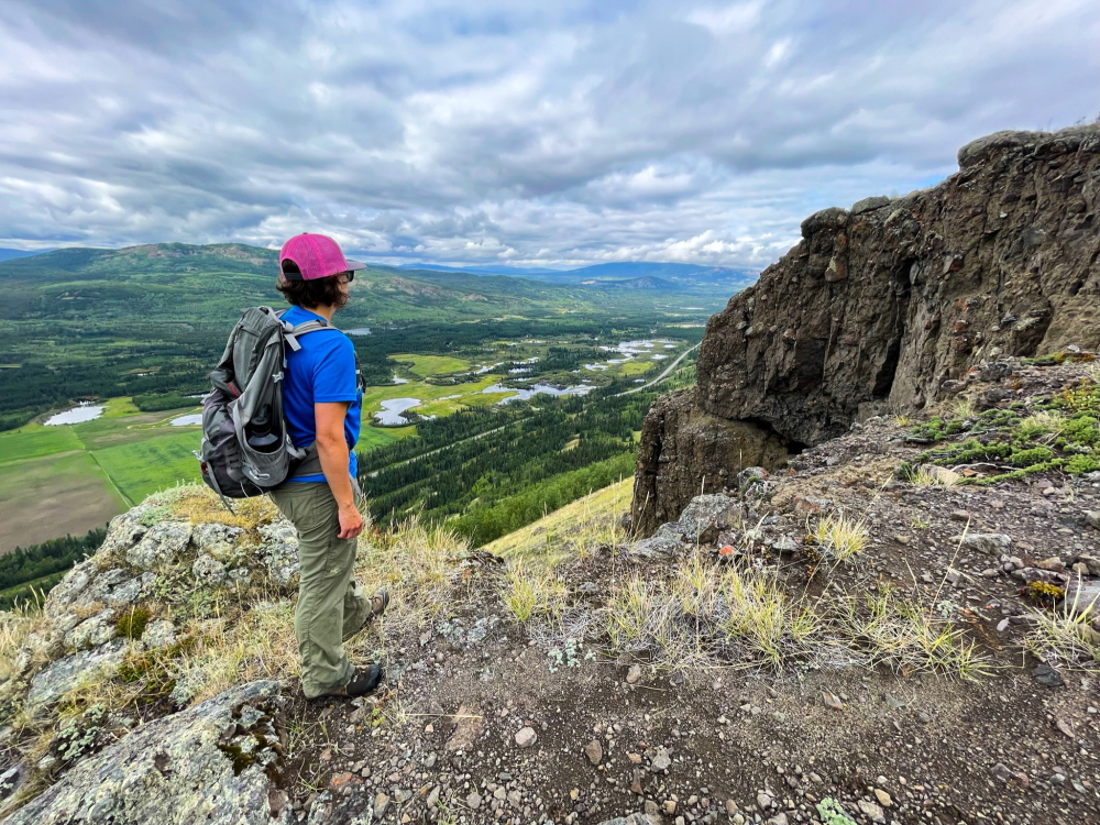
The rolling hills of the Carmacks area extend in all directions. Bushy Mountain is the rounded mountain to the southeast. The rocky bluffs are where you may find some plume agates (feather, flower or flame-shaped mineral growths within the agate silicates), but the bluffs are a bit precarious so be cautious.
To avoid causing erosion in the area, follow the same trail down.
Hiking along the road from the parking area.
Follow the trail as it takes a gradual approach through the aspen forest.
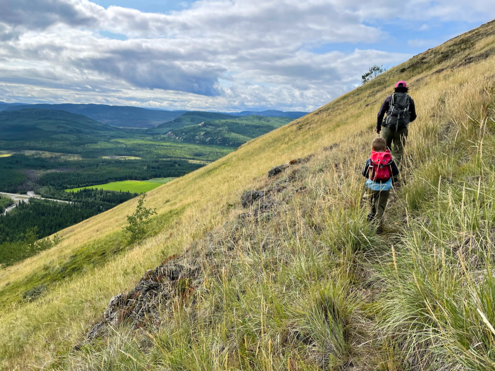
Once out of the trees enjoy walking the open grassy slopes.
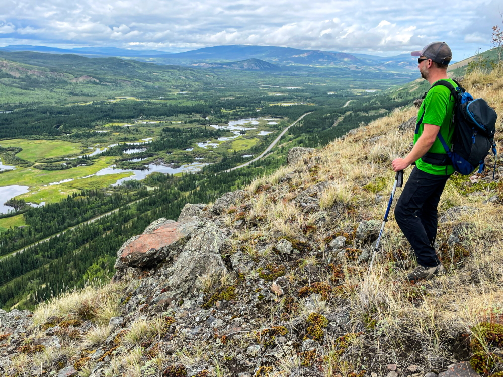
The views near the top, looking south.
Admire the views of the lush wetlands of the Nordenskiold River Valley.
Looking north towards Carmacks from the rocky bluffs.
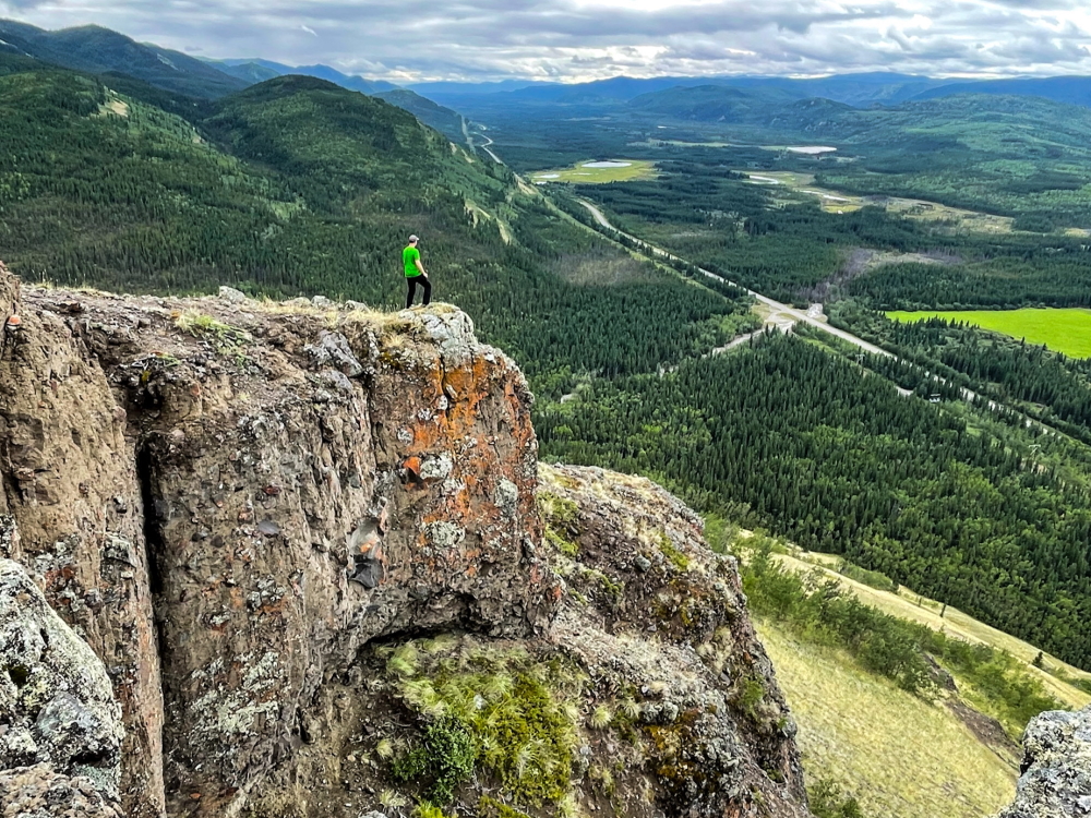
The bluffs offer a great perspective of the area and a good perch to watch birds of prey scouring the grassy slopes for rodents.
Kathy May 30, 2022
May 28, 2022, Very nice hike - completely dry.
