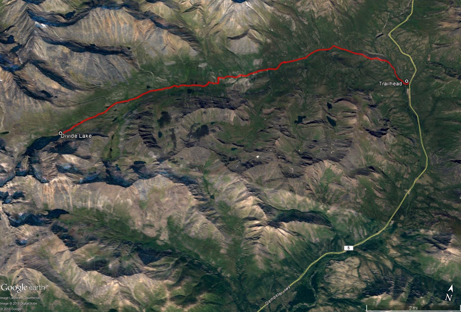

Total Distance: 35 km
Return Time: 2-3 days
Elevation Gain: 340 m
Difficulty: Moderate
Region: Tombstone
Traditional Territory: THFN
The winter route up the North Klondike Valley to Divide Lake is a great overnight ski trip within Tombstone Territorial Park. The route starts from the Tombstone Campground and follows along the frozen North Klondike River all the way to the lake. This route is best attempted in the late winter/early spring based on temperature, daylight hours and snow conditions. Also the valley is one of the few areas where snowmobile use is allowed in the park, therefore there is typically a packed trail to the lake, which makes the skiing a lot easier. Basic route finding skills are required.
This route starts from the Tombstone Campground at KM 72 of the Dempster Highway. The campground parking area at the entrance is kept clear of snow and the campground shelter with wood stove is open throughout the winter.
From the parking area, follow the main campground road to the left and access the North Klondike River from one of the riverside camping sites. Ensure that you assess ice conditions carefully, though by late winter/early spring there should be more than sufficient ice thickness to support snowmobiles and skiers.
The first one and half kilometers follows closely on and along the river heading northwest, until you reach a more wide-open-braided section of the river valley, which is covered in aufeis or overflow ice in the winter, essentially a large sheet-like mass of layered ice. Keep to the left as you traverse across the open ice sheet, avoiding any wet looking areas where water is seeping through. The going here is quite easy as the surface is flat and smooth for the next 1.5 km.
After the overflow ice section the river becomes one main channel again and the route essentially follows along the river to Divide Lake which lies to the southwest. For the first half of the route, the trail seems to follow along the right side (north side) of the river, but then does cross over to the left side (south side) towards the later half of the route. The elevation gain is very gradual along the route with a few ups and downs, but the trail stays mostly in the river valley. As for avalanche exposure, the route stays within simple avalanche terrain along the valley. If you've timed your trip right there should be a main snowmobile trail through the valley that you can follow. If you are not on a packed trail your progress will be a lot slower as the snowpack is not very supportive in such a dry and cold climate. The snow becomes very granulated (like white sugar), and it's common to sink up to your waist in snow.
There are suitable camping spots all along the length of the valley as well as at Divide Lake if you can make it there in a long day (17.4 km ~ 8.5 hours). The scenery in the area is stunning, particularly the steep granite cliffs that tower above the lake. From Divide Lake, as in the summer, you can also continue to Talus Lake (another 10 km, return) for a nice side trip for views of the iconic Tombstone Mountain and Mount Monolith. The snow is also better in this area for alpine touring with many possible ski slopes.

Starting out along the North Klondike River from the campground.

Crossing the overflow ice area.

Following the main snowmobile trail along the river valley.

The elevation gain is very gradual along the route with a few ups and downs.

Setting up camp just before Divide Lake in order to be out of the shadow of the granite cliffs.

Heading out on a ski tour past Divide Lake up to Tombstone Pass and Talus Lake.

Packing up camp and heading back down the valley.

Pekka Honkakoski April 1, 2023
Nice route and beautiful photoes!
I saw lot of snow. May be you and your hiking friends are keen to see this my "Winter stoves" video in low winter temperatures:
Free to share and free to link.
https://vimeo.com/800496527
Pekka
Ganesh Tiwari November 18, 2020
Please the logistics for this trip and tips for travelling by motor vehicle to tombstone at this time of the year. Such as how do you keep engines warm when not using? Do you need a permit? Is late December a good time to do this trip ?