Total Distance: 6 km
Return Time: 4 hours
Elevation Gain: 750 m
Difficulty: Moderate
Region: Kluane
Traditional Territory: KFN, WRFN
This route connects Nines Creek North and Nines Creek South. It is a great route if you want to either hike both Nines Creek North and Nines Creek South, or if you want to hike Nines Creek South and do somewhat of a loop route. The views from the saddle are worth the extra effort.
This route starts from either Nines Creek North or Nines Creek South.
You can hike this route in either direction (from Nines Creek North to Nines Creek South or vice versa). The description below is hiking from Nines Creek North to Nines Creek South. Time and distance is from where you leave Nines Creek North to the alpine lakes on the Nines Creek South route.
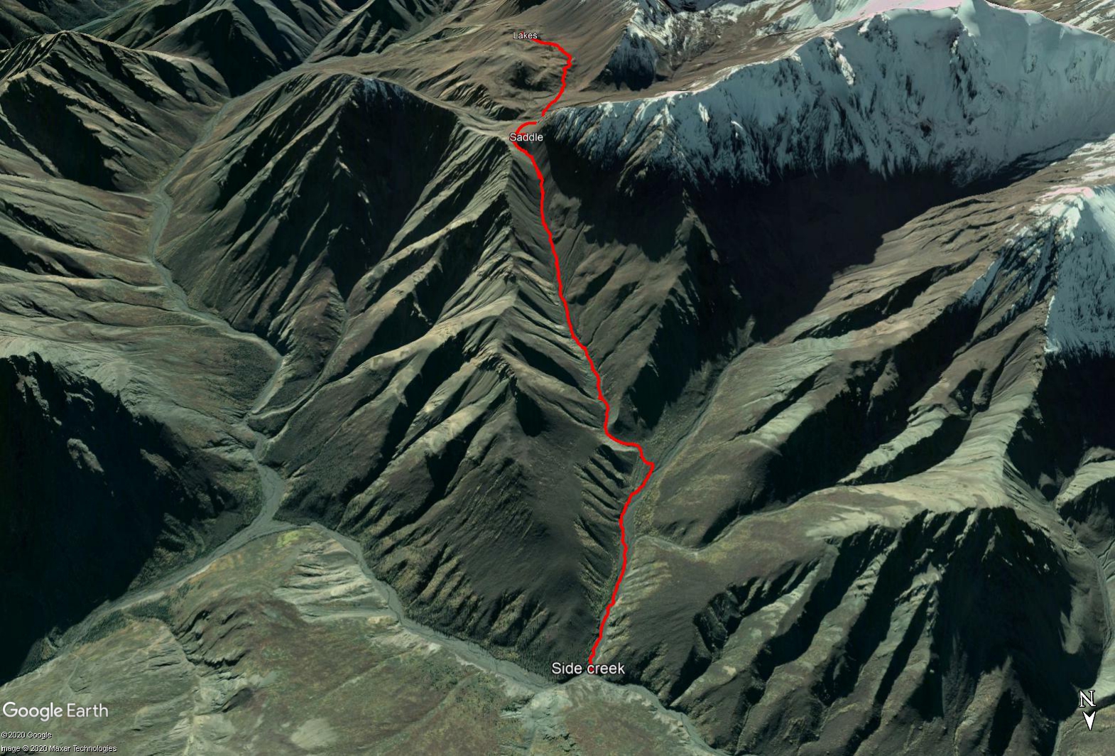
Follow the directions for Nines Creek North. From the Parking Area, hike for 5.0 km (along the Nines Creek North route) where you will see a large creek valley on your left. This is the valley you will be hiking up.
You can hike up on either side of the creek, but eventually you will want to be on the left (south) side. After 1 km, the creek will split. You will want to take the small left creek. It is a bit narrow and overgrown for about 300 meters, but is still easy to hike. After a bend in the creek, you will get your first good glimpse of the saddle you are aiming for, up at the end of the creek valley.
Continue up the creek valley to the saddle. From where you leave Nines Creek North to the saddle, it is 4 km and 750 m of elevation gain (the saddle is at 2000 m elevation). The view from the saddle in both directions is breathtaking Kluane scenery.
From the saddle, head down the scree slope to the vegetated plateau below, heading slightly to your right. There is evidence of mining claim posts at the bottom. From here, cross the small creek bed and ascend to the lowest point between the mounds and the ridge. Here the terrain will flatten out, and you will arrive at alpine lakes dotted with tall mounds. This is also the optional upper end-point of the Nines Creek South route.
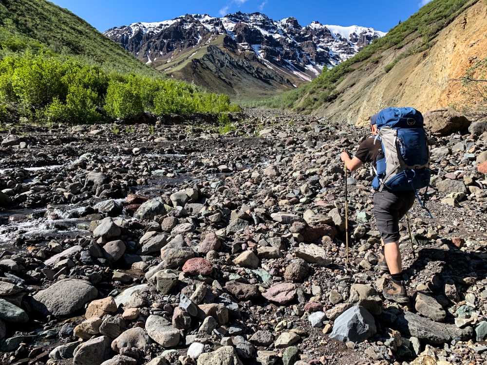
Starting up the side creek from Nines Creek North.
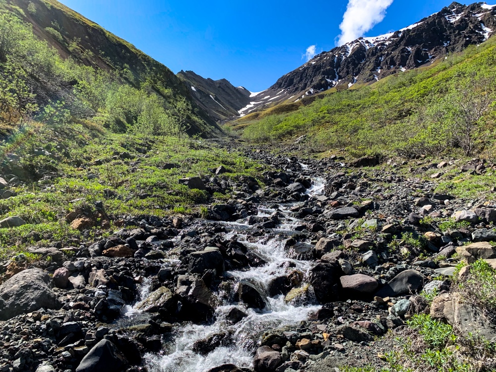
Looking up to the saddle after the bend in the smaller side creek.
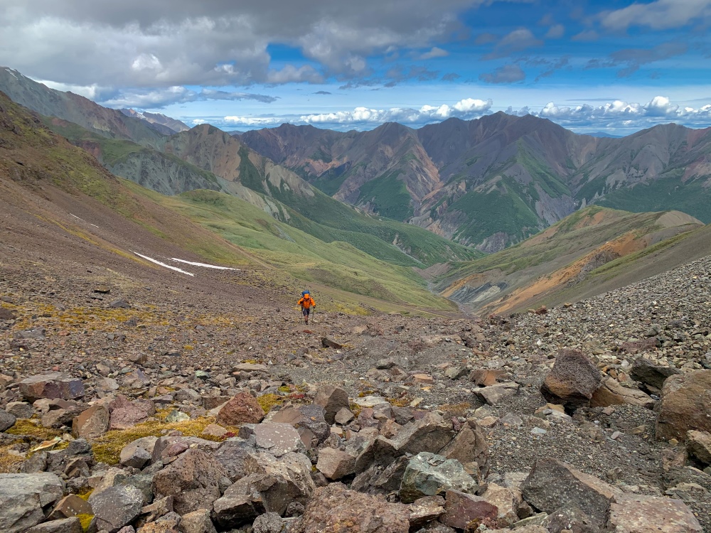
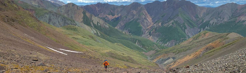
Looking back down to Nines Creek North from near the top of the saddle.
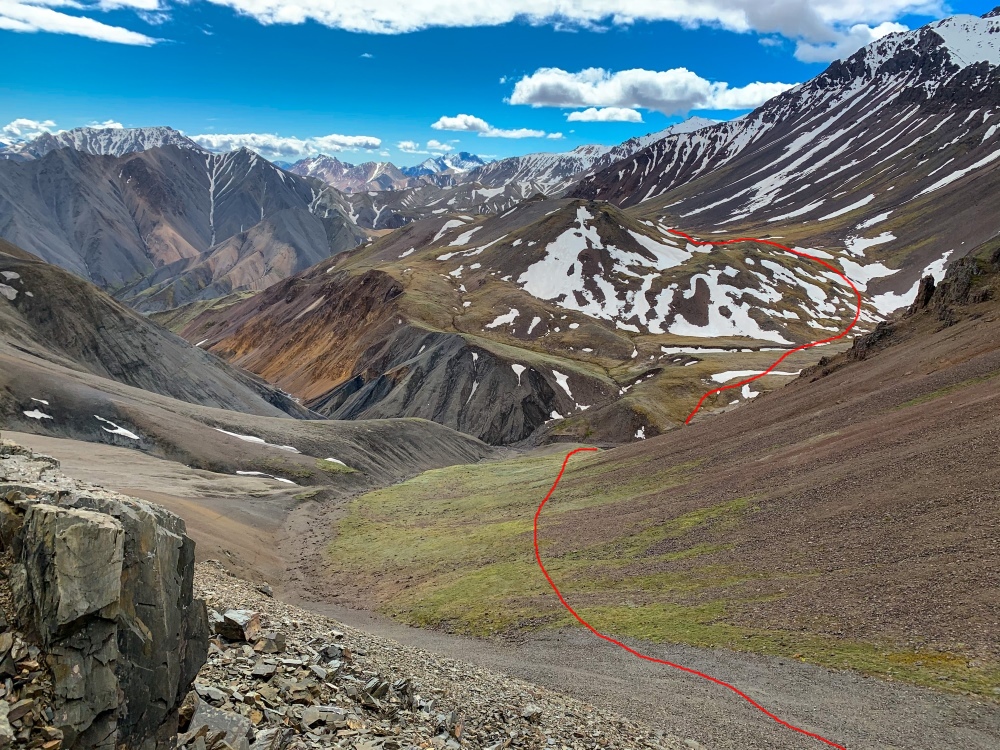
The view towards Nines Creek South from the saddle. The alpine lakes are at the end of the red line.
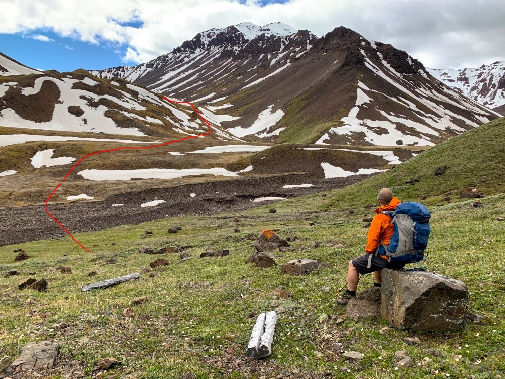
From the plateau below the saddle, just below the alpine lakes.
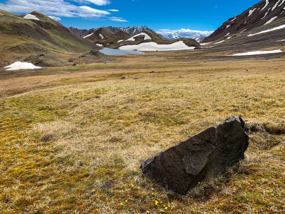
Approaching the alpine lakes with the giant mounds surrounding them.
Denise July 28, 2026
Hiked this July 10 south to north after staying overnight at the alpine lakes. Would rate it more as difficult rather than medium due to the steep descent on screen and the steep rocky terrain downwards. It is well worth the effort though and views don’t cease to impress!! The scree slope looks intimidating but is actually quite doable. Once you hit nines north, if you are heading back to nines south, be prepared for MANY creek crossings which can be rather tricky and time consuming at high water. This route is a great way to make nines south a loop!

Jazzy August 4, 2025
1-3 August 2025
Hiked up Nines South, and connector to Nimes North, and then up Nimes North. Highly recommend to do the loop from South to North: you are walking into the view on the connector route and avoid a long rocky climb. To make it even better take the easy pass that leads you from Nimes North to Bock creek and exit via Book creek: the pass is really beautiful and you have to cross Bock creek only once on your way out (instead of crossing Nimes Nirth 10 times to get out!)
