Total Distance: 29 km
Return Time: 9 hours
Elevation Gain: 917 m
Difficulty: Moderate
Region: Annie Lake
Traditional Territory: CTFN
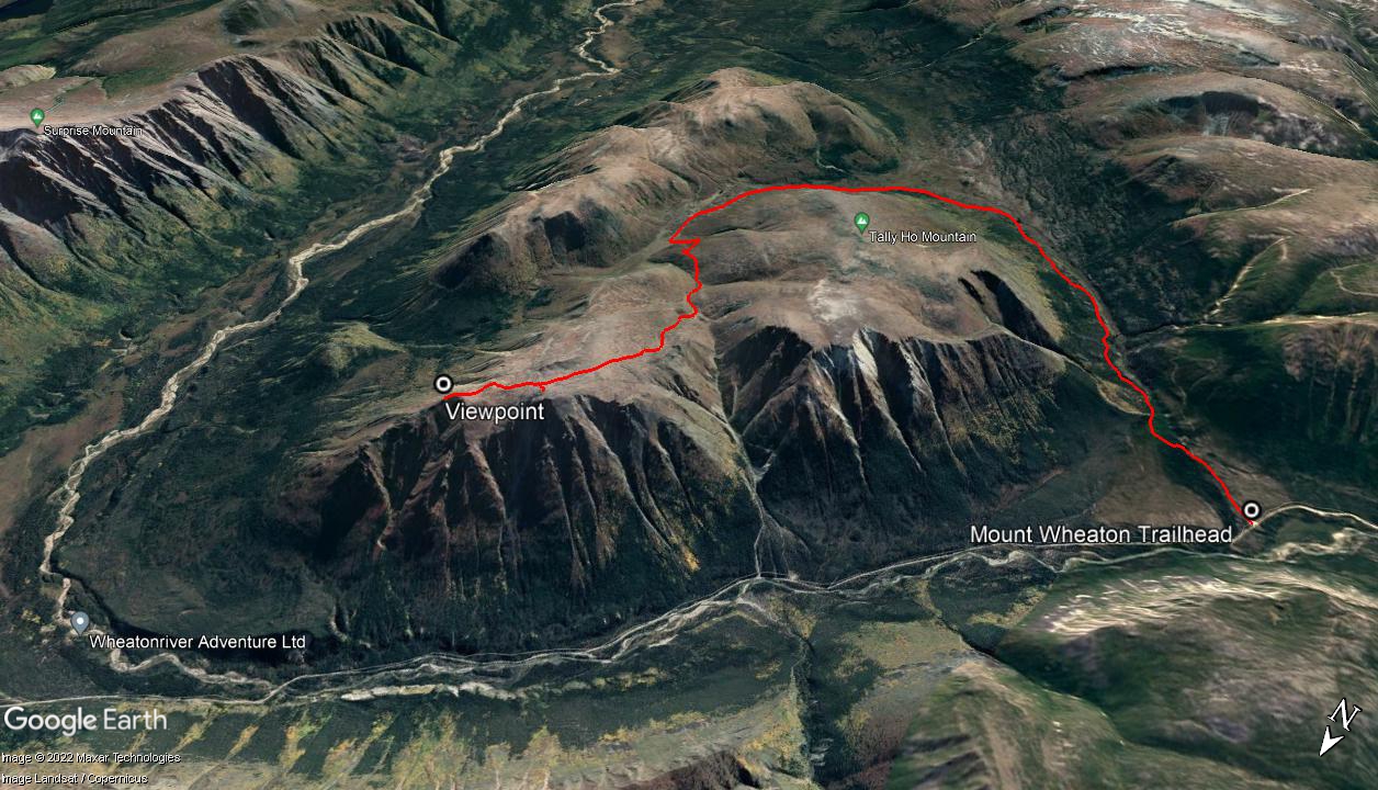
This mountain is located directly east of Tally-Ho Mountain with some amazing views over the southern portion of the Wheaton River and the extent of Gray Ridge. The route is straightforward following old exploration roads that take you nearly to the top of the mountain. Be warned though, this hike is quite a bit farther than Tally-Ho Mountain, and well worth it if you can tackle a portion of the route by bike or ATV. Alternatively you could tackle this hike as a 2 day trip, camping in the alpine. NOTE: This hike falls within Category A Settlement Lands of the Carcross Tagish First Nation. Please respect their rules and land.
From Whitehorse, drive south on the Alaska Highway to the Carcross Cutoff and turn right onto the South Klondike Highway. Drive south for about 17 km and turn right onto the Annie Lake Road. After 26 km on the Annie Lake Road, you will cross a bridge over the Wheaton River. Around 7.9 km after the bridge, you will reach a large pull-out on the left in a gravel pit with a rougher road leading into the forest. This is the trailhead. Note there is a similar looking pull-out with an ATV trail about 4 km after the bridge as well, but make sure you keep going to the second one on the left, 7.9 km after the bridge.
Follow the dirt road that leads into the forest from the pull-out. In less than a kilometre you will reach a fork in the road. Follow the road to the left (the road to the right takes you to Mount Anderson). After 1 km from the trailhead you will reach a fork in the road. The road to the right goes up Mount Anderson, so take the road to the left, which descends slightly. There is a creek crossing shortly after the fork. Earlier in the season (May - June) the water can be just below your knees so you may want to bring some light creek crossing shoes.
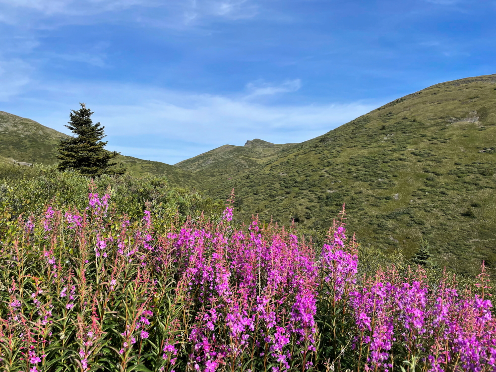
The route continues on the road heading southeast through mostly dry, lichen covered pine forests, following along the north side of the Partridge Creek Valley. There are some longer uphill sections after crossing the creek, but then the road eventually levels out for a bit, with gradual ups and downs. There are some nice lookouts along the way, including the first view of the Montana Mountain Massif near Carcross, after about 5.5 km Partridge Creek Valley. The road eventually curves to the northeast (left) heading into the subalpine.
You will then loose a little bit of elevation as you descend to a main fork in the road. The road to the right goes up towards Mount Stevens. Keep left at this fork, as the road continues gradually downhill. There will be another fork shortly after this (about 600 m), with the road heading uphill to the left. Follow this road, which leads steadily uphill. After about 700 m there will be another fork, with the fork to the left going up the backside of Tally-Ho, while the right road will take you to Mount Wheaton. From here the road contours along the side of Tally-Ho Mountain and does eventually drop down to a small creek, before heading back uphill. Yes there's a lot of elevation gain and loses on this hike, but overall, it is mostly downhill on the way back!
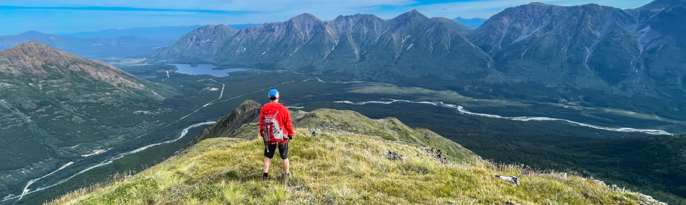
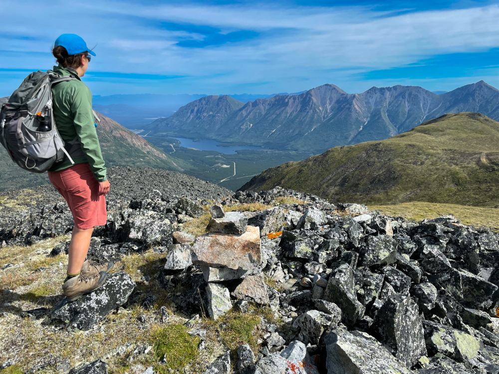
It is about 3.6 km from the trail fork with Tally-Ho Mountain, to the saddle where you can head off-road to the summit of Mount Wheaton (on your left). We recommend you also continue past the summit, on the road, to get the best viewpoint of the Wheaton River Valley and surrounding mountains. It is only about 900 m away, and heads downhill to a small plateau and then up slightly to a small ridge where a foot trail (sheep trail) takes you to a nice perch lookout. The views from here are stunning looking down over the southern portion of the Wheaton River and the extent of Gray Ridge across the river valley.
Return the way you came.
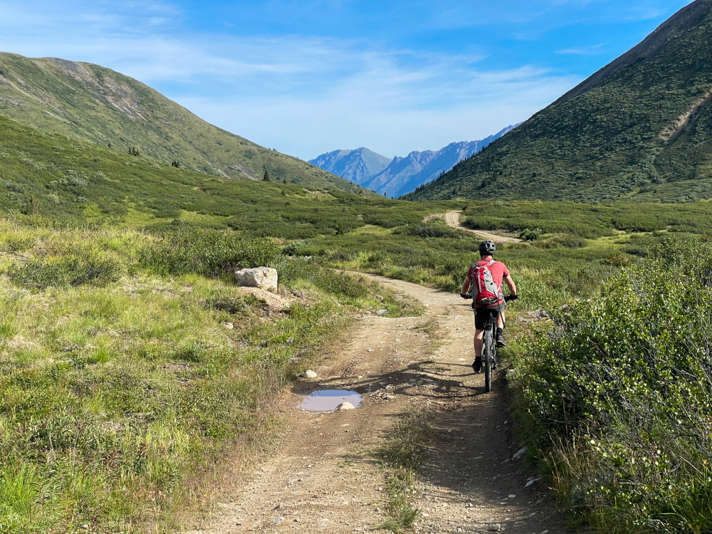
Using a bike for a portion of the access (whether an e-bike or not) will shave off many hours on any flat portions and downhill sections.
Heading up the valley between Tally-Ho and Mount Wheaton.
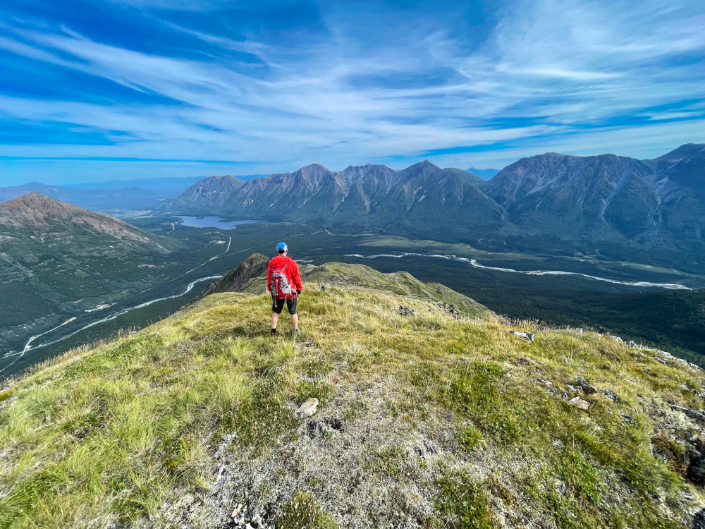
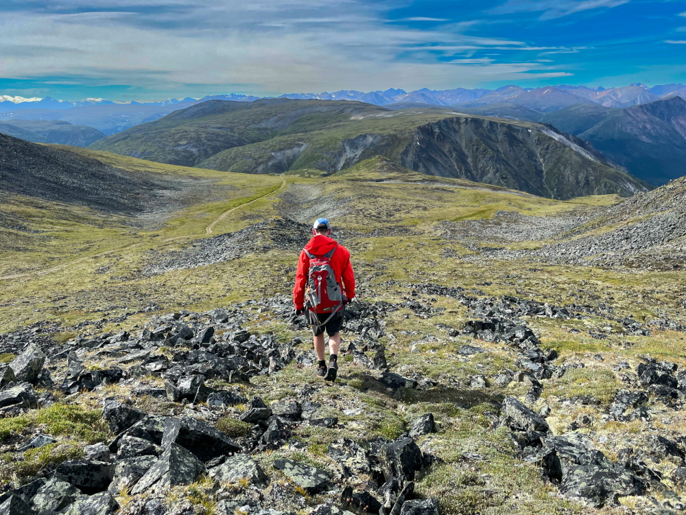
Soaking in the views of Annie Lake, below the summit of Mount Wheaton. Continuing to the next viewpoint (right of photo) is well worth it.
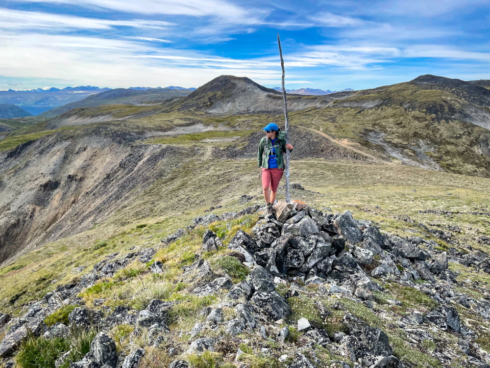
Nearing the viewpoint of the Wheaton River Valley, with the true summit of Mount Wheaton in the background (right of the photo).
The view over Annie Lake, the Wheaton River, and Gray Ridge.
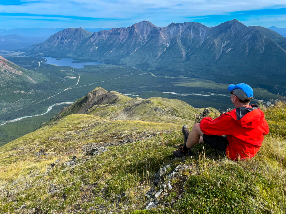
A snack break with a view.
Hiking back down. The bulk of Tally-Ho Mountain is in the background.