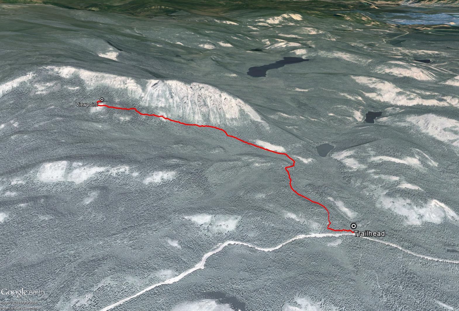
Total Distance: 5 km
Return Time: 2 hours
Elevation Gain: 280 m
Difficulty: Moderate
Region: Carmacks
Traditional Territory: LSCFN
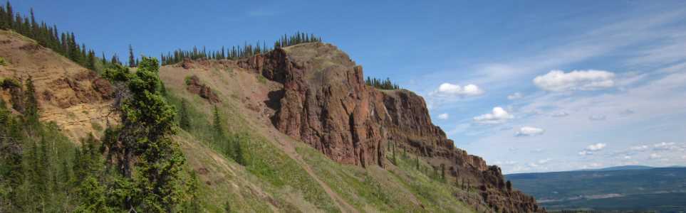
Miller Ridge is a great hike near Carmacks that passes through several different forest types with stunning views of the unique rounded and rolling hills, plateaus and broad valleys of the Yukon Plateau region. The rocky ridge of Miller Ridge itself is also impressive.
From the North Klondike Highway in Carmacks, take a left on either Nansen Road or Freegold Road. Once you reach River Drive, take a left and follow this road along the Yukon River. Continue until you cross a bridge over the Nordenskiold River and take the next left onto the Mount Nansen Road. Follow the Mount Nansen Road for 4 km until you reach a small parking area on the right with a sign saying 'Miller Ridge and Mineral Trail'. Note the Mount Nansen Road is a relatively well-maintained gravel road.
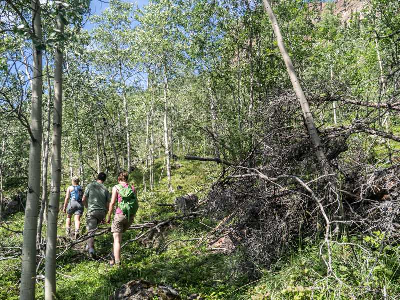
Follow the narrow trail that leads off to the left from the trail sign. It parallels the road for a short while. The route then heads generally northwest for 800 m before veering west to follow beneath the main ridge for another 1.4 km. The trail, while somewhat overgrown in places, is still easy to follow, and there is occasionally flagging along the route as well. While on the trail below the ridge, there are several sections that have been covered in rock debris due to landslides off the ridge. You will have to find your way around or across these little landslides that cover the trail. Note this could be a dangerous hike during a heavy rain, with potential for rockfall.
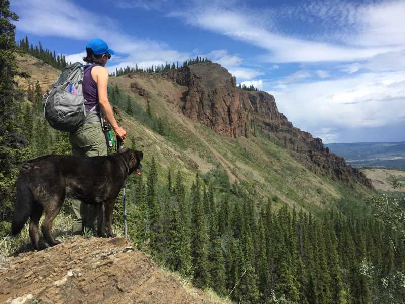
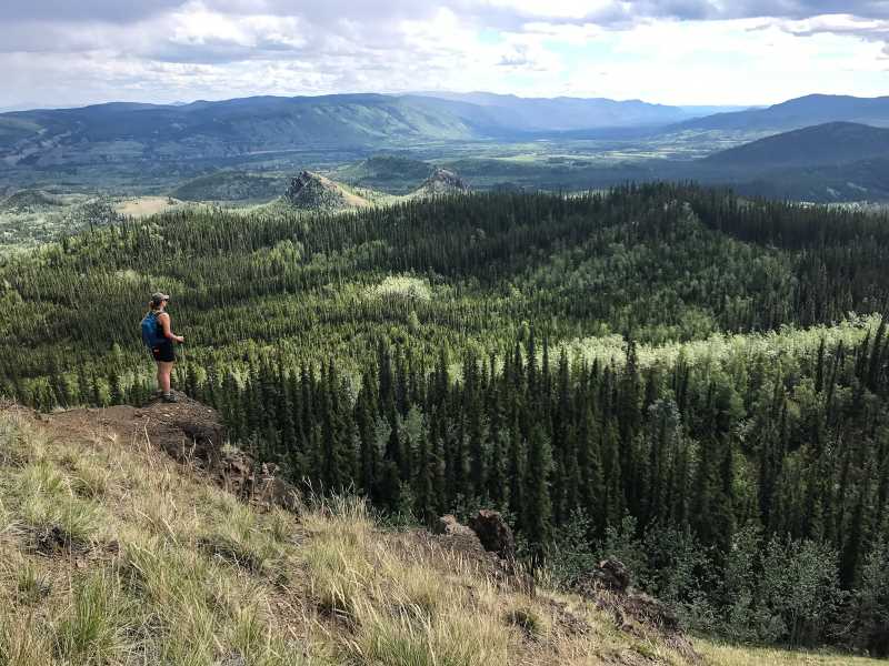
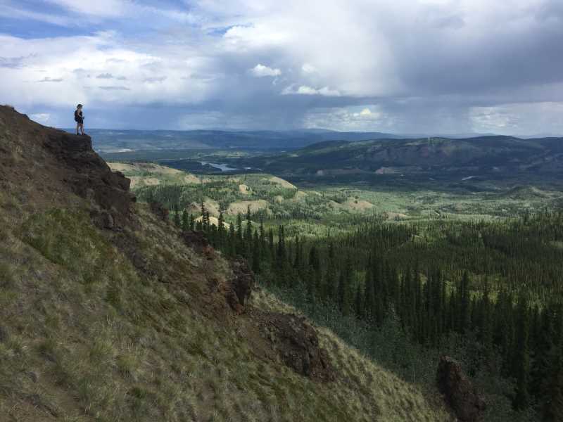
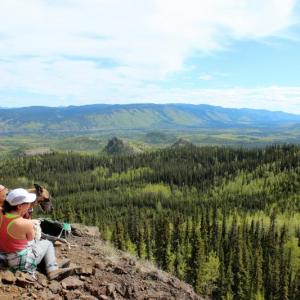
The elevation gain during the hike is quite gradual until the last part that heads up to the final viewpoint. This is where the trail becomes less defined and more of a steep grassy slope that you can switchback up to a little bluff overlooking the valley. From the viewpoint there are some neat rocky outcrops and amazing views of the area, showcasing the unique rounded and rolling hills and wide expansive valleys. You can see some of the agates and geodes in the rocky outcrops as well. Enjoy the views and return via the same trail back to the parking area.
Note the actual top of Miller Ridge is 100 m higher than the viewpoint and tricky to access. If you are looking for more of a challenge, it's possible to access the ridge from various parts along the trail. Be warned though it is extremely steep and of course there are rockfall hazards from the loose rocky outcrops above.
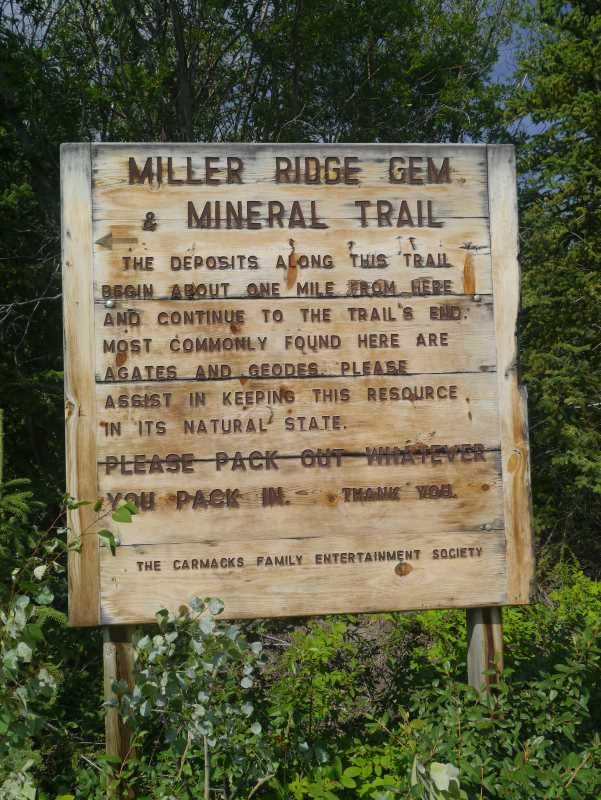
The sign at the trailhead and parking area.
The trail follows along the base of the cliffs for 1.4 km.
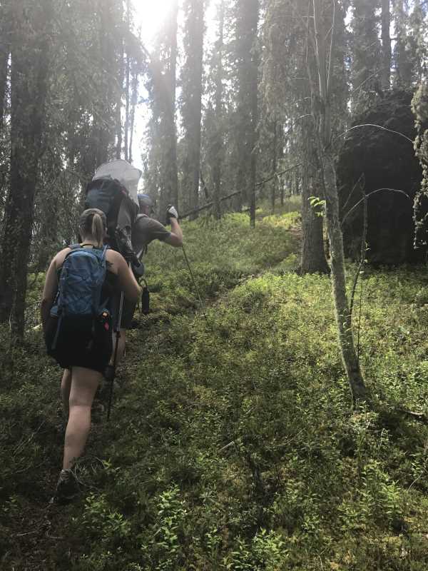
The route passes through a variety of forest types, including stands of aspen, black spruce and white spruce.
The view towards the cliffs from the end of the trail and viewpoint.
The view of the unique rounded, rolling hills across the valley floor to the south.
The view looking towards Carmacks and the Yukon River.
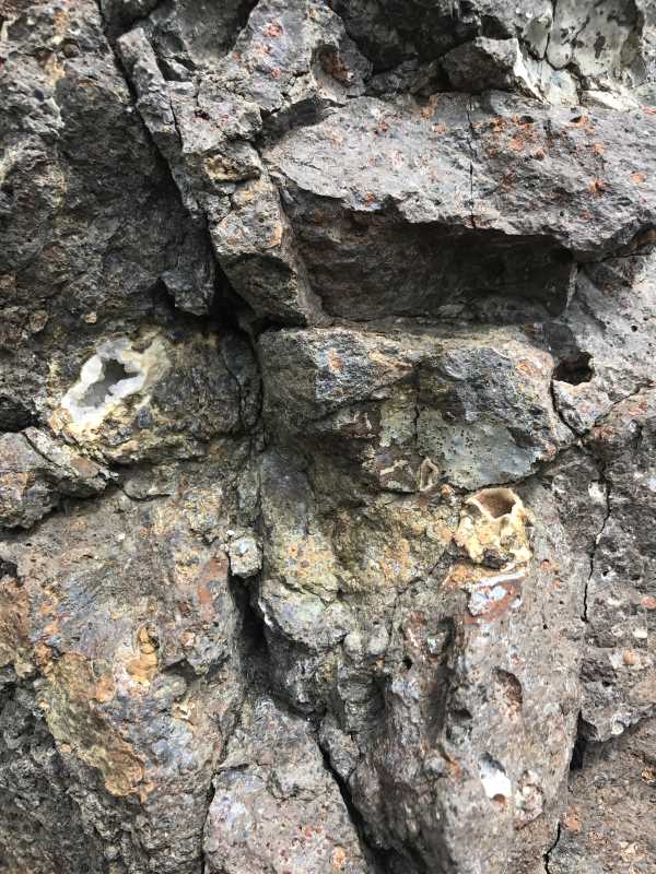
A closer look at some of the agates and geodes in the rocky outcrops near the viewpoint.
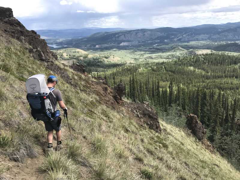
Heading back down from the viewpoint.
Liz B July 15, 2025
We hiked Miller Ridge on July 13 with our 3.5 year old. The distance was great for our toddler and he was able to crawl his way up the steeper sections all by himself. We had no issues getting through the treed area, there are lots of washouts and downed trees but the trail is still obvious. Others have mentioned this there are a ton of ants along this trail, watch where you stopping, we had a few spots where we didn't notice the ants until they were in our clothing. We had lunch in the trees at the top of the viewpoint and found some incredible geodes. Overall a good but steep hike if you're looking for something to do with a young child.
Martin July 13, 2025
Nice hike, I‘d highly advise to have the provided GPS track on any device, it saved me twice alerting „off path“ as these can sometimes easily been mistaken and markings are not there as often as it would be helpful.

Greyson James August 21, 2024
This trail was a great hike. Rock slides and fallen trees have covered some of the existing path. Look for flagging tape in the trees to follow. To the next hiker: replacing existing flagging tape with new would be great help as the old stuff is quite faded.

Slim Shady July 21, 2024
This trail was overall well marked and easy to follow. As posted by YukonA (thank you!), when you come to the end of the rock slide, go left. There is a fallen tree with flag tape that looks as if it was intentionally placed to block the trail but it's the exact opposite! Cross over the fallen tree with flag tape and continue on to the left. You need to get up close to the rocky outcrops to see the agates and geodes. We saw some when we were heading back down to meet the trail on the outcrops on our left hand side. Watch out for ants at the top if you stop to have lunch - they bite! A really fun short hike with unique rock formations!
callie July 3, 2023
Did the hike today. They have built a bypass road for the mine construction so about 1 km down, the road splits into two. Turn right to stay on Mt Nansen Rd to get to the trail head.
Significant wash out which made the trail hard to see at one point. There is a trail marker at the major wash out points, go straight over the fallen brush and you will come to the trail again.
Alastair Cook July 14, 2021
Our family hiked this trail on July 13th, which was a classic Yukon summer day, so the timing was perfect. This was the third time for my wife and I however. Miller Ridge is one of my favourite hikes. The highlight for me is the ever looming rocky cliffs and outcroppings which dominate the hike, which offer spectacular views even on the way up. It feels very epic.
Once at the top, there is an amazing view of the whole Carmacks area and beyond, and also to the south. Noticeable indeed are the unusual hill formations in the immediate vicinity, which lend a uniqueness to the hike.
There were comments about the rock slide area from another hiker, and the fact that there was flagging in places, but misleading. On this hike I made a point of putting up a lot of flagging to eliminate any problems. Should be obvious now.
YukonA July 13, 2021
Had the same experince as Miaclaire where there was flagging tape in the tree a little up the way( the base of the slide) which led us to beleive the trail went right up the rock slide. It was difficult and very unsafe, but we had awesome views under the hoo-doos, so thought it must be the way. Very difficult coming back down, and we discovered where the real trail went, which was very hidden and not flagged. Unless you've done it I expect everyone to make the same mistke since the trail is so hidden in the trees. My advice- as soon as the trail turns to a rock slide, turn left into the trees, not right up the hill, and you'll see the trail. Bugs were horrible, of course. Hiked June 25th.
Dyana July 8, 2021
There is a washout on the trail that makes continuing up rather difficult. You can go up approximately 1.5 kms then the trail has been taken out by the rocks. The town is planning a clean up of the trail in the summer of 2021 so hopefully it will be easier to see/keep going to the lookout after the trail is fixed.
Miaclaire June 29, 2021
Fun little hike today! At the first instance of rockslides I mistook the righthand one as the trail & climbed up right underneath part of the ridge. I also tried to go around up there to the right but was alone so decided it was safer to go back down & find the trail. This was doable without poles or anything but a little sketchy coming down.
Coming back from the viewpoint I got a bit turned around on the meadow part for a sec because it's hard to see the switchbacks and there are several. Note: when you're going down, stay left a bit (or have a better memory than me!)
Took 2.5 hrs with all the extra mountain-goating around. Probably would've been 1.5 without that.
Adam and Laurie May 30, 2020
We hiked this trail on May 23, 2020. It is a lovely hike through the forest. Great view from the lookout. Warning that the last short stretch to the lookout can be a bit treacherous in spots due to loose gravel and rocks.
Chris and Heather June 27, 2019
We hiked Miller Ridge on June 17, 2019. This was a very pleasant hike with great views of the town, valley and river below. The directions on this website are easy to follow and the road was in excellent condition. It doesn't take more than 1.5 hrs if you are walking quickly, so take the time as you are driving by and enjoy stretching the legs and the solitude. We didn't see anyone else that day.
Kate August 20, 2018
This hike was a lovely way to spend a couple of hours in the Carmacks area. It gives lovely views of the both the ridge and the valley. Saw two goats up on the ridge.
A little over halfway up the trail we came across two separate hornet nests in holes right in the trail. If there had only been two of us walking, we likely wouldn't have noticed them, but by the time the third and fourth members of our group passed over them, the hornets were swarming up out of the hole. Two stings later, we noted where the nests were and were careful to give them a wide birth on the way back. Couldn't see any really distinct features to mark the area by - the first was in one of the rock debris areas and the other was right after a hopping across a few big boulders in a forested area. Keep your eyes peeled once you've gone halfway in.
Kyle July 9, 2018
Went on this hike July 7th,
nice little hike. Lots of individual ridges too
to go adventuring on through bushwaking. You oversee Carmacks with the yukon river right where the bridge is.
Alex May 1, 2018
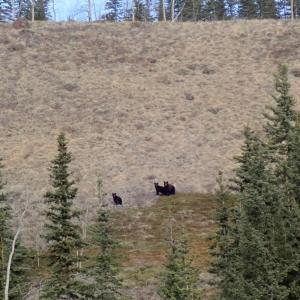
Bear sighting from April 25: black sow with two cubs seen from the Nansen road 500 m up from the trailhead. Make noise :)