Total Distance: 36 km
Return Time: 16 hours
Elevation Gain: 1705 m
Difficulty: Very Difficult
Region: Kluane
Traditional Territory: CAFN
Mount Martha Black is the highest peak within the Auriol Range, accessed via the Auriol Trail. This route is an excellent entry level mountaineering trip with varied terrain and a variety of skills required - glacier travel and up to Class 5 scrambling (rope, harnesses and helmets a must). It's a fair distance and elevation to cover, best completed with overnight stays in the beautiful alpine flower covered plateau.
NOTE: The route has changed slightly, as described below, due to a recent landslide and rock avalanche. The mountains and landscapes are changing and you may encounter different conditions along the route than described here.
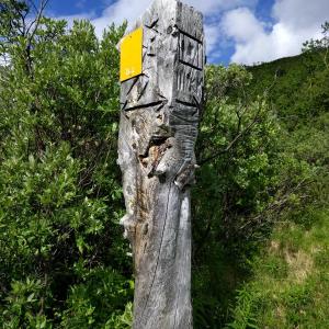
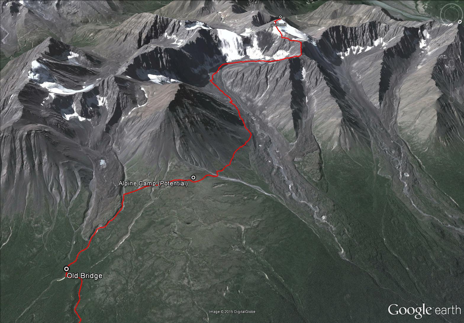
From Haines Junction, drive south on the Haines Highway towards Haines, Alaska for about 5 km. There will be a sign indicating the Auriol Trail is 2 km away. Continue for those 2 km and park in the parking lot for the Auriol Trail trailhead (on the right).
Note: Parks Canada requires registration for any backcountry overnight trips in the park.
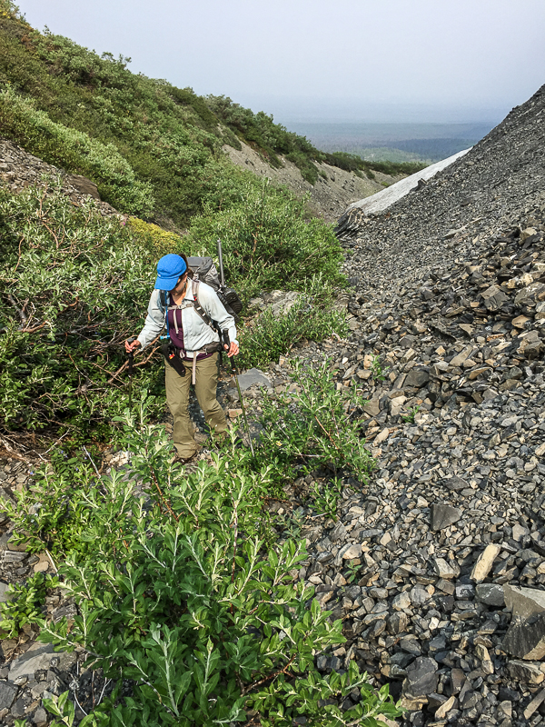
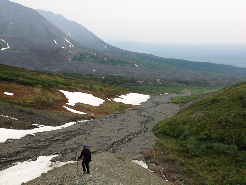
Follow the Auriol Trail to the first main junction (there's a 2 km trail marker there). Continue on the right trail, which is slightly shorter and more direct for the Martha Black route. Once closer to the sub-alpine and near the back part of the Auriol Trail Loop, you'll come across an old footbridge, about 500 m before reaching the backcountry campground. Here you will leave the trail and follow the creek up into the alpine.
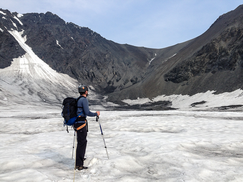
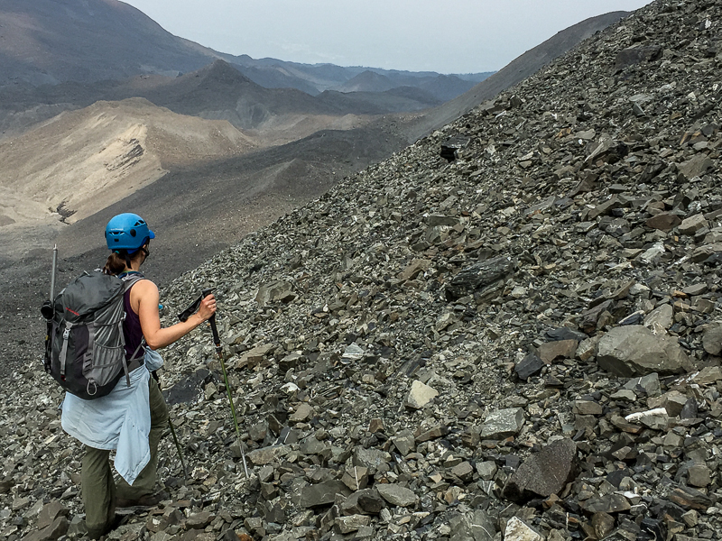
Pick your way along the creek, crossing as necessary to avoid any bushwacking. As you approach the base of the main rocky moraine, you'll need to follow along the right edge of it, along a small narrow drainage. Depending on the time of year, there may or may not be water flowing down this drainage and there may be some snow patches remaining into the summer. The drainage opens up as you gain more elevation. After about 1.6 km after leaving the Auriol Trail, you'll need to get up on the slopes on the right. You should be above most of the willows and shrubs on the slope and on a nice alpine plateau. The plateau offers many great areas to set up a camp - there should be water available in the creeks in the surrounding drainages and potentially small melt water channels off any snow patches.
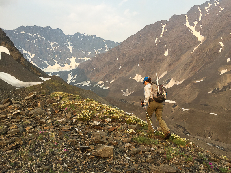
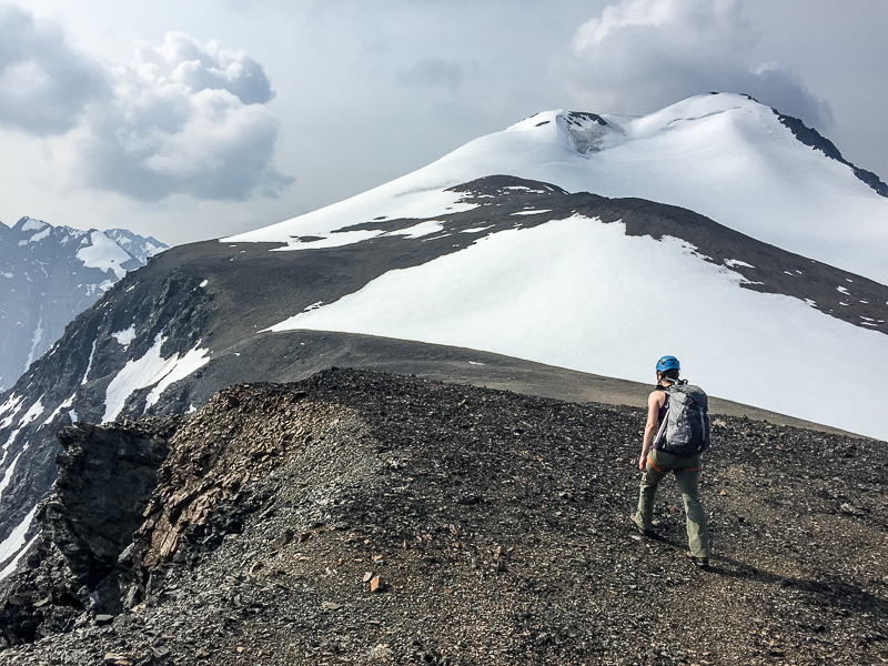
Traverse the plateau contouring along the base of a large pyramidal mountain (on your left).
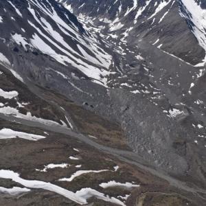
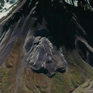
NOTE: NEW HAZARD ALONG ROUTE. As of October 2023, a very large landslide/rock avalanche has occurred just west of the potential camp noted. The slope is still very unstable and it is not recommended to traverse this area. The same signs of instability are showing in the areas adjacent to the landslide, so do not camp in the area or linger too long. You should drop down well below the unstable area and then pick up the route when it is safe to do so.
Continue contouring around the base of the mountain, following up the glacial valley (now heading southwest).
After just over 1 km of following up the glacial valley, you will need to get to the other side of the creek. This is just before the creek upstream heads underground for a short distance.
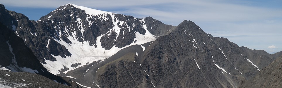
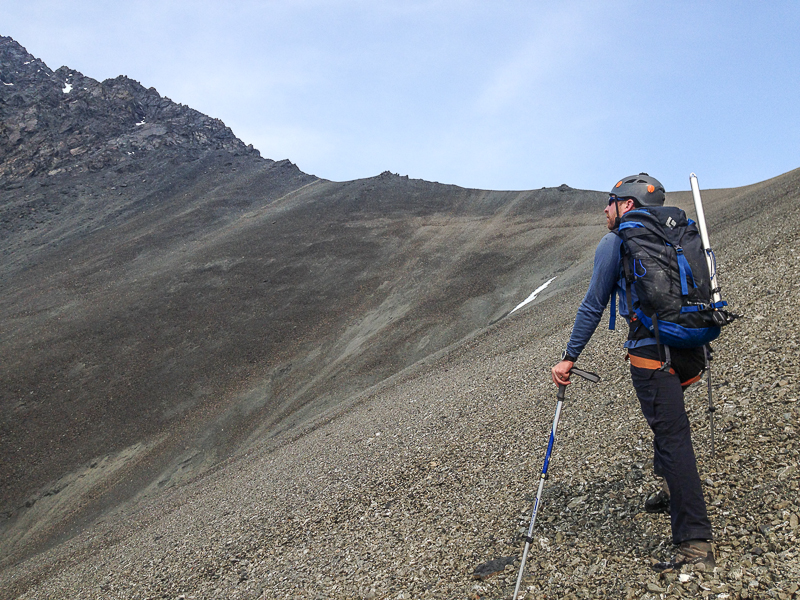
Continue heading south and now up the moraines towards the base of the large mountain ridge in front of you. Note glacial ice underlies the rocky surface of the moraines, including some obvious crevasses in some areas, so keep clear of the steeper, more gullied morainal area to the right, staying more to the middle, on the more gradual ridge part of the moraine. The terrain eventually levels out slightly as you continue following the glacial valley gradually uphill to the right (west). There should be a few small, meltwater creeks in this area where you can refill on water.
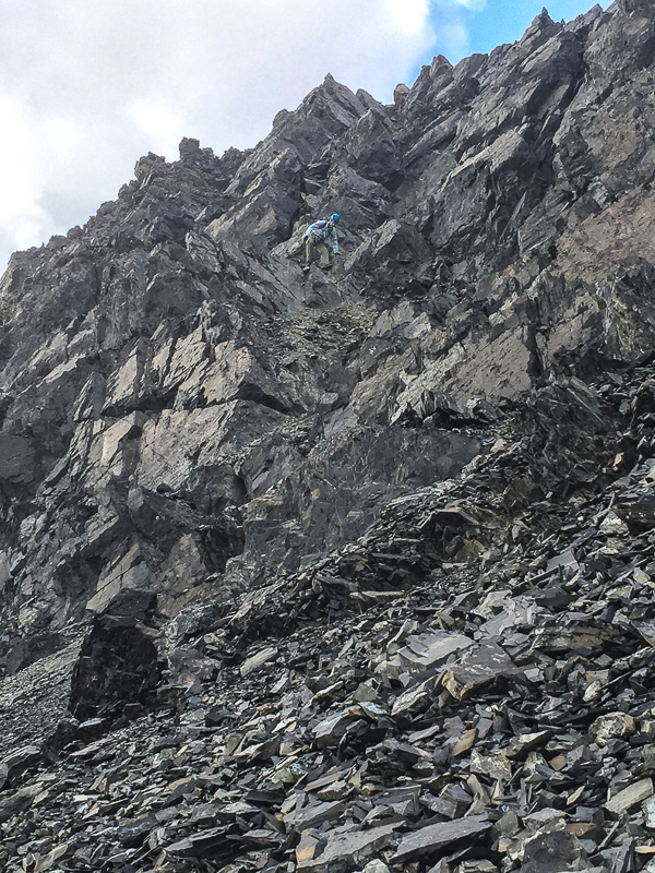
You will eventually reach the base of a steeper snow and ice section. Take a gradual route up staying to the right of the steeper exposed ice patch. Crampons may be helpful if the surface is firm. It is advisable to rope up for glacier travel for this section as this small glacier is crevassed. It's just about 100 m elevation gain till the glacier levels out again. Keep roped up and continue up the glacier towards the base of a rocky saddle. Stay clear of the mountain sides as rock fall is common in the area. Once on the rock again, you can remove the rope and climb up the scree slope (140 m) to the top of the saddle. Once at the saddle, head west (left) on the ridge to the first steep rocky section. At this point there's a 10-20 m section of of Class 3 to 5 climbing/scrambling. This is the most exposed and steepest part of the climb (a rope may be comforting for some), with lots of rock fall hazard (helmets are a must). Extreme caution is necessary.
Once up this crux, it's a short hike up a steep scree and snow slope to a wide open rocky plateau with the final view to the summit. Traverse the plateau till you reach the base of where the glacier and snow start again. Switch over to 'glacier travel' rope-mode again for the final approach to the summit. Take the more gradual route along the left ridge to the first sub-peak and then up to the summit. Enjoy the views of the surrounding peaks of the Auriol Range, and beyond to the Alsek Valley and the St. Elias Mountains.
Return the way you came. It's a little quicker on the way down than the way up, as with most mountain hikes.
Hike up the right drainage along the base of the rocky moraine from Auriol Trail.
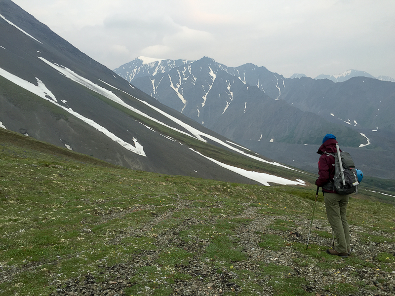
Traverse the alpine plateau with Mount Martha Black looming in the distance.
After about 1.6 km of heading northwest along the plateau, you'll drop down to another small creek drainage.
Follow the moraines southwest along the glacial valley.
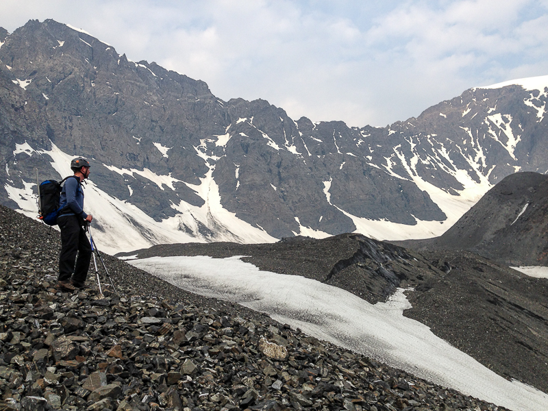
Glacial ice underlies much of the rocky surface of the moraines, so stick to the more gradual terrain avoiding any steeper slopes and gully areas.
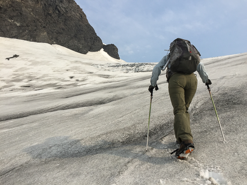
Head up the steeper snow and ice slope towards the small glacier (crampons may help if the surface is firm).
Rope up for the small glacier traverse - this area does have some crevasses. Head for the base of the rocky saddle.
Climb the scree to the rocky saddle.
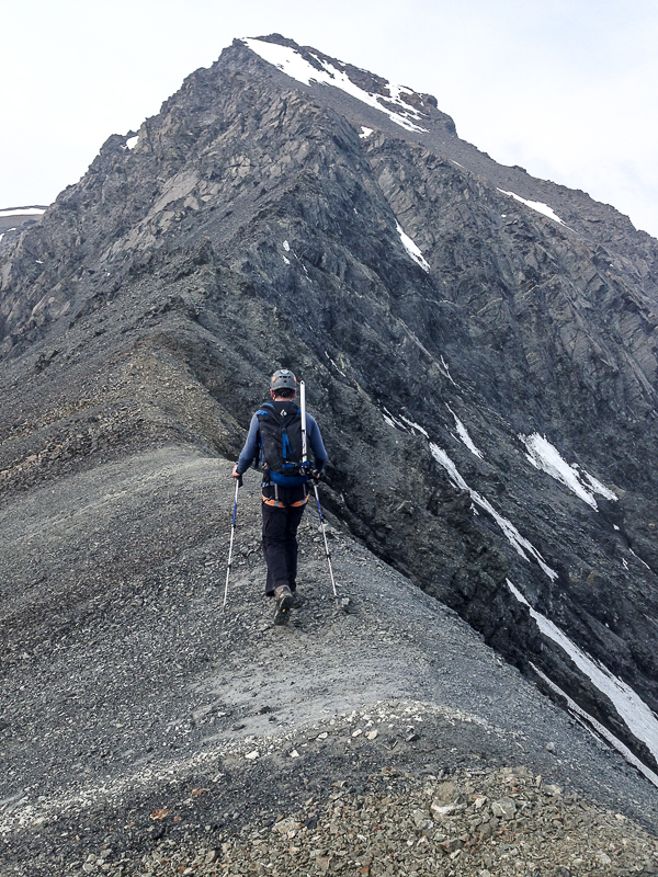
From the saddle head west on the ridge to the rocky crux.
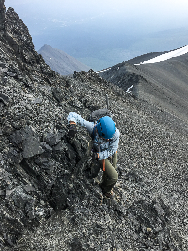
Scramble up the first section of the rocky crux.
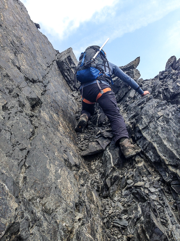
Some 5th class climbing is required.
Once up the crux, you'll reach a wide open plateau with a view of the summit (right). Follow the main ridge on the left.
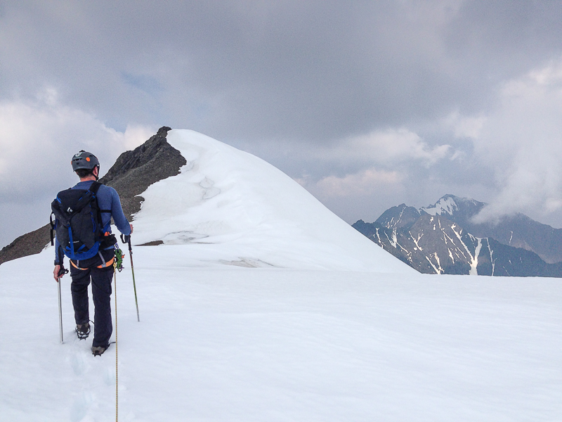
Rope up for the last glacier traverse to the summit.
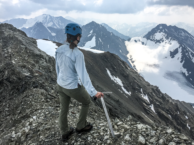
Enjoy the views form the summit of the Auriol Range and beyond.
Return the way you came up. It's a lot faster on the way down (Photo shows the climb coming down the crux rocky section).
Rocks and more rocks on the way out (heading back down the glacial valley).
Owen Krikorian July 12, 2026
Summited on July 11th we did it in one very long gruelling day and it took us almost exactly 16h. The scramble was a lot easier than we anticipated and although we did rope up for the glaciers we saw no signs of crevices (definitely could be some lurking as there was quite a bit of snow). Over all a stunning mountain and would definitely recommend.
Yukon Hiking January 15, 2025
Second photo of new landslide/rock avalanche to go with comment below. The landslide area is approximately 1 km long and 400 m wide.
Yukon Hiking January 15, 2025
The Yukon Geological Survey has notified us of a new hazard on the route. As of October 2023, a very large landslide/rock avalanche has occurred just west of the potential camp noted. The slope is still very unstable and it is not recommended to traverse this area. The same signs of instability are showing in the areas adjacent to the landslide, so do not camp in the area or linger too long. You should drop down well below the unstable area and then pick up the route when it is safe to do so.
Zac August 15, 2023
Hiked and summitted on August 3rd. We didn't feel the need to bring rope or climbing gear for the glaciers or the scramble. The lower glacier was snow-free at this point so we could easily spot the crevasses. With the upper glacier, there was still some snow so we probed around when we had to cross it. Punched through some small crevasses, nothing more than 15cm wide and 30cm deep though. The scramble felt quite easy and it was really short, I'd say at most slightly exposed class 4, I wouldn't be surprised if some people considered it no more than class 3. Beautiful hike but it's long and feels like quite a slog!
Bryan and Esther July 12, 2019
Attempted July 11.
We should have read the comments more closely! Definitely turn right at the 8.5 km sign. It's a dry drainage and will take you right up onto the plateau that you want to be. We followed the creek a few minutes past the sign and ended up being way off course once we got up into the alpine.
It is bone dry up there right now. Do not rely on finding water! We found one small snow patch with run off but we were getting a bit worried by the time we found it as we had counted on finding water at camp.
We were charged by a grizzly after setting up our tent on the plateau and saw 2 more shortly after on the way out. Lots of bear scat and digging all over that we should have trusted our gut about. Needless to say, we did not summit on this trip.
Nicolas Zöllner July 19, 2018
Warning!! This trail is way harder that other trails on this site marked as difficult. The trial description is mit very Good too. Once you are past the first plateu the rest of the way is stoney and not very good to walk. Furthermore when we left the last glacier part we had to climb about 250m on hands an feet to get to the last sattle from where the last climbing started. Attention again! You cant climb that part without proper Equipment and still its dangerous as the the stone is very fragile. Still the Hike is totally worth it if you not climb as the view is amazing from the last saddle. I would not recommend Camping as you can just Camp before the Hard Part starts. It took us about 11 hours.
Matthias September 4, 2017
The trailmarker says 8.5km were u can lekave the auriol loop.
Francois June 27, 2016
Gave a shot at Martha Black last weekend but turned around at the bottom of the first glacier. It is a long approach, but totally worth it. We turned around due to bad weather.
Update on the approach. Take the right fork at KM2 of the Auriol Trail. 90 minutes or so after leaving the car, you will come to a clear intersection (Park Canada marker 8.2). Instead of staying on the Auriol trail on the left, take the right trail. It leads directly to the alpine plateau and will save you about 30 minutes or more. You will hike on a trail, then on a dry creek bed and then an old moraine. No bushwacking. At about 1400m, turn N (right) and follow the description from the website. We discover this trail on the way back.