Total Distance: 11 km
Return Time: 5 hours
Elevation Gain: 949 m
Difficulty: Difficult
Region: White Pass
Traditional Territory: TRTFN
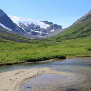
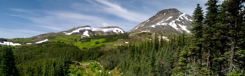
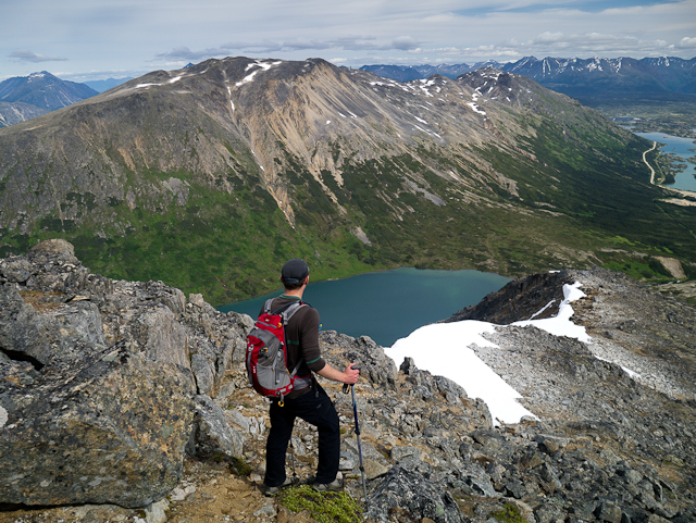
Fraser Peak looks like a giant wedge with a rocky top from the highway at Canada Customs. The hike to the summit is fairly moderate, with a few steep, scrambling sections. The expansive view from the top includes numerous glaciers, towering peaks down the White Pass, and the beautiful lakes and the unique moonscape terrain in this area.
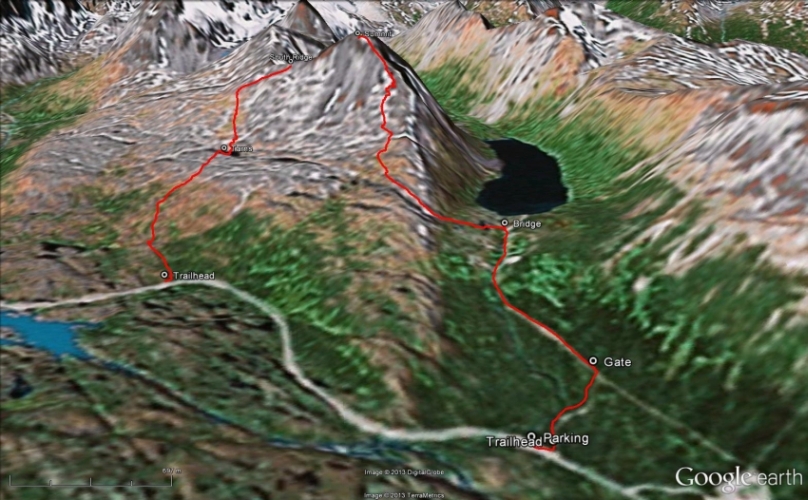
From Whitehorse, drive south on the Alaska Highway to the Carcross Cutoff and turn right onto the South Klondike Highway. After 120 km on the South Klondike Highway, you will reach Canada Customs. About 1 km after Customs, there is a large parking area on the left side of the highway - park here. The trailhead is on the other side of the highway, about 100 m back towards Customs.
If you do not have a passport to cross back into Canada, or do not wish to cross the border, take a right on the road immediately before Customs. Follow this road to the end and park near a large highway maintenance garage and gravel pit area. Pick up a trail in the northwestern part of the open gravel area which leads to an old road. Follow this road to the west for about 900 m until you reach a large metal gate (see trail description below).
The trail starts in the trees along a fairly wide old road with gradual elevation gain. After about 600 m, you will be at the intersection of another road. Turn left and continue along the road, walking around a metal gate, which is locked during the summer to stop people from driving in the area in order to protect important caribou habitat. The road continues to the east end of Fraser Lake (officially named Bryant Lake).
As you walk on the road, you will notice a large creek on your left - don't worry, there is a 'bridge' across the creek. The bridge is 1.5 kms down the road from the gate and is quite narrow, not very level, and has no handrails. That's because the 'bridge' is actually just wooden housing around a pipe, so if you are uncomfortable walking across it, this is also the best spot to cross on foot, as the creek is quite shallow and slower moving here.
Immediately after crossing the creek at this spot, head up the meadow to your left, towards the side of the large mountain. You will start by easily walking through a beautiful meadow surrounded with numerous small creeks and alpine tarns. Head straight towards the lowest part of the ridge ahead of you that will lead up Fraser Peak, and climb straight up to gain access to the ridge. This part is a little steep, but quite short.
Once on the ridge, the terrain is a mix of large boulders, rocky gullies, snow and small tarns. It is best to avoid the very edge of the ridge at first so you don't have to walk up and down the steeper rocky crests on the ridge. You want to stay near the north side of the ridge, but not right at the edge until closer to the summit.
Pick your way up through the boulders, meadows, and tarns, aiming for the right (north) side of the main rocky peak. There is a fair bit of scrambling and boulder hopping required along the way. If there is any snow still around, you can use it to your advantage in order to avoid walking on the rocks and boulders. Be careful on any steep sections of snow, because slipping would mean a slide down into the unforgiving rocks. If there is a lot of snow still present, a mountaineering axe would be handy or at least hiking poles.
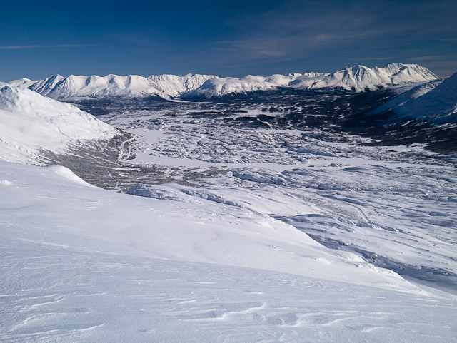
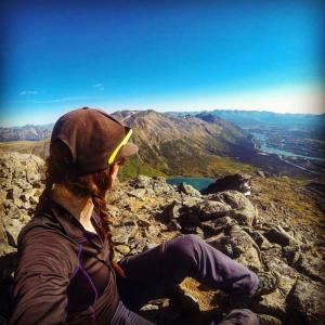
Near the top, you will have to navigate up to the summit on the rocks and may have to use your hands to scramble for a short time. This section is over quickly, and you will soon be at the summit of Fraser Peak. The summit is fairly flat and open. Marvel at all the glaciers to the west above the Chilkoot Trail. The closest mountain to the west is Taiya Peak, with it's beautiful hanging glacier. Far below you to the right is Fraser Lake, and following the valley to the pass at the end would lead you to Crater Lake and the Chilkoot Trail. You can see all the way down the White Pass and South Klondike Highway towards Feather Peak, Mount Cleveland, Mount Carmack, the Sawtooth Range, Laughton Glacier, and more.
Follow the same route back down. There is a wider couloir that leads directly from the summit all the way to the bottom at Fraser Lake. Unless you brought skis or a mountaineering axe with you, it is safer to follow the same route back down. Each to their own!
Fraser Peak is a great winter destination for backcountry skiing and splitboarding. The area offers a range of options for various skill levels. The route described here is different from the summer route, as it accesses the south ridge of the peak, and is suitable for beginner to intermediate skiers/riders.
South Ridge
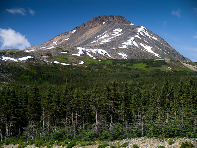
Fraser Peak, as seen from the parking area.
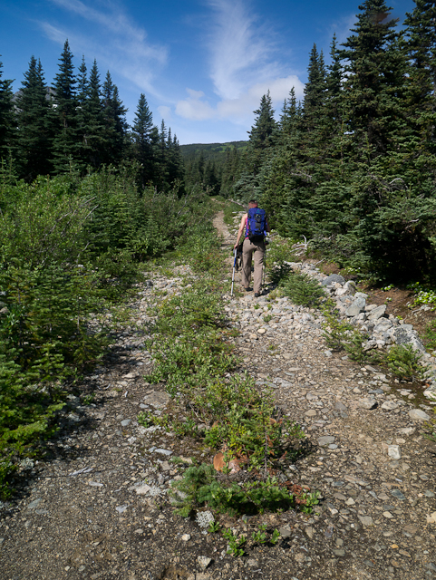
The start of the trail up the old road.
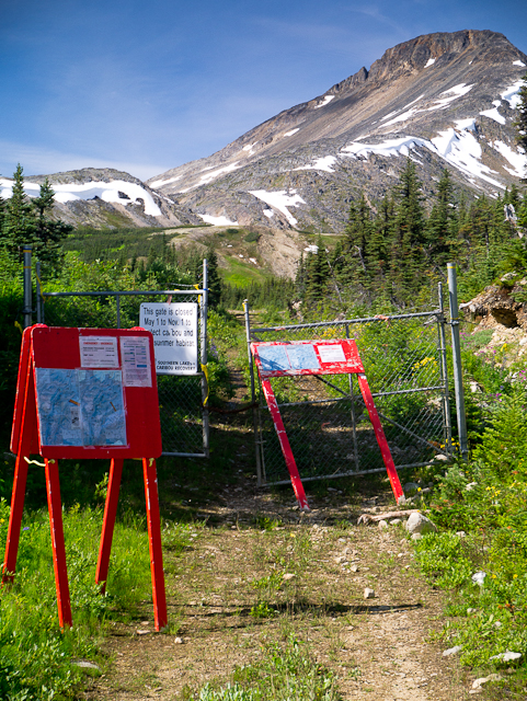
The gate at the intersection of the two roads.
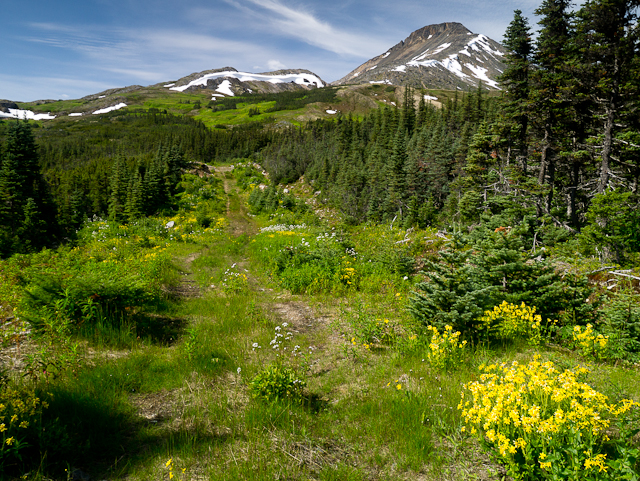
The wildflower-lined road, leading towards Fraser Lake.
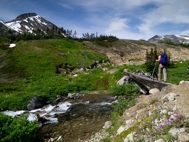
Either cross the creek on the 'bridge', or through the water at this spot.
Navigate through the meadows and small lakes to the lowest point on the ridge.
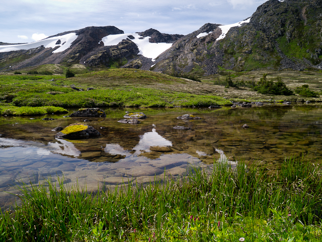
There are quite a few small tarns (alpine lakes) on the way up.
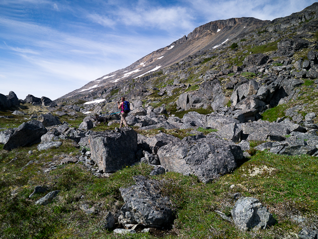
The lower section of the mountain is a mix of boulders and alpine meadow.
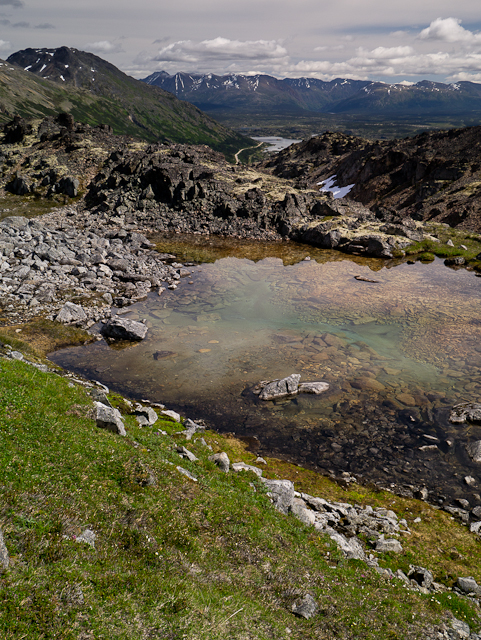
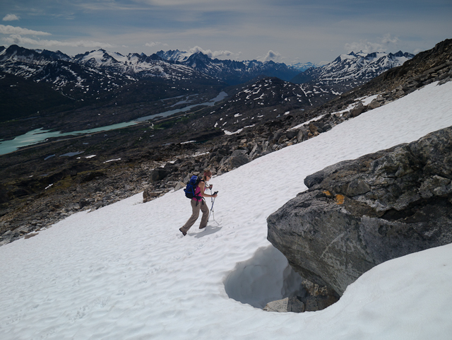
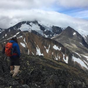
Hiking up, with a view down towards the moonscape terrain.
The terrain starts to turn rocky on the upper section of the route.
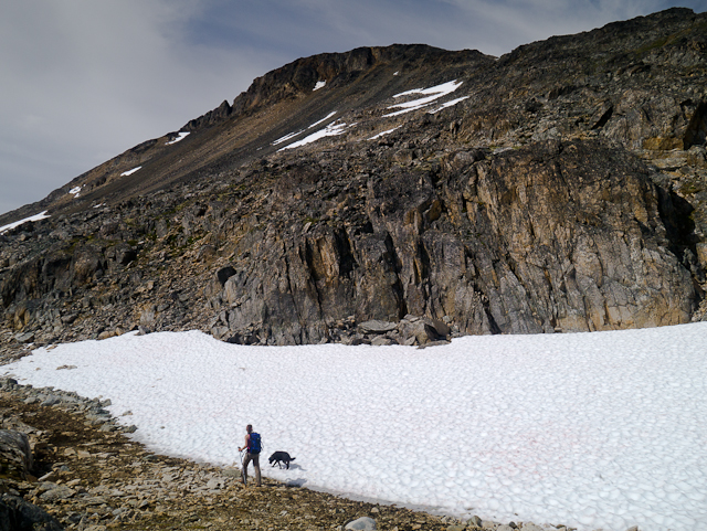
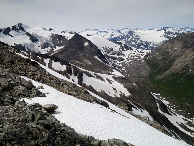
A view down the White Pass. You can take advantage of the snow, as long as you are comfortable walking up it.
The summit is fairly flat and safe.
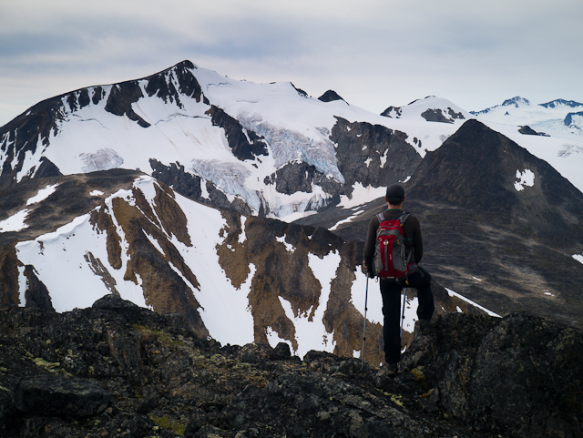
The hanging glacier on Taiya Peak.
Looking west towards the Chilkoot Trail, with the pass above Fraser Lake on the right.
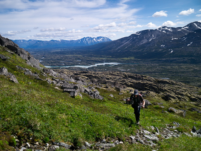
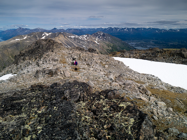
The view down the ridge, with Fraser Lake at the bottom.
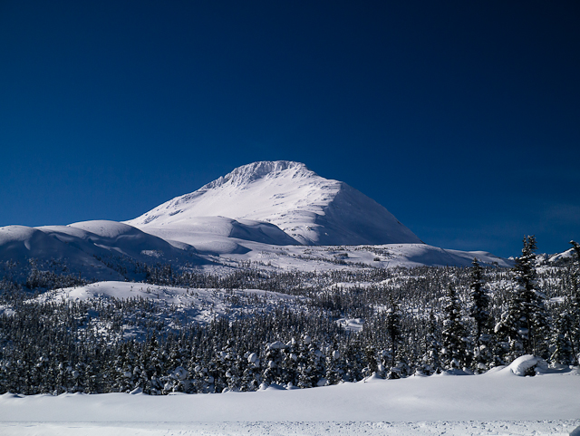
The view of Fraser Peak from the Canadian Customs Office in the winter.
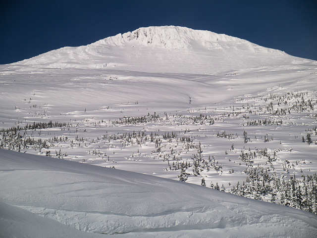
The view of Fraser Peak and the south ridge (left) from the winter trailhead.
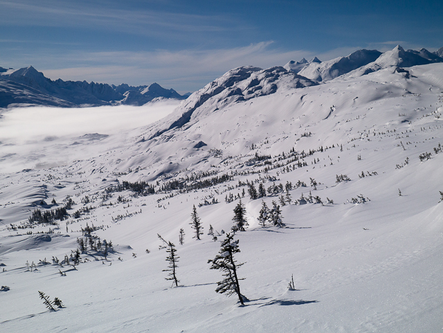
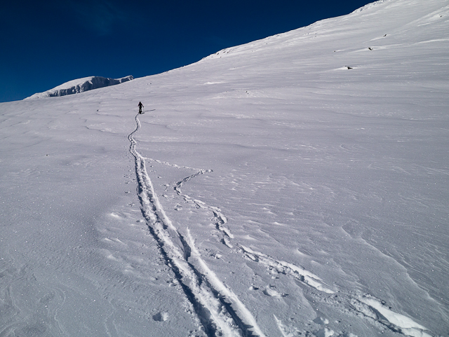
The ski up with a view south down the White Pass towards Summit Creek Hill and the peaks of the White Pass.
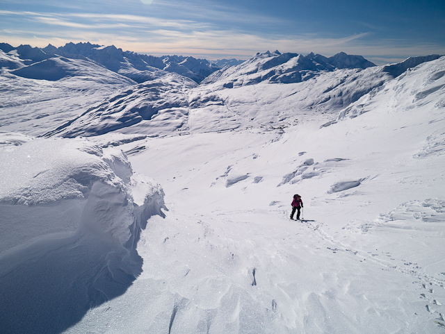
Approaching the bowl and heading to the south ridge.
Climbing the final part of the ridge to the saddle on the south ridge.
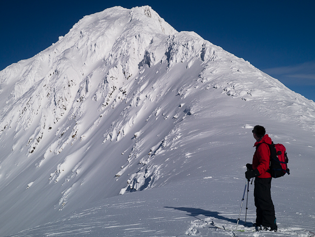
The view from the saddle looking west towards Taiya Peak (back, left).
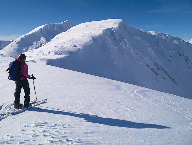
Admiring the view of Fraser Peak from the saddle of the south ridge.
Enjoying the ski down with views looking northeast towards Log Cabin Mountain and Bernard, Shallow and Maud lakes.
Danette August 27, 2022
Hiked this the other day. Beautiful hike, not difficult at all. No scrambling required - not sure where people were going up to scramble. Stay to the right on the ridge and it's easy peezy (though I went way left to get up to the ridge). Amazing views, one of the most beautiful hikes in the Yukon (BC, actually). I'm curious about whether you can make a ridgeline loop out of this hike.
Jen H July 30, 2022
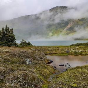
It would be great if Yukon Hiking created an alternate listing for Bryant Lake, since there is lots to explore for those who don’t go on to the peak. From the lake front, there is a footpath that wraps around the left side of the lake. The path isn’t very difficult but it can be muddy in spots, and you will have to cross an old rock slide that can be slippery if it’s been raining. It leads to the end of the lake where there is a sandy beach and view of the glacier that feeds the lake. It looks like you could continue up the rock field toward the glacier, but we didn’t go further. It was roughly 10km round trip from the parking lot to the end of the lake and back. Awesome hike: marmots we’re singing and the wild flowers were in full bloom!
Aline H. August 3, 2020
Tried to bike into Bryant Lake on August 1st, but the gate was closed with a sign saying the area is closed until November 1st for caribou habitat protection.
JR January 4, 2020
anyone available for questions about this hiking area?
Francois September 4, 2017
Hiked this trail yesterday. Beautiful views of the glaciers on Taiya and the surroundings. I'd stay away from the ridge's edge until you get to a fairly obvious canyon that cuts through. From there, I would stay close to the edge as the rocks are more stable and there is more green growing around the rocks, making a more enjoyable hike. (we came down this way). Light scramble closer to the summit (class 3), but nothing vertical on our way.
Another side trip in the area is to get to the col over looking the Crater lake. It would take about 5 hours return from the lake.
kyliestravel August 14, 2017
Hiked this trail 5th August. This is a beautiful hike, although it is difficult. I hiked it solo and fell short of the summit.
THe first hour up over the ridge line, is easy. However, the hike after this is bouldering all the way up. The picture you see is about 30 metres lower than where I made it to. At this point it was vertical climbing with sheer drops on either side. My fear of heights got the better of me, so hoping to get to do this hike to the summit one day - but tbh, its pretty difficult with the climbing up and down. a couple of points the rocks slide and I had to slowly move the rocks, as my feet got trapped - hence I left the hike about 100 metres from the summit - not worth getting hurt over!
But the views are amazing, be prepared for some sore muscles you didn't know you had!
Marc and Laura August 4, 2017
Did this hike on July 29th. It took approx 7 hours round trip with lots of time at the summit and many many breaks.
The first part was an easy walk to get to Fraser Lake. After the sketchy bridge, you just turn left and make your way on the ridge. Find the spot that looks the easiest. There is a good spot towards the left that allows you to easily access the ridge without any climbing or anything. Once on the ridge, you will be hiking on large rocks all the way up. There is a First Nations totem at the summit that you can see from far away.
It was a beautiful hike. For the time and effort, the views were awesome. We were lucky to go on one of the rare days with blue skies in the White Pass area. I definitely recommend to go when visibility is good. From the top, you can see Fraser Lake, the valley, many glaciers and you can also see the White Pass mountains on the other side. I recommend to anyone.
Murray Lundberg August 7, 2013
I highly recommend the trail to the head of Bryant Lake as well - it has a small sandy beach and the water warms up due to an extensive shallow area. The lush valley that continues west is enticing but I haven't had time to make that extension yet.