Mount Minto
May 16, 2023 by Marko Marjanovic
Location: Atlin
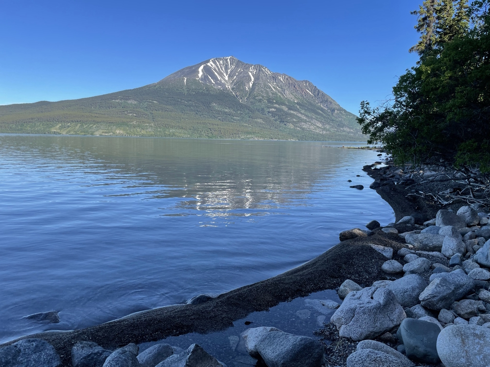
At the north end of Atlin Lake is Mount Minto (K'iyan to the Taku River Tlingit First Nation). A prominent peak at 2,107 m elevation, with no other mountains in the near vicinity, it stands out and is easily recognizable on the drive to Atlin, BC.
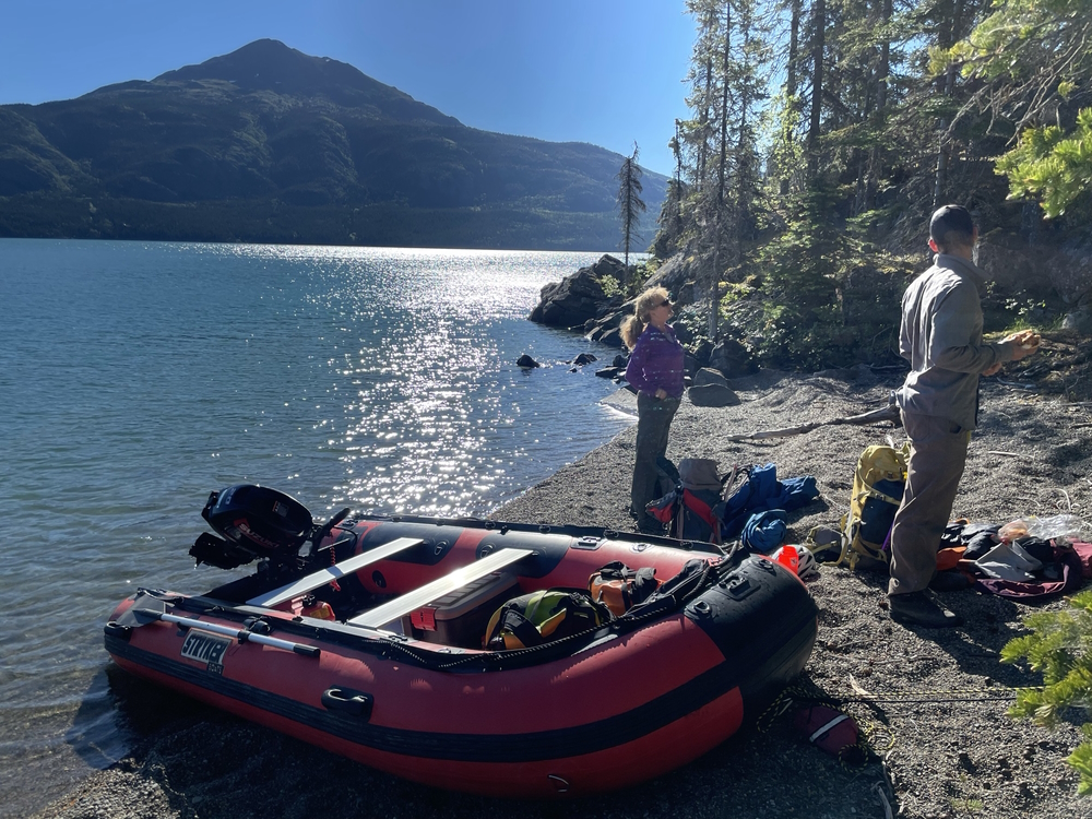
Logistically it is a bit of a challenging hike. First, you need to cross Atlin Lake at its northern end. Assuming your crossing is smooth, you will have to hope that at the end of the day, the lake will be calm enough to cross back.
Next, you have hike through what seems like a steep, endless bushwhack for hours. After the bushwhacking, comes a very steep climb up rocky scree. All the time, the slope remains constant with little relief. But the summit ridge is exciting and the view is worth all the effort.
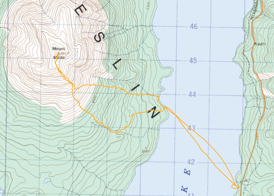
Our epic one day push to hike the mountain in late June 2021, started out with a calm crossing of Atlin Lake in the morning. We started from the boat launch (more of just a path to the lake) at a recreation site about 15 km from the north end of Atlin Lake. We aimed for a sheltered beach to tie the boat up, and figured we would just start hiking from there.
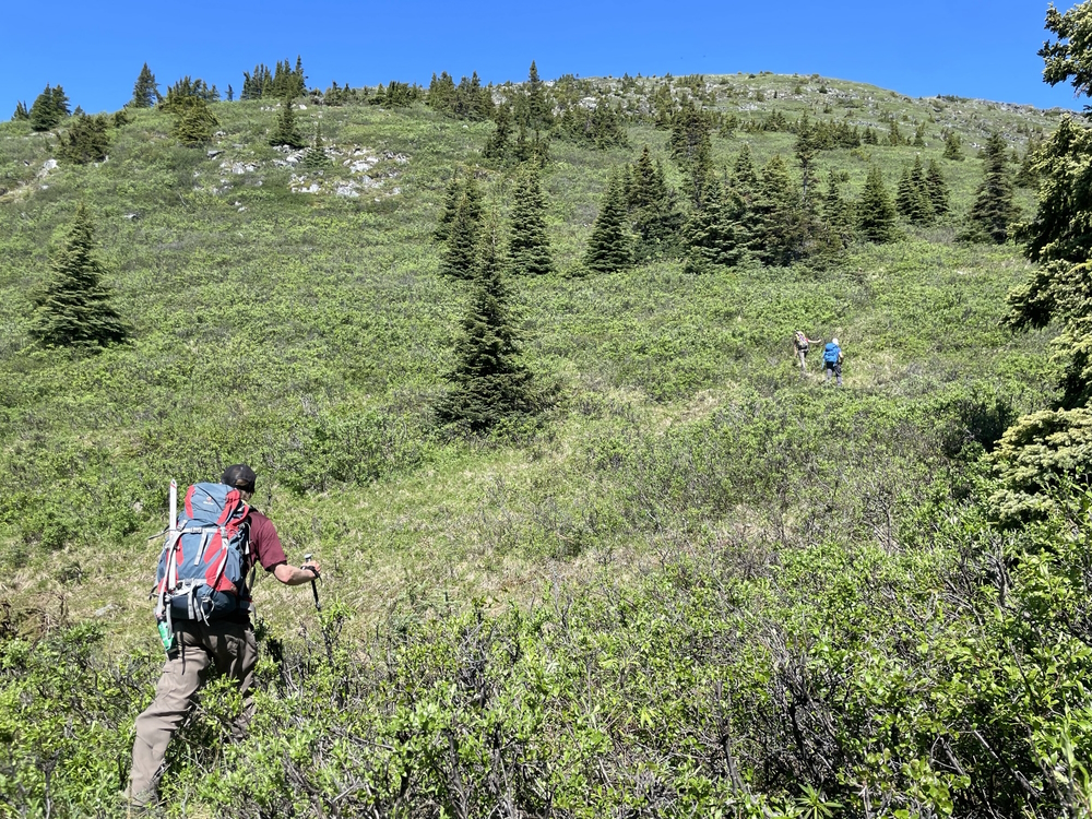
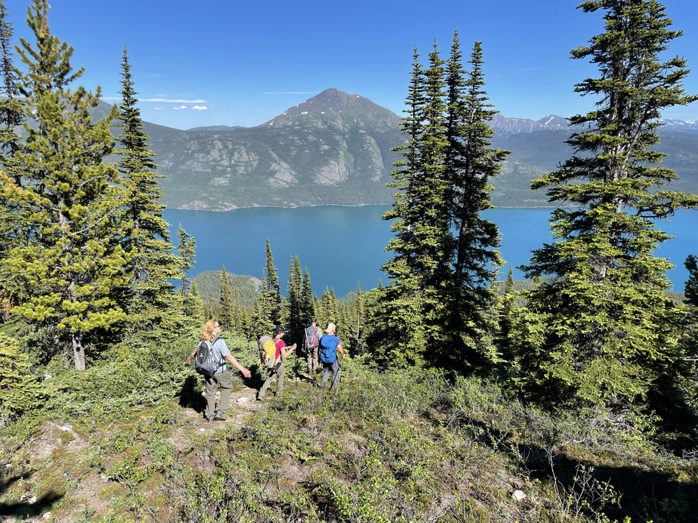
At first, the forest was open and the hiking was pleasant. We continued to follow the path of least resistance. This worked for a while, but we ended up aiming too far to our left, to the south of the ridge we were aiming for. We eventually had to abandon the easy path and start the unpleasant bushwhacking.
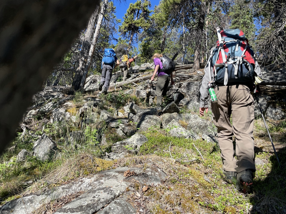
The bushwhacking started with a jungle of large deadfall that we had to climb over, leading to a canopy of alder that we had to duck under, and eventually to a fortress of fir trees that were very tight together making progress slow.
We abruptly popped out of the forest and the treeline was now mostly behind us. In front of us was a steep slope filled with chest-high brush. The brush was a nice relief from the thick forest, but it was still a challenge to hike up through it.
Back in the forest, the mosquitoes were relentless, but they seemed to stop at treeline. However, the day had become incredibly warm (26 C) and without a breeze, shade or anywhere to fill our water bottles, we were struggling in the heat.
We eventually reached a shoulder of the mountain, where the slope became flat. Here we were able to take a break and stuff snow into our water bottles (and under our hats to cool down).
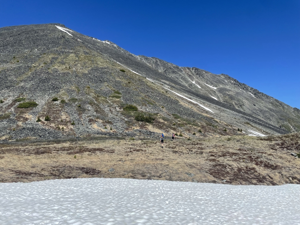
Above us was now rock, all the way to the summit. We slowly climbed up the rocky slope, sometimes using snow to change up the monotony of hiking up rocks. Halfway up the rocky slope was a small grassy patch where we had lunch.
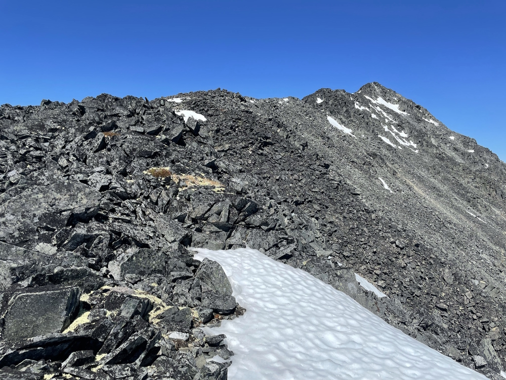
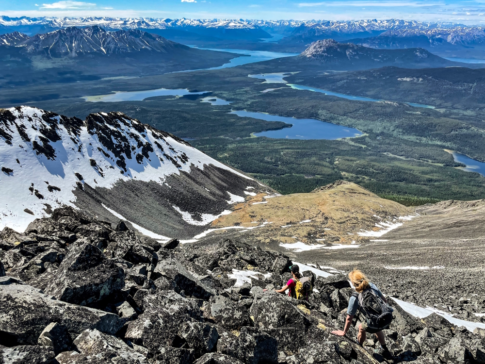
Continuing up the rocky slope involved using our hands as the rocks got larger. When we reached the top of the ridge, the scrambling got interesting. Although the route was safe from any large falls, there was still some exposure as we scrambled along the boulders to the summit.
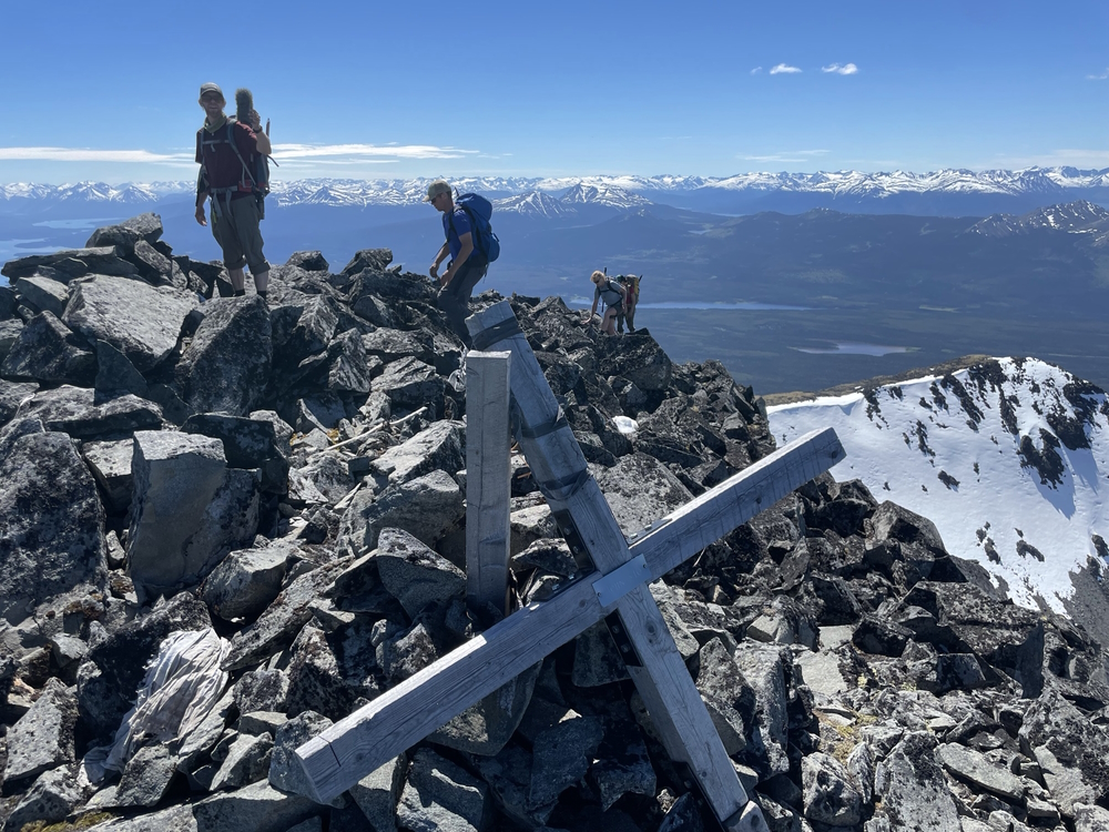
Reaching the summit, we found a large wooden cross and a summit log book. The views were astonishing. Atlin Lake, Little Atlin Lake, Tagish Lake, Tutshi Lake and Teslin Lake were all visible from the summit.
On our way down, we chose to aim more directly to where we left our boat. This route ended up being easier than our way up, with more clearings we could connect on the way down. We stumbled across a flagged trail, but it abruptly ended (or we lost it, although we did search for quite some time).
Swatting hordes of mosquitoes, we didn't stop as we continued downwards towards the water. After 9 hours of continuous hiking, over roughly 13 km, and 1,400 m of elevation gain, we reached our boat. The waves had come up a bit, so it took a lot longer to boat back across the lake. We were thankful the wind wasn't blowing too strong.