Caribou Mountain - True Summit
January 05, 2023 by Marko Marjanovic
Location: Carcross
I've hiked the popular Caribou Mountain trail many times, but I've always wanted to get to the top of the true summit of Caribou Mountain, which is about 2 km away and is considerably higher than the popular hiking trail. So in September last year, a friend and I were thinking of a nice day hike, and we settled on the true summit of Caribou Mountain.
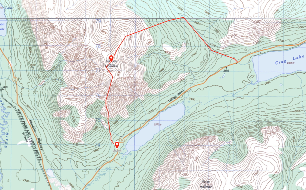
A map of our route.
Our plan was to hike to the summit and continue over it. We would hike down the other side to where, allegedly, we could bushwhack to an ATV trail that would lead us back to the Tagish Road. Before the hike, we stashed a bike there, and we would use the bike to get back to our vehicle. The ATV trail was a bit of an uncertainty, but we welcomed the adventure.
After stashing our bike, we drove back to a gravel pit on the Tagish Road, about 4 km from Carcross. Since there is no trail, the only way to start hiking was to bushwhack towards the ridge we were planning to ascend. We were aiming for a spine that came down the mountain above a small gulley as it looked like the least bushy route up.
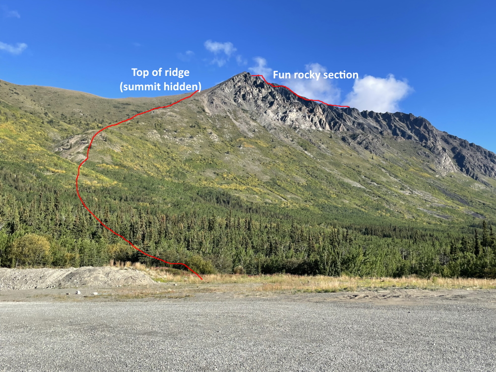
The route looking up from the gravel pit.
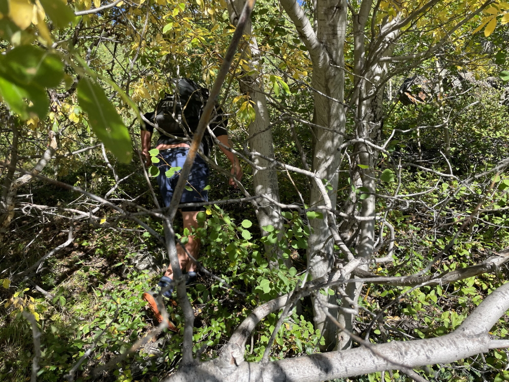
Thankfully, the bushwhack wasn't very long.
The route was relentlessly steep. We had great views of Bennett Lake below, but looking up, all I could see was more steep hiking. Such a leg burner.
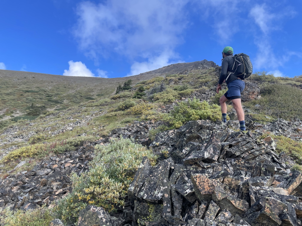
Looking up to the top of the ridge. Leg burner.
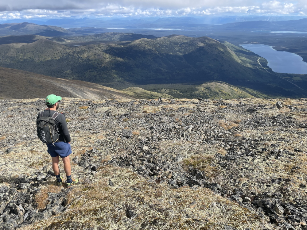
When we reached the ridge top, we got a glimpse of the true summit. It looked so far away! I seriously didn't think I could make it all the way there. We still had lots of time, so I figured we would keep hiking and see how far we could get.
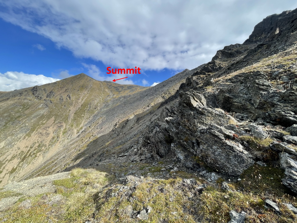
Looking up to the true summit, which seemed so far away.
The next section of the ridge was incredibly fun hiking. The ridge turned rocky with huge cliff faces that went down to the Tagish Road side. The other side of the ridge offered fairly safe hiking. You could pick your own route and have as much or as little exposure as you felt comfortable with.
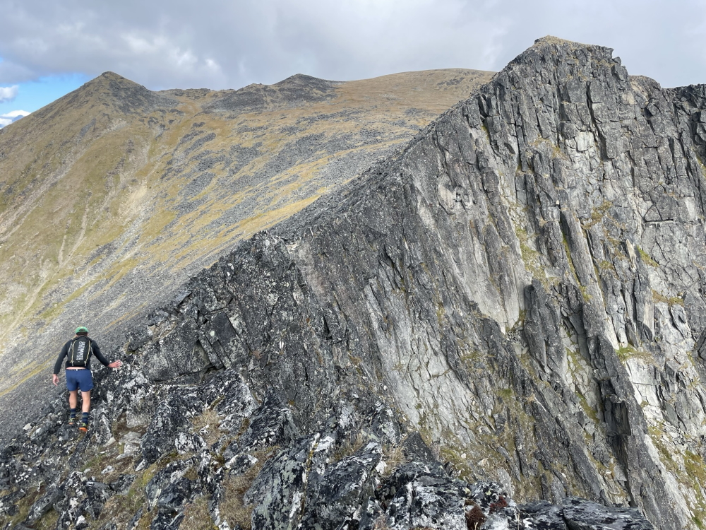
Scrambling along the rocky ridge.
After the rocky ridge, we took a lunch break with amazing views, including some sheep lower down. The true summit looked much closer now, so I knew we could make it.
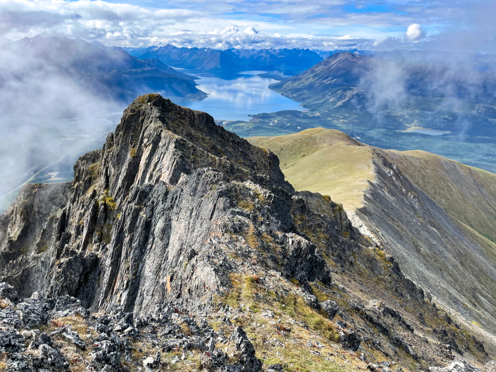
Looking back towards Bennett Lake.
We hiked across a flat plateau to get to the summit. The actual summit was also a large plateau, with old communications gear littered everywhere. The summit itself was a bit anticlimactic, since there was no prominent peak.
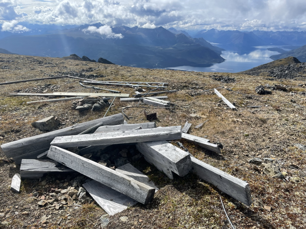
The not-so-satisfying summit.
From the summit, we plotted a route down the other side of the mountain. There was a lot of forest in the valley below us, and we were hoping to spot the ATV trail from up high. No such luck. But I was certain it was down there somewhere, as I had stumbled upon it many years ago.
Scoping our route down to the valley below, hoping to find an ATV trail through the forest.
We started descending from the alpine and entering the sub-alpine forest. It was still good walking, but we were slowly entering denser forest. Luckily we found some really nice animal trails that got us through the thickest forest.
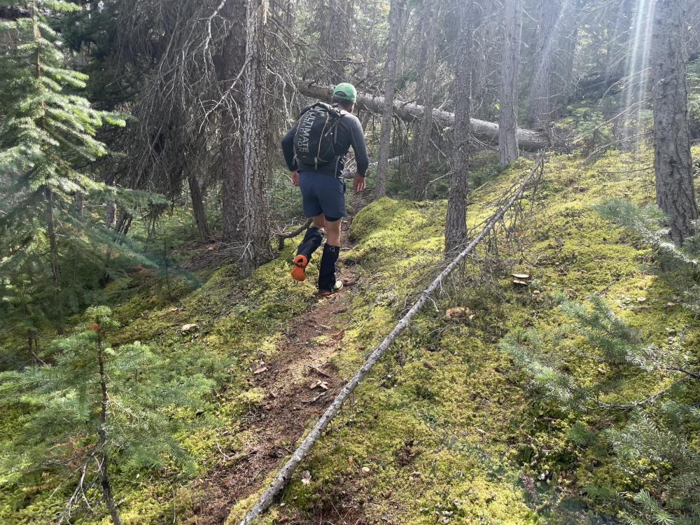
Finding an animal trail through the thick forest.
I zoomed in on my phone's mapping app, and it looked like there was an ATV trail not too far from us now. A few minutes later, we found the trail. From here, it was an easy walk out and back to our bike.
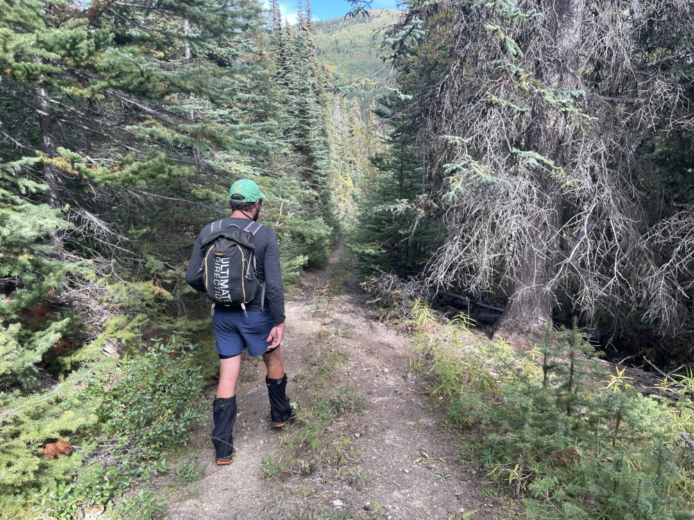
We found the ATV trail.
The hike took us 6 hours. Not bad for 1,300 m elevation gain over 12 km. Would I hike it again? Maybe. Mostly for the fun rocky section, once my memories of the bushwhack and the steep climb subsides. I would definitely recommend it, knowing fully what you are getting into.